National Geographic Our World, Updated Edition
A Child's First Picture Atlas
Seiten
2006
|
Updated ed.
National Geographic Kids (Verlag)
978-0-7922-5532-1 (ISBN)
National Geographic Kids (Verlag)
978-0-7922-5532-1 (ISBN)
- Titel ist leider vergriffen;
keine Neuauflage - Artikel merken
Zu diesem Artikel existiert eine Nachauflage
A very simple look at the continents and people of the world.
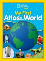
The National Geographic Society's world-renowned cartographers are proud to present a state-of-the-art world atlas for children ages 3 to 6. This updated edition of the award-winning National Geographic Our World: A Child's First Picture Atlas uses a puzzle-piece motif to introduce children to maps and geography and is the result of careful collaboration with experts in early childhood education. This big, boldly illustrated atlas invites young adventurers to explore the world's places, people, and animals. Lively text, pictures, and interactive activities make it easy and fun for kids to learn about and understand their world. In today's interconnected world, kids hear different languages, see different types of clothing, and eat food from different countries every day. Toys, televisions, and clothing all have labels saying where they were made. Children's natural curiosity will demand they know where these places are, who lives there, and what kind of things they do. This bright, beautiful atlas, chock-full of fun facts, ensures that even the youngest kids have the learning tools they need to find the answers to their questions. This updated edition features: 3 world maps, 7 continent maps, United States map, Canada map, 75 full-color illustrations, interactive activities, glossary, and pronunciation guide. There's a great big wonderful world out there for kids to explore with the mapping experts at National Geographic.
The National Geographic Society's world-renowned cartographers are proud to present a state-of-the-art world atlas for children ages 3 to 6. This updated edition of the award-winning National Geographic Our World: A Child's First Picture Atlas uses a puzzle-piece motif to introduce children to maps and geography and is the result of careful collaboration with experts in early childhood education. This big, boldly illustrated atlas invites young adventurers to explore the world's places, people, and animals. Lively text, pictures, and interactive activities make it easy and fun for kids to learn about and understand their world. In today's interconnected world, kids hear different languages, see different types of clothing, and eat food from different countries every day. Toys, televisions, and clothing all have labels saying where they were made. Children's natural curiosity will demand they know where these places are, who lives there, and what kind of things they do. This bright, beautiful atlas, chock-full of fun facts, ensures that even the youngest kids have the learning tools they need to find the answers to their questions. This updated edition features: 3 world maps, 7 continent maps, United States map, Canada map, 75 full-color illustrations, interactive activities, glossary, and pronunciation guide. There's a great big wonderful world out there for kids to explore with the mapping experts at National Geographic.
Billie W. Kapp, a Social Studies consultant for the Connecticut Geographic Alliance, acted as chief educational consultant for this atlas. She is a PIER Fellow at the Yale Center for International and Area Studies and the recipient of the Milken Family Foundation National Educator Award.
| Zusatzinfo | Illustrations |
|---|---|
| Sprache | englisch |
| Maße | 260 x 343 mm |
| Gewicht | 454 g |
| Themenwelt | Schulbuch / Wörterbuch |
| ISBN-10 | 0-7922-5532-1 / 0792255321 |
| ISBN-13 | 978-0-7922-5532-1 / 9780792255321 |
| Zustand | Neuware |
| Haben Sie eine Frage zum Produkt? |
Mehr entdecken
aus dem Bereich
aus dem Bereich
Buch | Softcover (2024)
Community Editions (Verlag)
CHF 21,90
Geometrie und Rechnen mit Größen
Buch | Hardcover (2024)
Kallmeyer (Verlag)
CHF 42,90


