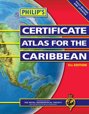
Philips Cert Atlas Caribbean
Seiten
2004
|
5th edition
Philip's (Verlag)
978-0-540-08089-2 (ISBN)
Philip's (Verlag)
978-0-540-08089-2 (ISBN)
- Titel erscheint in neuer Auflage
- Artikel merken
Zu diesem Artikel existiert eine Nachauflage
Skilfully integrating maps, text, diagrams and illustrations, 'Philip's Certificate Atlas for the Caribbean' provides extensive coverage of the Caribbean area, together with a comprehensive selection of world and regional maps.
The fifth edition of this atlas for CXC geography provides extensive coverage of the Caribbean area, together with a comprehensive selection of world and regional maps. This edition now includes sequential page numbering system throughout the atlas, an integrated index and world thematic maps on volcanoes, El Nino, tourism, gender, energy reserves, renewable energy and globalization. The atlas is arranged in three sections for ease of use, with each page colour-coded for rapid reference. The first section is devoted to a detailed coverage of the Caribbean region in 48 pages and includes maps of every island plus Belize and Guyana, as well as topographical, land use, tourism and mining maps. The second section is made up of 72 maps of world topographical maps, incorporating continental thematic maps on topics such as climate, population and economics, followed by 32 pages of world thematic maps. Completing the atlas is a section of CXC study maps covering topics such as farming, soil conservation, economics, tourism and urban land use. The index gives letter-figure grid references as well as latitude and longitude co-ordinates.
The fifth edition of this atlas for CXC geography provides extensive coverage of the Caribbean area, together with a comprehensive selection of world and regional maps. This edition now includes sequential page numbering system throughout the atlas, an integrated index and world thematic maps on volcanoes, El Nino, tourism, gender, energy reserves, renewable energy and globalization. The atlas is arranged in three sections for ease of use, with each page colour-coded for rapid reference. The first section is devoted to a detailed coverage of the Caribbean region in 48 pages and includes maps of every island plus Belize and Guyana, as well as topographical, land use, tourism and mining maps. The second section is made up of 72 maps of world topographical maps, incorporating continental thematic maps on topics such as climate, population and economics, followed by 32 pages of world thematic maps. Completing the atlas is a section of CXC study maps covering topics such as farming, soil conservation, economics, tourism and urban land use. The index gives letter-figure grid references as well as latitude and longitude co-ordinates.
| Erscheint lt. Verlag | 17.5.2004 |
|---|---|
| Zusatzinfo | Maps |
| Verlagsort | London |
| Sprache | englisch |
| Maße | 225 x 286 mm |
| Gewicht | 695 g |
| Themenwelt | Schulbuch / Wörterbuch |
| ISBN-10 | 0-540-08089-6 / 0540080896 |
| ISBN-13 | 978-0-540-08089-2 / 9780540080892 |
| Zustand | Neuware |
| Informationen gemäß Produktsicherheitsverordnung (GPSR) | |
| Haben Sie eine Frage zum Produkt? |
Mehr entdecken
aus dem Bereich
aus dem Bereich
Buch | Softcover (2024)
Community Editions (Verlag)
CHF 21,90
Geometrie und Rechnen mit Größen
Buch | Hardcover (2024)
Kallmeyer (Verlag)
CHF 42,90
Brilliant Answers to Baffling Questions
Buch | Hardcover (2024)
DK Children (Verlag)
CHF 31,90


