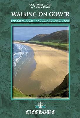
Walking on Gower
Cicerone Press (Verlag)
978-1-85284-666-4 (ISBN)
- Titel erscheint in neuer Auflage
- Artikel merken
This guidebook has 30 circular day routes right across the Gower Area of Outstanding Natural Beauty, taking in the wide variety of landscapes and ranging from 4km to 22km long. The peninsula is understandably famous for its spectacularly steep, rugged coastline and perfect golden sand beaches but this guide also takes walkers to the inland valleys, hills and ridges little expored by most holidaymakers. Some coastal areas are well frequented, such as those around Langland, Oxwich and Port Eynon but this guidebook concentrates on the areas where walkers can really escape the crowds to find peace and solitude. Along the way, the author provides a wealth of information on plants, animals, geology, history and archaeology of a region with something for everyone all within a compact area easily accessible from Swansea and Mumbles. Routes are illustrated with OS mapping extracts and inspiring photography and accompanied by a route summary table to help you choose your walks to suit your location and ability and useful websites for planning your trip.
Andy Davies, a professional photographer and author for over 20 years, spent every school holiday in Pennard on Gower, where his voracious childhood exploration became an enduring love for marine environments and landscapes. Andy now teaches photographic and video skills classes and was employed by Countryside Council for Wales to write management plans for Gower Coast National Nature Reserve.
Introduction
Geology
History
Wildlife
Transport to and around Gower
Staying in Gower
Using this guide
Walk 1 The Mumbles, Langland and Caswell
Walk 2 Caswell, Pwlldu and Bishopston Valley
Walk 3 Bishopston Valley
Walk 4 Pwlldu Head and Bishopston Valley
Walk 5 Pobbles, Three Cliffs Bay and Pennard Pill and Castle
Walk 6 Three Cliffs Bay, Pennard Pill, Ilston Cwm and Bishopston Valley
Walk 7 Pennard Pill, Three Cliffs Bay and Parc le Breos
Walk 8 Cefn Bryn, Broad Pool and Parc le Breos
Walk 9 Three Cliffs Bay, Tor Bay, Nicholaston Woods and Cefn Bryn
Walk 10 Millwood, Cefn Bryn, Reynoldston and Berry Wood
Walk 11 Penrice Castle, Cefn Bryn, Three Cliffs Bay and Oxwich NNR
Walk 12 Oxwich National Nature Reserve
Walk 13 Oxwich Point
Walk 14 Oxwich, Horton and Millwood
Walk 15 South Gower Cliffs and Port Eynon
Walk 16 Thurba Head and South Gower Cliffs
Walk 17 Rhossili Down, South Gower Cliffs and Port Eynon
Walk 18 Rhossili Down and Bay, Fall Bay and Mewslade Bay
Walk 19 Rhossili, Fall Bay, Mewslade Bay and Worms Head extension
Walk 20 Rhossili Down, Llanmadoc Hill and Broughton Burrows
Walk 21 Gower Coast NNR, Rhossili Down and Hardings Down
Walk 22 Mewslade Bay, Fall Bay, Rhossili Down and Hardings Down
Walk 23 Llanmadoc Hill, Llangennith, Burry Holms and Broughton Bay
Walk 24 Llanmadoc Hill, Broughton Bay and Whiteford NNR
Walk 25 Whiteford National Nature Reserve
Walk 26 Landimore Marsh, Cheriton, Burry Pill and Weobley Castle
Walk 27 Landimore Marsh, Arthur's Stone, Llanrhidian and Weobley Castle
Walk 28 Cefn Bryn, Llanrhidian and Weobley Castle
Walk 29 Llanrhidian and Weobley Castle
Walk 30 Llanrhidian, Cil Ifor Top, Parc le Breos and Cefn Bryn
Appendix A Walk summary table
Appendix B Index of information boxes
Appendix C Useful websites
| Zusatzinfo | 30 OS map extracts and 96 colour photos |
|---|---|
| Verlagsort | Kendal |
| Sprache | englisch |
| Maße | 116 x 172 mm |
| Gewicht | 230 g |
| Themenwelt | Sachbuch/Ratgeber ► Sport |
| ISBN-10 | 1-85284-666-6 / 1852846666 |
| ISBN-13 | 978-1-85284-666-4 / 9781852846664 |
| Zustand | Neuware |
| Informationen gemäß Produktsicherheitsverordnung (GPSR) | |
| Haben Sie eine Frage zum Produkt? |
aus dem Bereich


