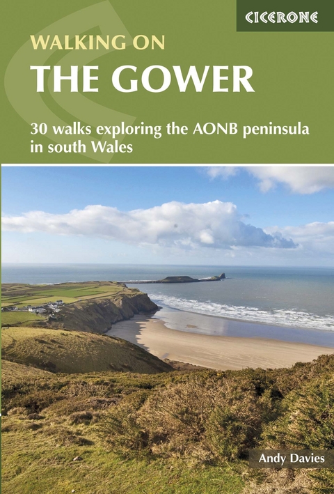
Walking on Gower
Cicerone Press (Verlag)
978-1-85284-821-7 (ISBN)
A guidebook to 30 day walks in the Gower National Landscape. Exploring the rich variety of landscapes across this beautiful area of South Wales, the walks are suitable for all abilities, from gentle strolls to more strenuous and demanding walks.
The walks range in length from 4 to 23km (3–14 miles) and can be enjoyed in 2–5 hours. Many of the walks take in sections of the Wales Coast Path.
1:50,000 OS maps included for each walk
Detailed information on refreshments and transport options for each walk
Easy access from Swansea
Local points of interest are featured including Rhossili and Three Cliffs Bay
Information included on geology, history and archaeology
Andy Davies has been a professional photographer for over 20 years and specialises in wildlife and landscape photography. He moved to West Wales in 1999 to be immersed in the environment which inspires. A former university lecturer, he now combines his love of photography and his passion for passing on skills to others in a series of photographic and video workshops in West Wales. He is also an external tutor for Aberystwyth University in outdoor and wildlife photography.
Map key
Overview map
Introduction
Geology
History
Wildlife habitats
Transport to and around Gower
Staying in Gower
Using this guide
Walk 1 The Mumbles, Langland and Caswell
Walk 2 Caswell, Pwlldu and Bishopston Valley
Walk 3 Bishopston Valley
Walk 4 Pwlldu Head and Bishopston Valley
Walk 5 Pobbles, Three Cliffs Bay and Pennard Pill and Castle
Walk 6 Three Cliffs Bay, Pennard Pill, Ilston Cwm and
Bishopston Valley
Walk 7 Pennard Pill, Three Cliffs Bay and Parc le Breos
Walk 8 Cefn Bryn, Broad Pool and Parc le Breos
Walk 9 Three Cliffs Bay, Tor Bay, Nicholaston Woods and Cefn Bryn
Walk 10 Millwood, Cefn Bryn, Reynoldston and Berry Wood
Walk 11 Penrice Castle, Cefn Bryn, Three Cliffs Bay and Oxwich NNR
Walk 12 Oxwich National Nature Reserve
Walk 13 Oxwich Point
Walk 14 Oxwich, Horton and Millwood
Walk 15 South Gower Cliffs and Port Eynon
Walk 16 Thurba Head and South Gower Cliffs
Walk 17 Rhossili Down, South Gower Cliffs and Port Eynon
Walk 18 Rhossili Down and Bay, Fall Bay and Mewslade Bay
Walk 19 Rhossili, Fall Bay and Mewslade Bay
Walk 20 Rhossili Down, Llanmadoc Hill and Broughton Burrows
Walk 21 Gower Coast NNR, Rhossili Down and Hardings Down
Walk 22 Mewslade Bay, Fall Bay, Rhossili Down and Hardings Down
Walk 23 Llanmadoc Hill, Llangennith, Burry Holms
and Broughton Bay
Walk 24 Llanmadoc Hill, Broughton Bay and Whiteford NNR
Walk 25 Whiteford National Nature Reserve
Walk 26 Landimore Marsh, Cheriton, Burry Pill and
Weobley Castle
Walk 27 Landimore Marsh, Arthur's Stone, Llanrhidian and
Weobley Castle
Walk 28 Cefn Bryn, Llanrhidian and Weobley Castle
Walk 29 Llanrhidian and Weobley Castle
Walk 30 Llanrhidian, Cil Ifor Top, Parc le Breos and Cefn Bryn
Appendix A Walk summary table
Appendix B Index of information boxes
Appendix C Useful websites
| Erscheint lt. Verlag | 21.11.2022 |
|---|---|
| Reihe/Serie | Cicerone guidebooks |
| Verlagsort | Kendal |
| Sprache | englisch |
| Maße | 116 x 172 mm |
| Gewicht | 220 g |
| Themenwelt | Sachbuch/Ratgeber ► Sport |
| Reisen ► Sport- / Aktivreisen ► Europa | |
| ISBN-10 | 1-85284-821-9 / 1852848219 |
| ISBN-13 | 978-1-85284-821-7 / 9781852848217 |
| Zustand | Neuware |
| Informationen gemäß Produktsicherheitsverordnung (GPSR) | |
| Haben Sie eine Frage zum Produkt? |
aus dem Bereich
