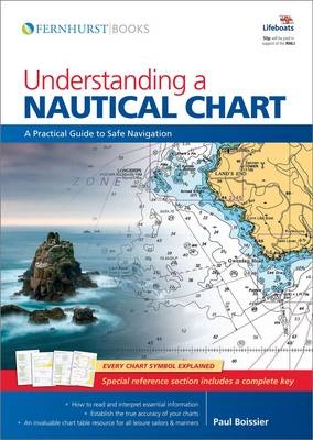
Understanding a Nautical Chart
A Practical Guide to Safe Navigation
Seiten
2011
John Wiley & Sons Inc (Verlag)
978-0-470-74913-5 (ISBN)
John Wiley & Sons Inc (Verlag)
978-0-470-74913-5 (ISBN)
- Titel erscheint in neuer Auflage
- Artikel merken
Zu diesem Artikel existiert eine Nachauflage
Navigation and charts fascinate novice and experienced seamen alike, and this book is the easiest way to gain an immediate and clear understanding of the wealth of information available on a nautical chart. There is a full explanation of how to establish the accuracy of charts to allow you to navigate with confidence and safety.
A handy guide to making sense of a nautical chart Whether they are paper or electronic, charts are the most fundamental navigational tool. Making the best use of them requires a great understanding of symbols and abbreviations, as well as an awareness of the limits of accuracy in positions and soundings. Understanding a Nautical Chart not only helps you to read a chart, it allows you to understand that information and use it to navigate safely. Learning the abbreviations and symbols are critical to anybody using a chart and before you can use one, you must know them or at have easy access to the definitions, all of which are included in a full copy of the key to UKHO charts (Chart 5011). * Explains how to establish the accuracy of charts to allow you to navigate with confidence and safety * Written by a former Royal Navy Deputy Commander in Chief, Paul Boissier* Includes a full copy of the key to UKHO chart symbols (Chart 5011).The chart information included is presented in the following sections: *General Chart Number, Title, Marginal Notes, Positions, Distances, Directions, Compass *Topography Natural Features, Cultural Features, Landmarks, Ports, Topographic Terms *Hydrography Tides, Currents, Depths, Nature of the Seabed, Rocks, Wrecks, Obstructions, Offshore Installations, Tracks, Routes Areas, Limits, Hydrographic Terms *Aids and Services Lights, Buoys, Beacons, Fog Signals, Radar, Radio, Electronic Position-Fixing Systems, Services, Small Craft Facilities *Alphabetical Index Index of Abbreviations, International Abbreviations, List of Descriptors, IALA Maritime Buoyage System *Chart 5011 About the author: Paul Boissier has spent much of his professional life at sea and was a senior admiral in the Royal Navy.
He is also a very experienced yachtsman and has cruised extensively. These perspectives make him the ideal author this guide. Paul is now the chief executive of the RNLI (Royal National Lifeboat Institution), the charity that saves lives at sea and operates over 340 lifeboats around the UK and the Republic of Ireland.
Chapter 1 What is a Chart? Chapter 2 A Chart is Never 100% Accurate. Chapter 3 What the Chart-Maker Does for Us. Chapter 4 Other Relevant Documentation. Chapter 5 How to Use a Chart. Chapter 6 Orientation. Chapter 7 The Basics (and Where to Find Them). Chapter 8 Depth and Elevations. Chapter 9 Landmarks, Light and Coastal Features. Chapter 10 Dangers: Wrecks, Rocks and Obstructions. Chapter 11 Navigation Restrictions and Limits. Chapter 12 Radar and Radio. Chapter 13 Tides, Tidal Streams and Currents. Chapter 14 Small Craft Features. Chapter 15 Other Charting Authorities. Chapter 16 GPS. Chapter 17 Digital Charting.
| Zusatzinfo | Illustrations, maps |
|---|---|
| Sprache | englisch |
| Maße | 210 x 296 mm |
| Gewicht | 748 g |
| Einbandart | Paperback |
| Themenwelt | Sachbuch/Ratgeber ► Sport ► Segeln / Tauchen / Wassersport |
| ISBN-10 | 0-470-74913-X / 047074913X |
| ISBN-13 | 978-0-470-74913-5 / 9780470749135 |
| Zustand | Neuware |
| Haben Sie eine Frage zum Produkt? |
Mehr entdecken
aus dem Bereich
aus dem Bereich
wie ich meinem Traum folge und alleine durch die Ozeane der Welt …
Buch | Hardcover (2024)
Polyglott (Verlag)
CHF 34,90
Buch | Spiralbindung (2023)
Stadler Konstanz (Verlag)
CHF 33,90


