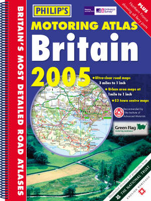
Philip's Motoring Atlas Britain
Seiten
2004
Philip's OS Publications (Verlag)
978-0-540-08592-7 (ISBN)
Philip's OS Publications (Verlag)
978-0-540-08592-7 (ISBN)
- Titel ist leider vergriffen;
keine Neuauflage - Artikel merken
A brand-new edition of the best-selling Motoring Atlas of Britain, using fully-updated computer-generated mapping. The unique feature of the atlas is its newly illustrated listings section, including concise descriptions of 850 properties owned by the National Trust, National Trust for Scotland, English Heritage, Historic Scotland and of gardens owned by the Royal Horticultural Society. The 96 pages of main road mapping are at the large scale of 3 miles to 1 inch, and the atlas also includes route-planning maps, an M25 map, 9 large-scale city approach maps, 53 extra-detailed town and city plans, airport and port plans and mapping of northern France. Numerous additional features include restricted motorway junction information, a distances chart, and a central London street plan. Also included is a map detailing National and Forest Parks, Long Distance paths and the unitary authorities.
| Erscheint lt. Verlag | 5.7.2004 |
|---|---|
| Reihe/Serie | Philip's Road Atlases & Maps |
| Zusatzinfo | all col. maps |
| Verlagsort | London |
| Sprache | englisch |
| Maße | 297 x 398 mm |
| Gewicht | 725 g |
| Themenwelt | Reisen ► Karten / Stadtpläne / Atlanten ► Europa |
| ISBN-10 | 0-540-08592-8 / 0540085928 |
| ISBN-13 | 978-0-540-08592-7 / 9780540085927 |
| Zustand | Neuware |
| Haben Sie eine Frage zum Produkt? |
Mehr entdecken
aus dem Bereich
aus dem Bereich
Buch | Spiralbindung (2024)
Freytag-Berndt und ARTARIA (Verlag)
CHF 41,85


