


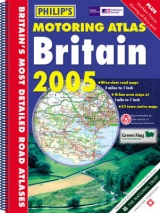
Philip's Motoring Atlas Britain
Seiten
2003
|
Revised edition
Philip's (Verlag)
978-0-540-08420-3 (ISBN)
Philip's (Verlag)
978-0-540-08420-3 (ISBN)
- Titel erscheint in neuer Auflage
- Artikel merken
Zu diesem Artikel existiert eine Nachauflage
Offering leisure information from the National Trust, English Heritage and Historic Scotland, this motoring atlas of Britain should be ideal for weekend drivers. Local detail and places of interest are higlighted and route-planning maps, a distance table, and town and city plans feature.
Using computer-generated map data from Ordnance Survey, this motoring atlas of Britain should be ideal for weekend drivers. A wealth of leisure information, including an eight-page directory of places to visit from the National Trust, English Heritage and Historic Scotland feature in this atlas. There are 95 pages of large-scale main road mapping which are fully compatible with OS walking maps. Based on the National Grid, they show masses of local detail, including places to visit, view points, camping and caravanning sights, Roman roads, ancient monuments and battlefields. Additional features include route-planning maps, an M25 map, eight large-scale city approach maps, a central London street plan, a distance table wit hestimated journey times, and 53 detailed town and city plans.
Using computer-generated map data from Ordnance Survey, this motoring atlas of Britain should be ideal for weekend drivers. A wealth of leisure information, including an eight-page directory of places to visit from the National Trust, English Heritage and Historic Scotland feature in this atlas. There are 95 pages of large-scale main road mapping which are fully compatible with OS walking maps. Based on the National Grid, they show masses of local detail, including places to visit, view points, camping and caravanning sights, Roman roads, ancient monuments and battlefields. Additional features include route-planning maps, an M25 map, eight large-scale city approach maps, a central London street plan, a distance table wit hestimated journey times, and 53 detailed town and city plans.
| Erscheint lt. Verlag | 7.7.2003 |
|---|---|
| Zusatzinfo | maps, table, index |
| Verlagsort | London |
| Sprache | englisch |
| Maße | 304 x 397 mm |
| Gewicht | 684 g |
| Themenwelt | Reisen ► Hotel- / Restaurantführer ► Europa |
| Reisen ► Karten / Stadtpläne / Atlanten ► Europa | |
| ISBN-10 | 0-540-08420-4 / 0540084204 |
| ISBN-13 | 978-0-540-08420-3 / 9780540084203 |
| Zustand | Neuware |
| Haben Sie eine Frage zum Produkt? |
Mehr entdecken
aus dem Bereich


aus dem Bereich
Bestehend aus 2 Bänden inkl. ACSI CampingCard Ermässigungskarte
Buch | Softcover (2023)
Hallwag (Verlag)
CHF 38,90