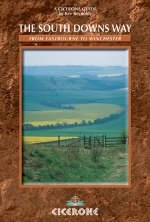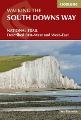
The South Downs Way
Cicerone Press (Verlag)
978-1-85284-429-5 (ISBN)
- Titel erscheint in neuer
- Artikel merken
This walking guidebook to the South Downs Way National Trail covers the entirety of the 100 mile route from Winchester to Eastbourne with route descriptions from west to east and east to west. The route is described in 12 stages, accompanied by OS maps and information on accommodation and facilities en route for each day's walking.
The South Downs Way explore the Sussex Downs and East Hampshire Areas of Outstanding Natural Beauty, often along ancient tracks, linking points of interest such as Medieval villages, Iron Age hill forts, and the Long Man of Wilmington - England's largest chalk-figure. The route traces an escarpment for most of the way, providing sweeping views, rarely descending to towns and villages except for the interruption of rich green river valleys, resulting in a surprisingly secretive walk.
As well as detailed route descriptions, this guidebook includes practical information on walking the South Downs Way, such as advice on finding accommodation, facilities en route to resupply, as well as details on the best way to travel to and from the start and finish of the walk. The result is an ideal companion for a trek across the South Downs.
This guide is part of a two-book series on the North and South Downs Ways.
Kev Reynolds is a freelance writer, photojournalist and lecturer. He has published many books on the Alps, a series of trekkers' guides to Nepal and, nearer to home, several guides on walking in southern England. A member of the alpine Club, Austrian Alpine Club and the Outdoor Writers' Guild, he is also first Honorary Member of the British Association of European Mountain Leaders. Most winters find Kev travelling around Britain sharing his love of wild places through his lectures.
Trail Description - Westbound
Section 1: Eastbourne to Alfriston (Footpath route via the Seven Sisters)
Section 1(a): Eastbourne to Alfriston (Bridleway route inland via Jevington)
Section 2: Alfriston to Southease
Section 3: Southease to Housedean (A27)
Section 4: Housedean (A27) to Pyecombe
Section 5: Pyecombe to Botolphs (Adur Valley)
Section 6: Botolphs to Washington
Section 7: Washington to Amberley
Section 8: Amberley to Cocking
Section 9: Cocking to South Harting
Section 10: South Harting to Buriton (Queen Elizabeth Forest)
Section 11: Buriton to Exton
Section 12: Exton to Winchester
Trail Description - Eastbound
Section 1: Winchester to Exton
Section 2: Exton to Buriton
Section 3: Buriton to South Harting
Section 4: South Harting to Cocking
Section 5: Cocking to Amberley
Section 6: Amberley to Washington
Section 7: Washington to Botolphs (Adur Valley)
Section 8: Botolphs to Pyecombe
Section 9: Pyecombe to Housedean (A27)
Secion 10: Housedean (A27) to Southease
Section 11: Southease to Alfriston
Section 12: Alfriston to Eastbourne (Footpath route via the Seven Sisters)
Section 12(a): Alfriston to Eastbourne (Bridleway route inland via Jevington)
| Erscheint lt. Verlag | 26.7.2012 |
|---|---|
| Zusatzinfo | 60 colour photos and 20 OS maps |
| Verlagsort | Kendal |
| Sprache | englisch |
| Maße | 116 x 172 mm |
| Gewicht | 230 g |
| Themenwelt | Sachbuch/Ratgeber ► Sport |
| Reiseführer ► Europa ► Großbritannien | |
| ISBN-10 | 1-85284-429-9 / 1852844299 |
| ISBN-13 | 978-1-85284-429-5 / 9781852844295 |
| Zustand | Neuware |
| Informationen gemäß Produktsicherheitsverordnung (GPSR) | |
| Haben Sie eine Frage zum Produkt? |
aus dem Bereich


