The South Downs Way
Cicerone Press (Verlag)
978-1-85284-782-1 (ISBN)
- Titel ist leider vergriffen;
- Artikel merken
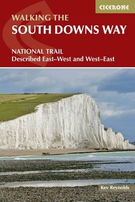
The South Downs Way National Trail is a glorious 100-mile (160km) walk between Eastbourne and Winchester, passing entirely through the South Downs National Park. Described in 12 daily stages, the route is described in both east-west and west-east directions. The South Downs Way is a waymarked bridleway with very few stiles, and the trail can be walked at any time of year. The step-by-step route descriptions are illustrated with extracts from OS mapping for every stage, and detailed practical information is included on getting to the trail, facilities and accommodation en route.
Kev Reynolds is a freelance writer, photojournalist and lecturer. A prolific compiler of guidebooks, his first title for Cicerone appeared in 1978; he has since produced many more guides. A member of the Outdoor Writers' Guild, the Alpine Club and Austrian Alpine Club, he lives in Kent, sharing his knowledge and enthusiasm throughout Britain through his lectures.
Map key
Overview map
Introduction
The Downs
The South Downs Way
Accommodation
Getting There - and Back
Using the Guide
Trail Description - Westbound
Section 1: Eastbourne to Alfriston (Footpath route via the Seven Sisters)
Section 1(a): Eastbourne to Alfriston (Bridleway route inland via Jevington)
Section 2: Alfriston to Southease
Section 3: Southease to Housedean (A27)
Section 4: Housedean (A27) to Pyecombe
Section 5: Pyecombe to Botolphs (Adur Valley)
Section 6: Botolphs to Washington
Section 7: Washington to Amberley
Section 8: Amberley to Cocking
Section 9: Cocking to South Harting
Section 10: South Harting to Buriton (Queen Elizabeth Forest)
Section 11: Buriton to Exton
Section 12: Exton to Winchester
Trail Description - Eastbound
Section 1: Winchester to Exton
Section 2: Exton to Buriton
Section 3: Buriton to South Harting
Section 4: South Harting to Cocking
Section 5: Cocking to Amberley
Section 6: Amberley to Washington
Section 7: Washington to Botolphs (Adur Valley)
Section 8: Botolphs to Pyecombe
Section 9: Pyecombe to Housedean (A27)
Secion 10: Housedean (A27) to Southease
Section 11: Southease to Alfriston
Section 12: Alfriston to Eastbourne (Footpath route via the Seven Sisters)
Section 12(a): Alfriston to Eastbourne (Bridleway route inland via Jevington)
Appendices
| Erscheint lt. Verlag | 19.1.2015 |
|---|---|
| Zusatzinfo | 60 colour photos and 20 OS maps |
| Verlagsort | Kendal |
| Sprache | englisch |
| Maße | 116 x 172 mm |
| Gewicht | 220 g |
| Themenwelt | Sachbuch/Ratgeber ► Sport |
| Reiseführer ► Europa ► Großbritannien | |
| ISBN-10 | 1-85284-782-4 / 1852847824 |
| ISBN-13 | 978-1-85284-782-1 / 9781852847821 |
| Zustand | Neuware |
| Informationen gemäß Produktsicherheitsverordnung (GPSR) | |
| Haben Sie eine Frage zum Produkt? |
aus dem Bereich


