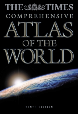
The Times Atlas of the World
Seiten
1999
|
Comprehensive Tenth edition
Times Books (Verlag)
978-0-7230-0792-0 (ISBN)
Times Books (Verlag)
978-0-7230-0792-0 (ISBN)
- Titel erscheint in neuer Auflage
- Artikel merken
Zu diesem Artikel existiert eine Nachauflage
The Millennium edition of the world’s most prestigious reference atlas, The Times Comprehensive Atlas of the World, featuring 248 pages of new, digitally created mapping and a specially commissioned 72 page introductory section to celebrate the millennium. Index to over 200,000 place names.
This 10th edition is the first entirely new edition of the atlas since the five volume Mid-Century Edition. In the fifty years since that edition was published, the art and science of cartography have been revolutionised : mapping created on hand-etched copper plates has been replaced by mapping computer generated from world and regional databases.
The atlas in introduced by unique satellite images of the continents as they appear from space. This preliminary section continues with a series of innovative images, maps, photographs and graphics reviewing the cosmos and the natural world, and man’s interaction with it at the end of the second millennium; the images and maps themselves illustrate how satellite technology continues to extend our knowledge of the earth. The section continues by chronicling the evolution of the world map and concludes with a geographical information summary on physical features, states and territories.
The reference maps that follow present the most accurate and up-to-date representation of our knowledge of the earth today. The area shown, and the scale and projection of each plate, have been entirely redesigned using computer technology to allow each plate to be individually generated to optimum parameters. As well as creating mapping of enhanced accuracy, the technology used has allowed the design to be even clearer and more accessible. The number of plates has been extended to include detailed large scale coverage of more regions to provide ever more comprehensive coverage of each country in the world.
The gazetteer-index to over 200,000 geographical features illustrates the unique scope of the atlas; the gazetteer is fully cross-referenced with alternative and former names and is supported by a glossary of geographical terms used in the atlas.
The atlas includes:
72 page introductory section
248 pages of reference maps of continents, countries and oceans
224 page gazetteer index to over 200,000 geographical features
| Erscheint lt. Verlag | 4.10.1999 |
|---|---|
| Zusatzinfo | 320 col plates (320pp), Index |
| Verlagsort | London |
| Sprache | englisch |
| Maße | 316 x 456 mm |
| Gewicht | 5615 g |
| Themenwelt | Reisen ► Karten / Stadtpläne / Atlanten |
| ISBN-10 | 0-7230-0792-6 / 0723007926 |
| ISBN-13 | 978-0-7230-0792-0 / 9780723007920 |
| Zustand | Neuware |
| Haben Sie eine Frage zum Produkt? |
Mehr entdecken
aus dem Bereich
aus dem Bereich
Buch | Hardcover (2022)
Klett (Verlag)
CHF 43,90


