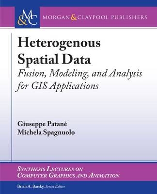
Heterogeneous Spatial Data
Morgan and Claypool Life Sciences (Verlag)
978-1-62705-462-1 (ISBN)
- Keine Verlagsinformationen verfügbar
- Artikel merken
New data acquisition techniques are emerging and are providing fast and efficient means for multidimensional spatial data collection. Airborne LIDAR surveys, SAR satellites, stereo-photogrammetry and mobile mapping systems are increasingly used for the digital reconstruction of the environment. All these systems provide extremely high volumes of raw data, often enriched with other sensor data (e.g., beam intensity). Improving methods to process and visually analyze this massive amount of geospatial and user-generated data is crucial to increase the efficiency of organizations and to better manage societal challenges.
Within this context, this book proposes an up-to-date view of computational methods and tools for spatio-temporal data fusion, multivariate surface generation, and feature extraction, along with their main applications for surface approximation and rainfall analysis. The book is intended to attract interest from different fields, such as computer vision, computer graphics, geomatics, and remote sensing, working on the common goal of processing 3D data. To this end, it presents and compares methods that process and analyze the massive amount of geospatial data in order to support better management of societal challenges through more timely and better decision making, independent of a specific data modeling paradigm (e.g., 2D vector data, regular grids or 3D point clouds).
We also show how current research is developing from the traditional layered approach, adopted by most GIS softwares, to intelligent methods for integrating existing data sets that might contain important information on a geographical area and environmental phenomenon. These services combine traditional map-oriented visualization with fully 3D visual decision support methods and exploit semantics-oriented information (e.g., a-priori knowledge, annotations, segmentations) when processing, merging, and integrating big pre-existing data sets.
Giuseppe Patane is a researcher at CNR-IMATI (2006-today) Institute for Applied Mathematics and Information Technologies--Italian National Research Council. Since 2001, his research activities have been focused on the definition of paradigms and algorithms for modeling and analyzing digital shapes and multidimensional data. He received a Ph.D. in Mathematics and Applications from the University of Genova (2005) and a Post-Lauream Degree Master in Applications of Mathematics to Industry from the F. Severi National Institute for Advanced Mathematics, Department of Mathematics and Applications--University of Milan (2000). Michela Spagnuolo is the Research Director at CNR-IMATI-GE, where she has been working since July 2001. Her research interests include geometric and semantic modeling of 3D objects, approaches based on computational topology for the analysis of shapes, and methods for the evaluation of similarity at the structural and semantic level. She authored more than 130 reviewed papers in scientific journals and international conferences, and is an associate editor of international journals in computer graphics (currently, The Visual Computer and Computers & Graphics). She actively works as chair of conferences and workshops, and she is a member of the steering committee of Shape Modeling International and of the EG Workshops on 3D Object Retrieval. In 2014, she was nominated as Fellow of the Eurographics Association.
List of Figures
List of Tables
Preface
Acknowledgments
Spatio-temporal Data Fusion
Spatial and Environmental Data Approximation
Feature Extraction
Applications to Surface Approximation and Rainfall Analysis
Conclusions
Bibliography
Authors' Biographies
| Erscheinungsdatum | 13.05.2016 |
|---|---|
| Reihe/Serie | Synthesis Lectures on Visual Computing: Computer Graphics, Animation, Computational Photography and Imaging |
| Verlagsort | San Rafael, CA |
| Sprache | englisch |
| Maße | 191 x 235 mm |
| Gewicht | 333 g |
| Themenwelt | Mathematik / Informatik ► Informatik ► Grafik / Design |
| Informatik ► Web / Internet ► Web Design / Usability | |
| Naturwissenschaften ► Geowissenschaften ► Geografie / Kartografie | |
| Technik | |
| ISBN-10 | 1-62705-462-6 / 1627054626 |
| ISBN-13 | 978-1-62705-462-1 / 9781627054621 |
| Zustand | Neuware |
| Informationen gemäß Produktsicherheitsverordnung (GPSR) | |
| Haben Sie eine Frage zum Produkt? |
aus dem Bereich


