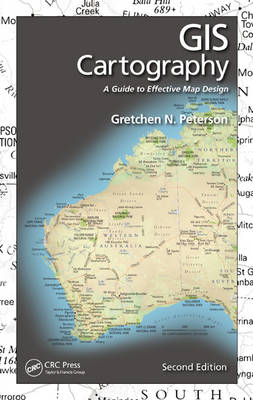
GIS Cartography
Apple Academic Press Inc. (Verlag)
978-1-4822-2067-4 (ISBN)
- Titel erscheint in neuer Auflage
- Artikel merken
See What’s New in the Second Edition
Projection theory
Hexagonal binning
Big Data point density maps
Scale dependent map design
3D building modeling
Digital cartography and its best practices
Updated graphics and references
Study questions and lab exercises at the end of each chapter
In this second edition of a bestseller, author Gretchen Peterson takes a "don’t let the technology get in the way" approach to the presentation, focusing on the elements of good design, what makes a good map, and how to get there, rather than specific software tools. She provides a reference that you can thumb through time and again as you create your maps. Copiously illustrated, the second edition explores novel concepts that kick-start your pursuit of map-making excellence. The book doesn’t just teach you how to design and create maps, it teaches you how to design and create better maps.
Introduction
On Design Experience
Constructive Criticism
What Is a Geoprofessional?
Tick-Tock Goes the Clock
Why Good Design Matters
Audience
How to Use This Book
Skipping the How-Tos to Get Straight to the Good Stuff
Relative Map Scales
Endnotes
Creative Inspiration
You Can Be Creative
Doing
Seeing
An Example of How to See
Applying All of This to Your Map
Summary and Final Prodding
Creative Maps
A Few Places to Start Seeing Art from Your Desktop
Endnotes
Exercise
Layout Design
All Together Now
Layout Checklist
Element Details and Examples
Style
Context
Arrangement
Emphasis Maps and Wireframes
Simplicity versus Complexity
Margins
Balance
Endnotes
Suggestions for Further Reading
Study Questions
Exercises
Fonts
Choosing the Right Font
Serif versus Sans Serif
Modifying the Font
Placing the Text
Text Direction
Study Questions
Resources
Endnotes
Color
Color Theory
RGB
Hexadecimal
HSV
HSL
CMYK
CIELAB
Rules
Inspiration
Grayscale Modern
Endnotes
Resources
Study Questions
Exercises
Features
Roads
Rivers and Streams
Bodies of Water
Cities and Towns
Political Boundaries
Fuzzy Features
Parcels
Currents
Wind
Temperature
Land Use and Land Cover
Trails
Utilities
Impervious Surface
Basins
Buildings
Soils
Geology
Endnotes
Suggestions for Further Reading
Study Questions
Exercises
Static Maps
DPI
Export Formats and Workflow
Slides
Presentation Style: Fast or Slow, Busy or Simple?
Reports
Posters
Dual Purposes
Endnotes
Suggestions for Further Reading
Study Questions
Exercise
Projections
Distortions: Where Projections Fall Flat
Map Considerations: Choosing a Suitable Projection
Directional Types
Choosing a Projection in the Real World
Endnotes
Resources
Study Questions
Exercises
Zoom-Level Design
Zoom Levels and Scales
Zoom Fields
Incremental Styling
Repetition
Testing a Multizoom Design
Endnotes
Resources
Study Questions
Exercises
Appendix A: Layout Sketches
Appendix B: Map Examples
Appendix C: Color Swatches
| Zusatzinfo | 232 Illustrations, black and white |
|---|---|
| Verlagsort | Oakville |
| Sprache | englisch |
| Maße | 156 x 235 mm |
| Gewicht | 676 g |
| Themenwelt | Mathematik / Informatik ► Informatik ► Web / Internet |
| Naturwissenschaften ► Geowissenschaften ► Geografie / Kartografie | |
| Naturwissenschaften ► Geowissenschaften ► Geologie | |
| ISBN-10 | 1-4822-2067-9 / 1482220679 |
| ISBN-13 | 978-1-4822-2067-4 / 9781482220674 |
| Zustand | Neuware |
| Informationen gemäß Produktsicherheitsverordnung (GPSR) | |
| Haben Sie eine Frage zum Produkt? |
aus dem Bereich


