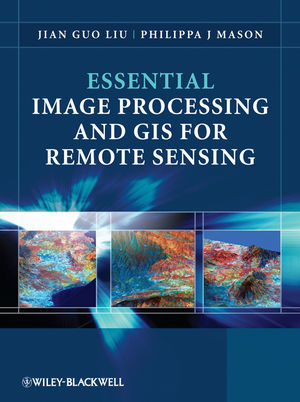
Essential Image Processing and GIS for Remote Sensing
Wiley-Blackwell (Verlag)
978-0-470-51032-2 (ISBN)
- Titel erscheint in neuer Auflage
- Artikel merken
Throughout the book the relationships between GIS, Image Processing and Remote Sensing are clearly identified to ensure that students are able to apply the various techniques that have been covered appropriately. The latter chapters use numerous relevant case studies to illustrate various remote sensing, image processing and GIS applications in practice.
Overview of the Book. Part One Image Processing. 1 Digital Image and Display. 1.1 What is a digital image? 1.2 Digital image display. 1.3 Some key points. Questions. 2 Point Operations (Contrast Enhancement). 2.1 Histogram modification and lookup table. 2.2 Linear contrast enhancement. 2.3 Logarithmic and exponential contrast enhancement. 2.4 Histogram equalization. 2.5 Histogram matching and Gaussian stretch. 2.6 Balance contrast enhancement technique. 2.7 Clipping in contrast enhancement. 2.8 Tips for interactive contrast enhancement. Questions. 3 Algebraic Operations (Multi-image Point Operations). 3.1 Image addition. 3.2 Image subtraction (differencing). 3.3 Image multiplication. 3.4 Image division (ratio). 3.5 Index derivation and supervised enhancement. 3.6 Standardization and logarithmic residual. 3.7 Simulated reflectance. 3.8 Summary. Questions. 4 Filtering and Neighbourhood Processing. 4.1 Fourier transform: understanding filtering in image frequency. 4.2 Concepts of convolution for image filtering. 4.3 Low-pass filters (smoothing). 4.4 High-pass filters (edge enhancement). 4.5 Local contrast enhancement. 4.6 *FFT selective and adaptive filtering. 4.7 Summary. Questions. 5 RGB-IHS Transformation. 5.1 Colour coordinate transformation. 5.2 IHS decorrelation stretch. 5.3 Direct decorrelation stretch technique. 5.4 Hue RGB colour composites. 5.5 *Derivation of RGB-IHS and IHS-RGB transformations based on 3D geometry of the RGB colour cube. 5.6 *Mathematical proof of DDS and its properties. 5.7 Summary. Questions. 6 Image Fusion Techniques. 6.1 RGB-IHS transformation as a tool for data fusion. 6.2 Brovey transform (intensity modulation). 6.3 Smoothing-filter-based intensity modulation. 6.4 Summary. Questions. 7 Principal Component Analysis. 7.1 Principle of PCA. 7.2 Principal component images and colour composition. 7.3 Selective PCA for PC colour composition. 7.4 Decorrelation stretch. 7.5 Physical-property-orientated coordinate transformation and tasselled cap transformation. 7.6 Statistic methods for band selection. 7.7 Remarks. Questions. 8 Image Classification. 8.1 Approaches of statistical classification. 8.2 Unsupervised classification (iterative clustering). 8.3 Supervised classification. 8.4 Decision rules: dissimilarity functions. 8.5 Post-classification processing: smoothing and accuracy assessment. 8.6 Summary. Questions. 9 Image Geometric Operations. 9.1 Image geometric deformation. 9.2 Polynomial deformation model and image warping co-registration. 9.3 GCP selection and automation. 9.4 *Optical flow image co-registration to sub-pixel accuracy. 9.5 Summary. Questions. 10 *Introduction to Interferometric Synthetic Aperture Radar Techniques. 10.1 The principle of a radar interferometer. 10.2 Radar interferogram and DEM. 10.3 Differential InSAR and deformation measurement. 10.4 Multi-temporal coherence image and random change detection. 10.5 Spatial decorrelation and ratio coherence technique. 10.6 Fringe smoothing filter. 10.7 Summary. Questions. Part Two Geographical Information Systems. 11 Geographical Information Systems. 11.1 Introduction. 11.2 Software tools. 11.3 GIS, cartography and thematic mapping. 11.4 Standards, interoperability and metadata. 11.5 GIS and the Internet. 12 Data Models and Structures. 12.1 Introducing spatial data in representing geographic features. 12.2 How are spatial data different from other digital data? 12.3 Attributes and measurement scales. 12.4 Fundamental data structures. 12.5 Raster data. 12.6 Vector data. 12.7 Conversion between data models and structures. 12.8 Summary. Questions. 13 Defining a Coordinate Space. 13.1 Introduction. 13.2 Datums and projections. 13.3 How coordinate information is stored and accessed. 13.4 Selecting appropriate coordinate systems. Questions. 14 Operations. 14.1 Introducing operations on spatial data. 14.2 Map algebra concepts. 14.3 Local operations. 14.4 Neighbourhood operations. 14.5 Vector equivalents to raster map algebra. 14.6 Summary. Questions. 15 Extracting Information from Point Data: Geostatistics. 15.1 Introduction. 15.2 Understanding the data. 15.3 Interpolation. 15.4 Summary. Questions. 16 Representing and Exploiting Surfaces. 16.1 Introduction. 16.2 Sources and uses of surface data. 16.3 Visualizing surfaces. 16.4 Extracting surface parameters. 16.5 Summary. Questions. 17 Decision Support and Uncertainty. 17.1 Introduction. 17.2 Decision support. 17.3 Uncertainty. 17.4 Risk and hazard. 17.5 Dealing with uncertainty in spatial analysis. 17.6 Summary. Questions. 18 Complex Problems and Multi-Criteria Evaluation. 18.1 Introduction. 18.2 Different approaches and models. 18.3 Evaluation criteria. 18.4 Deriving weighting coefficients. 18.5 Multi-criteria combination methods. 18.6 Summary. Questions. Part Three Remote Sensing Applications. 19 Image Processing and GIS Operation Strategy. 19.1 General image processing strategy. 19.2 Remote-sensing-based GIS projects: from images to thematic mapping. 19.3 An example of thematic mapping based on optimal visualization and interpretation of multi-spectral satellite imagery. 19.4 Summary. Questions. 20 Thematic Teaching Case Studies in SE Spain. 20.1 Thematic information extraction (1): gypsum natural outcrop mapping and quarry change assessment. 20.2 Thematic information extraction (2): spectral enhancement and mineral mapping of epithermal gold alteration, and iron ore deposits in ferroan dolomite. 20.3 Remote sensing and GIS: evaluating vegetation and land-use change in the Nijar Basin, SE Spain. 20.4 Applied remote sensing and GIS: a combined interpretive tool for regional tectonics, drainage and water resources. Questions. References. 21 Research Case Studies. 21.1 Vegetation change in the three parallel rivers region, Yunnan province, China. 21.2 Landslide hazard assessment in the three gorges area of the Yangtze river using ASTER imagery: Wushan-Badong-Zogui. 21.3 Predicting landslides using fuzzy geohazard mapping; an example from Piemonte, North-west Italy. 21.4 Land surface change detection in a desert area in Algeria using multi-temporal ERS SAR coherence images. Questions. References. 22 Industrial Case Studies. 22.1 Multi-criteria assessment of mineral prospectivity, in SE Greenland. 22.2 Water resource exploration in Somalia. Questions. References. Part Four Summary. 23 Concluding Remarks. 23.1 Image processing. 23.2 Geographical information systems. 23.3 Final remarks. Appendix A: Imaging Sensor Systems and Remote Sensing Satellites. A.1 Multi-spectral sensing. A.2 Broadband multi-spectral sensors. A.2.1 Digital camera. A.2.2 Across-track mechanical scanner. A.2.3 Along-track push-broom scanner. A.3 Thermal sensing and thermal infrared sensors. A.4 Hyperspectral sensors (imaging spectrometers). A.5 Passive microwave sensors. A.6 Active sensing: SAR imaging systems. Appendix B: Online Resources for Information, Software and Data. B.1 Software - proprietary, low cost and free (shareware). B.2 Information and technical information on standards, best practice, formats, techniques and various publications. B.3 Data sources including online satellite imagery from major suppliers, DEM data plus GIS maps and data of all kinds. References. General references. Image processing. GIS. Remote sensing. Part One References and further reading. Part Two References and further reading. Index.
| Zusatzinfo | bIllustrations |
|---|---|
| Verlagsort | Hoboken |
| Sprache | englisch |
| Maße | 196 x 254 mm |
| Gewicht | 1302 g |
| Themenwelt | Naturwissenschaften ► Geowissenschaften ► Geografie / Kartografie |
| ISBN-10 | 0-470-51032-3 / 0470510323 |
| ISBN-13 | 978-0-470-51032-2 / 9780470510322 |
| Zustand | Neuware |
| Informationen gemäß Produktsicherheitsverordnung (GPSR) | |
| Haben Sie eine Frage zum Produkt? |
aus dem Bereich


