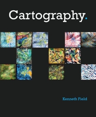
Cartography.
ESRI Press (Verlag)
978-1-58948-502-0 (ISBN)
- Titel ist leider vergriffen;
keine Neuauflage - Artikel merken
Dr. Kenneth Field brings a wealth of experience from academia and commercial practice into this book. He is a winner of numerous cartographic awards for his original maps as well as his writing. His work has been recognized by numerous peer-reviewed bodies for its quality, and this book brings together this body of cartographic knowledge for the first time. Ken is active in a wide range of societies and external bodies (International Cartographic Association, British Cartographic Society, North American Cartographic Information Society), and has written and edited books, journals, and papers, and presented keynotes on cartographic design widely. This is a landmark book that makes a strong statement about the worth of cartography and cartographic thinking and the value of a designed approach to making maps in a contemporary setting.
Introduction
Making maps is easy
Making great maps is hard
1. Maps as Information Products
The nature of an information product
What is design?
Trends in map design
Functional design
Designer, data and audience
Engineers vs Designers vs Map Makers
Simplicity and complexity
Form and Function
Dispersal and Layering
Telling stories (metaphors and simile)
Minimalism and efficiency
Novelty or redundancy
Data density
Originality
Emotional response
Integrity
Self-explanatory focus
Wayfinding maps
Experiential maps
Numerical and statistical maps
Production paradigms
Viewing paradigms
2. Perceptions and Conventions
The way the eye and brain works
Vizualising for the mind
Logically coding points
Pictograms vs Icons vs Symbols
Logically coding lines
Logically coding areas
Connotations of form
Connotations of colour
Mixing and using colours
Colour constraints
Connotations of value
Working in greyscale
Connotations of typeface
Labelling hierarchies
Making connections on the map
Consistent denotation
Innovation and familiarity
Compare and contrast
Ways of seeing
Navigating the page
Navigating the screen
Navigating the mobile device
Factual understanding vs Interpretation
3. Objective Dimensions
Information overload
Selection by feature type
Selection by numbers
Dimensional comparison
Measurement of Earth
Scale
Distances
Spheres and elipses
Datums
Latitude and longitude
Geographic coordinates
Projected coordinates
Numerical integrity
Making numbers meaningful
Geographical distortions
Projection distortions
Projection families
Choosing a good projection
Compromising geographical form
Geography as a diagram
Measurement and proportions
Absolute data
Percentages, ratios and rates
Comparatives
Summarising data distributions
Classifying data
4. Structure and Organisation
Dispersal vs Layering
Grids in information design
Organisation and response
Generalising features
Styling features
Graphical hierarchies
Contrast
Actors and support cast
Repetition
Proximity
Balance
Staging hierarchies
Which way is up?
Signs and pointers
Focussing attention
Distractions
Language and phraseology
Choosing a font
Serif
Sans serif
Font efficiency: width, height, size
Font efficiency: structure, form, direction, colour
Typeface differentiation
Legibility
Type placement
The small print (marginalia)
5. Pick’n’Map
Choropleth
Isarithmic
Dot Density
Binning
Dasymetric
Value by alpha
Cartogram
Flow
Network mapping
Schematic diagrams
Isochrones
Graduated Symbol
Proportional Symbol
Unique Values
Bivariate mapping
Multivariate mapping
Embedded charts
Small multiples
Chernof Faces
Proportional text
6. Different viewpoints
Planimetric
Panoramic
Isometric
Aspect
Prism maps
3D isolines
Mapping change
Animation
Dynamic variables
Temporal
7. Going digital – the UI/UX challenge
Map Mashups
The 2 second rule
Resolution
Size
Performance
Responsive maps
Interaction
Capabilities
Native v Browser apps
Partial attention
Time and day
Inputs
Connectivity
Currency
Personalising the map experience
User testing
Eye tracking
Wireframes
Workflow
Prototypes
Development technologies
| Erscheinungsdatum | 12.09.2018 |
|---|---|
| Verlagsort | Redlands |
| Sprache | englisch |
| Maße | 215 x 266 mm |
| Themenwelt | Informatik ► Software Entwicklung ► User Interfaces (HCI) |
| Naturwissenschaften ► Geowissenschaften ► Geografie / Kartografie | |
| ISBN-10 | 1-58948-502-5 / 1589485025 |
| ISBN-13 | 978-1-58948-502-0 / 9781589485020 |
| Zustand | Neuware |
| Informationen gemäß Produktsicherheitsverordnung (GPSR) | |
| Haben Sie eine Frage zum Produkt? |
aus dem Bereich


