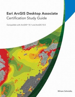
Esri ArcGIS Desktop Associate Certification Study Guide
ESRI Press (Verlag)
978-1-58948-351-4 (ISBN)
- Titel erscheint in neuer Auflage
- Artikel merken
The Esri ArcGIS Desktop Associate Certification Study Guide includes access to a 180-day version of ArcGIS 10.1 for Desktop Advanced software or ArcGIS Desktop 10 (ArcEditor license) software and a DVD containing data for working through the exercises.
Miriam Schmidts teaches GIS classes and develops course materials for the Esri Educational Services team. She is an experienced instructor, CompTIA Certified Technical Trainer (CTT ), and Esri Certified ArcGIS Desktop Professional.
Acknowledgments
Using this book
Chapter 1: ArcGIS products and extensions
Chapter 2: Working with geographic data storage formats
Chapter 3: Using the geodatabase
Chapter 4: Managing geographic data
Chapter 5: Coordinate systems
Chapter 6: Evaluating data
Chapter 7: Associating tables
Chapter 8: Georeferencing and spatial adjustment
Chapter 9: Geocoding
Chapter 10: Creating feature geometry
Chapter 11: Updating feature geometries
Chapter 12: Editing attributes
Chapter 13: Maintaining attribute integrity
Chapter 14: Editing with topology
Chapter 15: Geoprocessing for analysis
Chapter 16: Analyzing and querying tables
Chapter 17: Performing spatial analysis
Chapter 18: Organizing layers
Chapter 19: Displaying layers
Chapter 20: Composing map layouts and graphs
Chapter 21: Creating data driven pages
Chapter 22: Creating map text and symbols
Chapter 23: Preparing maps for publishing
Chapter 24: Sharing maps and data
Image and data credits
Installing the data and software
Data license agreement
| Erscheint lt. Verlag | 23.11.2013 |
|---|---|
| Zusatzinfo | 282 illustrations |
| Verlagsort | Redlands |
| Sprache | englisch |
| Themenwelt | Informatik ► Weitere Themen ► Zertifizierung |
| Naturwissenschaften ► Geowissenschaften ► Geografie / Kartografie | |
| ISBN-10 | 1-58948-351-0 / 1589483510 |
| ISBN-13 | 978-1-58948-351-4 / 9781589483514 |
| Zustand | Neuware |
| Informationen gemäß Produktsicherheitsverordnung (GPSR) | |
| Haben Sie eine Frage zum Produkt? |
aus dem Bereich


