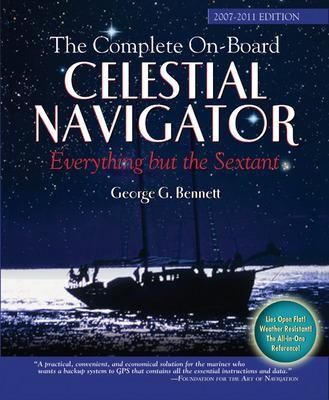
The Complete On-Board Celestial Navigator, 2007-2011 Edition
International Marine Publishing Co (Verlag)
978-0-07-148569-2 (ISBN)
- Titel ist leider vergriffen;
keine Neuauflage - Artikel merken
Your All-in-One Navigation Tool KitCelestial navigation remains an essential skill for every mariner who ventures out of sight of land. In this era of electronic navigation, it is the perfect backup system, enabling you to determine your position when the GPS malfunctions or your boat loses electrical power.Here in one volume is every bit of information you need to understand the process, take sights, and find your location anywhere in the world. Compiled for beginning and experienced celestial navigators alike, and elegantly designed on the assumption that 1-mile precision is perfectly adequate for backup navigation, this handy volume replaces $300 worth and thousands of pages of guides, tables, and almanacs. The Complete On-Board Celestial Navigator includes:
A clear, concise primer/refresher that explains the entire processA five-year nautical almanac (2007–2011) for determining precise star, sun, moon, and planet locations at the time of sightingA star finderSight reduction tables for crunching the numbers and producing a fix anywhere in the world
"The only complete self-contained work available. When your electronic navigation fails, 'steering by the stars' will guide you safely to your destination."—Sydney Afloat (Australia)
Dr. George G. Bennett is the former head of The School of Surveying, Faculty of Engineering at the University of New South Wales. He holds a PhD in geography/surveying and has published extensively in international journals in the fields of surveying and navigation. He has served as a visiting scientist at HM Nautical Almanac Office at the Royal Greenwich Observatory. He owns and directs a company producing navigational software sold in the U.S. and Australia. He is a fellow of the Institution of Surveyors and Institute of Navigation. An experienced sailor, he teaches navigation at the Cruising Yacht Club of Australia and has sailed as navigator in nine Sydney-Hobart races. HOMETOWN: Mosman, NSW, Australia
Part One: How to Work a Sight—An OverviewHow To Work a Sight—An Overview1 Introduction2 Scope and Contents3 Equipment3.1 SextantPerpendicularity ErrorSide ErrorIndex Error3.2 Clocks4 Almanac Data4.1 Stars and Aries4.2 Sun and Planets4.3 Moon4.4 Summary4.5 Alternative Interpolation Method5 Planning and Observations5.1 Planning5.2 Sextant Observations5.3 Identification5.4 Observation Methods5.5 Sunrise, Sunset, and Twilight6 Sextant Altitude Corrections6.1 Dip Correction6.2 Index Correction6.3 Star and Planet Corrections6.4 Sun Correction6.5 Moon Correction6.6 Summary7 The Marcq St. Hilaire Method7.1 Intercept7.2 AzimuthAzimuth TablesWeir Diagrams7.3 The Position Fix8 Amplitudes9 Polaris9.1 Azimuth9.2 Latitude10 Sun Observations10.1 Running Fixes10.2 Meridian Observations11 Sight Reduction at Very Low AltitudesPart Two: Tables, Examples, and FormsConstants and FormulasGHA Aries and Star EphemeridesSun and Planet EphemeridesSun and Planet Interpolation and Altitude CorrectionsMoon EphemeridesMoon Declination InterpolationMoon (GHA-GMT) InterpolationMoon Altitude CorrectionsSextant Altitude Analysis ExamplePrediction and IdentificationLAT of Sunrise and SunsetLAT of Civil TwilightSight Reduction TablesAzimuth TablesWeir DiagramsPolaris (Latitude and Azimuth)Change of Altitude in 5 Minutes of TimeSight Reduction Example: Stars, Planet, and MoonRunning Fix Example: SunAlternative Interpolation Table (Calculator)Form: Sextant Altitude AnalysisForm: Sight ReductionForm: Sight Reduction (Plot)The Navigational StarsIndexConversion of Time to Arc
| Erscheint lt. Verlag | 16.1.2007 |
|---|---|
| Zusatzinfo | 12 Illustrations |
| Verlagsort | Rockport, ME |
| Sprache | englisch |
| Maße | 221 x 274 mm |
| Gewicht | 517 g |
| Themenwelt | Natur / Technik ► Fahrzeuge / Flugzeuge / Schiffe ► Schiffe |
| Sachbuch/Ratgeber ► Sport ► Segeln / Tauchen / Wassersport | |
| Technik ► Fahrzeugbau / Schiffbau | |
| Schlagworte | Navigation |
| ISBN-10 | 0-07-148569-4 / 0071485694 |
| ISBN-13 | 978-0-07-148569-2 / 9780071485692 |
| Zustand | Neuware |
| Haben Sie eine Frage zum Produkt? |
aus dem Bereich


