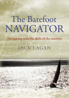
The Barefoot Navigator
Navigating With the Skills of the Ancients
Seiten
2006
Adlard Coles Nautical (Verlag)
978-0-7136-7429-3 (ISBN)
Adlard Coles Nautical (Verlag)
978-0-7136-7429-3 (ISBN)
- Titel ist leider vergriffen;
keine Neuauflage - Artikel merken
An exploration of the skills of navigation employed by the ancients and transferrable. This is an analysis of practical technology-free navigation, whose techniques can easily be employed by modern navigators to supplement their personal navigation skills in order to just 'know' where they are.
The Barefoot Navigator is an unusual and fascinating exploration of the skills of navigation employed by the ancients and transferrable to the present day. The first half of the book investigates the navigation capabilities of seafarers long before modern navigation instruments or charts became available. For example, how did the Polynesians manage to populate an area of ocean larger than North America simply by analysing clouds, currents, wind direction, sun, stars and the flight patterns of ocean birds? And how did the Vikings routinely travel between Iceland, Greenland and Scandinavia - huge tracts of treacherous water? The second part of the book analyses how the techniques of the ancients can be employed by 21st century seafarers to supplement today's navigational hardware - especially in survival situations. This is a unique analysis of practical technology-free navigation, whose techniques can easily be employed by modern navigators to supplement their personal navigation skills in order to just 'know' where they are. It will fascinate navigators and landlubbers alike.
The Barefoot Navigator is an unusual and fascinating exploration of the skills of navigation employed by the ancients and transferrable to the present day. The first half of the book investigates the navigation capabilities of seafarers long before modern navigation instruments or charts became available. For example, how did the Polynesians manage to populate an area of ocean larger than North America simply by analysing clouds, currents, wind direction, sun, stars and the flight patterns of ocean birds? And how did the Vikings routinely travel between Iceland, Greenland and Scandinavia - huge tracts of treacherous water? The second part of the book analyses how the techniques of the ancients can be employed by 21st century seafarers to supplement today's navigational hardware - especially in survival situations. This is a unique analysis of practical technology-free navigation, whose techniques can easily be employed by modern navigators to supplement their personal navigation skills in order to just 'know' where they are. It will fascinate navigators and landlubbers alike.
Jack Lagan has been sailing since the 1960s on everything from 14ft dinghies to 30m Baltic Traders around the world. When not living-aboard, fitting navigation systems and helping with yacht deliveries, he is a writer and documentary film-maker.
| Zusatzinfo | b/w diagrams+charts+photo |
|---|---|
| Verlagsort | London |
| Sprache | englisch |
| Maße | 171 x 244 mm |
| Gewicht | 396 g |
| Einbandart | Paperback |
| Themenwelt | Sachbuch/Ratgeber ► Sport ► Segeln / Tauchen / Wassersport |
| Technik ► Fahrzeugbau / Schiffbau | |
| ISBN-10 | 0-7136-7429-6 / 0713674296 |
| ISBN-13 | 978-0-7136-7429-3 / 9780713674293 |
| Zustand | Neuware |
| Informationen gemäß Produktsicherheitsverordnung (GPSR) | |
| Haben Sie eine Frage zum Produkt? |
Mehr entdecken
aus dem Bereich
aus dem Bereich
wie ich meinem Traum folge und alleine durch die Ozeane der Welt …
Buch | Hardcover (2024)
Polyglott (Verlag)
CHF 34,90
Buch | Spiralbindung (2023)
Stadler Konstanz (Verlag)
CHF 33,90


