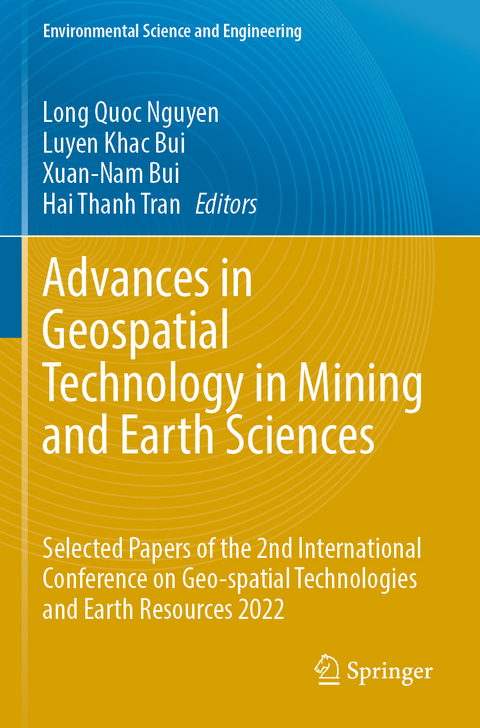
Advances in Geospatial Technology in Mining and Earth Sciences
Springer International Publishing (Verlag)
9783031204654 (ISBN)
GTER 2022 is technically co-sponsored by Vietnam Mining Science and Technology Association (VMST), Vietnam Association of Geodesy, Cartography and Remote Sensing (VGCR), Vietnam National Coal-Mineral Industries Holding Corporation Limited (VINACOMIN), and the Dong Bac Corporation (NECO).
GTER 2022 aims to bring together experts, researchers, engineers, and policymakers to discuss and exchange their knowledge and experiences in recent geospatial technologies, advances in mining and earth sciences.
Chapter 1: 202 Application of Unmanned Aerial Vehicles for Surveying and Mapping in Mines: A Review.- Chapter 2: 147 Traditional and Advanced Techniques for Extraction of Large Dimension Stone Blocks for Rock-cladding and Monumental Purposes.- Chapter 3: 017 Mining-induced Land Subsidence Detected by Persistent Scatterer InSAR: Case Study in Pniówek Coal Mine, Silesian Voivodeship, Poland.- Chapter 4: 156 Slope Stability Evaluation of Fenghuangshan Landfill Under Rainfall Condition: A Case Study.- Chapter 5: 117 Forecasting PM10 Concentration from Blasting Operations in Open-Pit Mines Using Unmanned Aerial Vehicles and Adaptive Neuro-Fuzzy Inference System.- Chapter 6: 066 Assessing the Effect of Open-pit Mining Activities and Urbanization on Fine Particulate Matter (PM2.5) Concentration by Using Remote Sensing Imagery. A Case Study in Binh Duong Province, Vietnam.- Chapter 7: 016 Effect of Loading Frequency on the Liquefaction Resistance of Poorly Graded Sand.- Chapter 8: 144 An Automatic Method for Clay Minerals Extraction from Landsat 8 OLI Data. A Case Study in Chi Linh City, Hai Duong Province.- Chapter 9: 009 Evaluation of the Precision of SARAL/AltiKa and Sentinel-3A Satellite Altimetry Data over the Vietnam Sea and Its Surroundings.- Chapter 10: 070 Detection of GNSS-TEC Noise Related to the Tonga Volcanic Eruption Using Optimization Machine Learning Techniques and Integrated Data.- Chapter 11: 149 Stability of Road Embankments on Weak Soils.- Chapter 12: 053 Indirect Georeferencing in Terrestrial Laser Scanning: One-step and Two-step Approaches.- Chapter 13: 196 Technological Solutions for Fly Ash and Red Mud Upcycling Approach the Vietnam's Government Target of Net-zero Carbon By 2050.- Chapter 14: 153 Pile-soil Interaction Mechanism and Optimization Measures Based on Finite Element Method.- Chapter 15: 055 Determination of Illegal Signs of Coal Mining Expansion in Thai Nguyen Province, Vietnam From a Combination of Radar and Optical Imagery Mine Production Tracking Platform and Its Initial Application in the Digital Transformation for a Vietnamese Coal Exploitation Company Chapter 21: 163 Shear Strength of Poorly Graded Granular Material in Multi-stage Direct Shear Test.- Chapter 22: 152 High-resolution Seismic Reflection Survey of Young Sediment at Can Gio Coast, Ho Chi Minh City, Vietnam.- Chapter 23: 140 Analysis of Geological Structures by 2D Magnetotelluric Inversion in Bang Hot Spring Area, Quang Binh Province.- Chapter 24: 119 Physicochemical characteristics of the Middle Triassic Limestone in Ha Nam Province, Vietnam and the Ability of Adsorption of Heavy Metal Ions from Aqueous Environments.- Chapter 25: 159 Local Mechanical Behaviors of Steel Box Girder During Skew Incremental Launching.- Chapter 26: 094 GIS Applications in Land Adaptability Mapping for Perennial Industrial Crops in Nghe An Province.- Chapter 27: 083 Land-use and Land-cover Change Detection and Classification to Analyze Dynamics of Dragon Fruit Farming in Sand Dunes Area of Binh Thuan Province of Vietnam.- Chapter 28: 059 Random Forest Analysis of Land Use and Land Cover Change Using Sentinel-2 Data in Van Yen, Yen Bai Province.- Chapter 29: 155 Engineering Geological Problems of Foundation Pit Construction in Quaternary Strata: Taking Suzhou Area as An example Chapter 30: 034 Roof Condition Characteristics Affecting the Stability of Coal Pillars and Retained Roadway.- Chapter 31: 194 On the Flow Assurance for Un-Insulated Subsea Pipeline Systems: Application on the Multiphase Pipeline from Pearl Field to FPSO Ruby II Offshore Vietnam.- Chapter 32: 017 Detection of Underground Anomalies by Evaluation of Ground Penetrating Radar Attribute Combination.- Chapter 33: 157 Dynamic Failure Process of Soil Particles at the End of Shield Tunnel Based on Discrete Element.- Chapter 34: 205 Early Triassic Tectonic Evolution in the Northeastern Kontum Massif: New Constrains from the S-type Granite in Ba To Area, Quang Ngai Province, Central Vietnam.- C
| Erscheinungsdatum | 07.03.2024 |
|---|---|
| Reihe/Serie | Environmental Science and Engineering |
| Zusatzinfo | XVI, 548 p. 300 illus., 270 illus. in color. |
| Verlagsort | Cham |
| Sprache | englisch |
| Maße | 155 x 235 mm |
| Themenwelt | Naturwissenschaften ► Geowissenschaften |
| Technik ► Bauwesen | |
| Technik ► Bergbau | |
| Schlagworte | Civil Engineering • earth sciences • Geographic Information System • Geospatial Technology • global navigation satellite system • Mine Surveying • Open-pit and Underground Mining • Remote Sensing • terrestrial laser scanning • unmanned aerial vehicle |
| ISBN-13 | 9783031204654 / 9783031204654 |
| Zustand | Neuware |
| Informationen gemäß Produktsicherheitsverordnung (GPSR) | |
| Haben Sie eine Frage zum Produkt? |
aus dem Bereich


