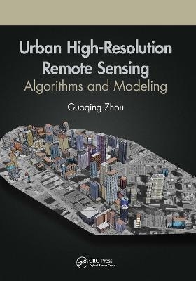
Urban High-Resolution Remote Sensing
CRC Press (Verlag)
978-0-367-85750-9 (ISBN)
Advanced sensor technologies and image processing methodologies such as deep learning, data mining, etc., facilitate the wide applications of remote sensing technology in urban areas. This book presents advanced image processing methods and algorithms focused on three very important roots of urban remote sensing: 3D urban modelling using different remotely sensed data, urban orthophotomap generation, and urban feature extraction, which are also today’s real challenges in high resolution remote sensing. Data generated by remote sensing, with its repetitive and synoptic viewing and multispectral capabilities, constitutes a powerful tool for mapping and monitoring emerging changes in the city's urban core, as well as in peripheral areas.
Features:
Provides advances in emerging methods and algorithms in image processing and technology
Uses algorithms and methodologies for handling high-resolution imagery from a ground sampling distance (GSD) less than 1.0 meter
Focuses on 3D urban modelling, orthorectification methodologies, and urban feature extraction algorithms from high-resolution remotely sensed imagery
Demonstrates how to apply up-to-date techniques to the problems identified and how to analyze research results
Presents methods and algorithms for monitoring, analyzing, and modeling urban growth, urban planning, and socio-economic developments
In this book, readers are provided with valuable research studies and applications-oriented chapters in areas such as urban trees, soil moisture mapping, city transportation, urban remote sensing big data, etc.
Guoqing Zhou received his first Ph.D. from Wuhan University, Wuhan, China, in 1994 and his second Ph.D. from Virginia Tech at Blacksburg, Virginia, USA in 2001. He was a Visiting Scholar at the Department of Computer Science and Technology, Tsinghua University, Beijing, China, and a Postdoctoral Researcher at the Institute of Information Science, Beijing Jiaotong University, Beijing, China from 1994-1996. He continued his research as an Alexander von Humboldt Fellow at Technical University of Berlin, Berlin, Germany from 1997-1998, and afterward became a Postdoctoral Researcher at the Ohio State University, Columbus, OH, USA from 1998 to 2000. Later he worked at Old Dominion University, Norfolk, VA, USA, as an Assistant Professor, Associate Professor, and Full Professor in 2000, 2005, and 2010, respectively. He is currently professor at the Guilin University of Technology, Guilin, China. He is author of 4 books and has published more than 300 papers in peer-reviewed journals and conference proceedings.
Part I Introduction. Chapter 1 Introduction. Chapter 2 Urban Remote Sensing and Urban Studies. Chapter 3 Advances of Urban Remote Sensing. Part II Information Extroduction. Chapter 4 Urban 3D Surface Information Extraction from Aerial Image Sequences. Chapter 5 Urban 3D Surface Information Extraction from Linear Pushbroom Stereo Imagery. Chapter 6 Urban 3D Building Extraction Through Lidar and Aerial Imagery. Chapter 7 Urban 3D Building Extraction From Lidar and Orthoimages. Chapter 8 Vehicle Extraction from High Resolution Aerial Image. Chapter 9 Single Tree Canopy Extraction From Lidar Point Cloud Data. Chapter 10 Power Lines Extraction from Aerial Images. Part III Urban Orthophotomap Generation. Chapter 11 The Basic Principle of Urban True Orthophotomap Generation. Chapter 12 Orthomap Creation with Extremely High Buildings. Chapter 13 Near Real-Time Orthophoto Map Generation from UAV Video. Chapter 14 Orthophotomap Generation from Satellite Imagery without Camera Parameters. Chapter 15 Building Occlusion Detection in Urban True Orthophotomap. Part IV Advanced Agorithms Urban Remote Sensing Application. Chapter 16 Hierarchical Spatial Features Learning for Image Classification. Chapter 17 Surface Soil Moisture Retrieval From CBERS-02B Satellite Imagery. Chapter 18 Measuring Control Delay at Signalized Intersections Using GPS and Video Flow. Chapter 19 Measurement of Dry Asphalt Road Surface Friction Using Hyperspectral Images
| Erscheinungsdatum | 15.01.2021 |
|---|---|
| Zusatzinfo | 51 Tables, black and white; 267 Illustrations, black and white |
| Verlagsort | London |
| Sprache | englisch |
| Maße | 178 x 254 mm |
| Gewicht | 798 g |
| Themenwelt | Naturwissenschaften ► Geowissenschaften ► Geografie / Kartografie |
| Technik ► Umwelttechnik / Biotechnologie | |
| Weitere Fachgebiete ► Land- / Forstwirtschaft / Fischerei | |
| ISBN-10 | 0-367-85750-2 / 0367857502 |
| ISBN-13 | 978-0-367-85750-9 / 9780367857509 |
| Zustand | Neuware |
| Informationen gemäß Produktsicherheitsverordnung (GPSR) | |
| Haben Sie eine Frage zum Produkt? |
aus dem Bereich


