2000 Chart Atlas
Imray, Laurie, Norie & Wilson Ltd (Verlag)
978-1-84623-974-8 (ISBN)
- Titel erscheint in neuer Auflage
- Artikel merken
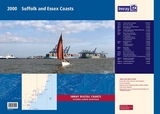
2000.1 Suffolk and Essex Coasts
1: 120 000 WGS 84
2000.2 Rivers Ore and Alde
1: 35 000 WGS 84
2000.3 River Deben and Orford Haven
1: 35 000 WGS 84
Plans Woodbridge, Tide Mill Yacht Harbour
2000.4 Harwich Approaches and Walton Backwaters
1: 35 000 WGS 84
Plans Walton Yacht Basin and Titchmarsh Marina
2000.5 Rivers Stour and Orwell
1: 35 000 WGS 84
Plans Upper Orwell to Ipswich, Fox's Marina, Woolverstone Marina, Suffolk Yacht Harbour, Shotley Marina
2000.6 River Blackwater
1: 35 000 WGS 84
Plans Maldon, Tollesbury Marina, Bradwell Marina
2000.7 River Colne
1: 35 000 WGS 84
Plans Wivenhoe, Brightlingsea
2000.8 River Crouch Entrance
1: 35 000 WGS 84
2000.9 Rivers Crouch and Roach
1: 35 000 WGS 84
Plans Fambridge Yacht Haven, Bridgemarsh Marina, Burnham Yacht Harbour, Continuation of River Crouch
2000.10 Orford Ness to Lowestoft
1: 90 000 WGS 84
Plans Lowestoft Approaches, Lowestoft Harbour, Lowestoft Harbour - Lake Lothing, Southwold Harbour
For this February 2018 edition the latest depth surveys have been applied. The latest wind farm information is included where relevant.
There has been general updating throughout.
The 2018 edition is now wirobound and tidal stream information is included. Individual sheets of this atlas will no longer be sold separately. However, 1st edition charts Y2, Y6 and Y12 are to be published and are replicas of charts 2000.2, 2000.1 and 2000.5 respectively.
Imray Laurie Norie & Wilson Ltd was formed in 1904 when three private chart publishing firms amalgamated. Each of these London companies had a long history going back to the mid-18th century. James Imray and Son published an extensive list of charts and pilot books. RH Laurie and Sons was associated with charts published for the East India Company. Norie and Wilson, founded by JW Norie, whose Nautical Tables are still supplied to navigators across the world, produced charts and books on navigation and sold nautical instruments.Until 1939 we were based in the City of London, where long serving cartographers produced charts from copper plate engravings which were supplied to mariners throughout the World. For over a century Blueback Charts were the first choice of many shipping companies. Now based in St Ives in Cambridgeshire, Imray charts are produced digitally for printed and electronic editions by our drawing office team. Our catalogue of yachting charts is regarded by the sailing community as the most comprehensive available. Our paper charts are complemented by a growing list of electronic publications and high quality pilot books by leading authors.
| Erscheinungsdatum | 15.05.2018 |
|---|---|
| Reihe/Serie | 2000 |
| Verlagsort | Huntingdon |
| Sprache | englisch |
| Maße | 590 x 420 mm |
| Themenwelt | Natur / Technik ► Fahrzeuge / Flugzeuge / Schiffe ► Schiffe |
| Sachbuch/Ratgeber ► Sport ► Segeln / Tauchen / Wassersport | |
| Technik ► Fahrzeugbau / Schiffbau | |
| Technik ► Maschinenbau | |
| ISBN-10 | 1-84623-974-5 / 1846239745 |
| ISBN-13 | 978-1-84623-974-8 / 9781846239748 |
| Zustand | Neuware |
| Haben Sie eine Frage zum Produkt? |
aus dem Bereich