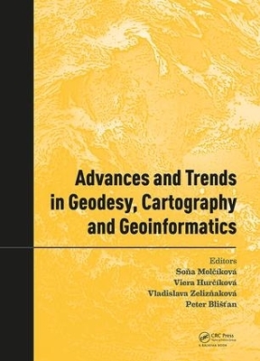
Advances and Trends in Geodesy, Cartography and Geoinformatics
CRC Press (Verlag)
978-1-138-58489-1 (ISBN)
Soňa Molčíková, M.Sc., Ph.D. (BERG faculty, Technical University of Košice, Slovakia), currently holds the position of assistant professor at the Institute of Geodesy, Cartography and Geographical Information Systems at the faculty of BERG, TUKE. She was a member of the organizing committee for all 10 years of the conference, and she was a chairman three times. She professionally and scientifically specializes in geodesy and cartography, with a focus on physical geodesy and visualization of spatial data in geographic information systems. She is the author and co-author of circa 30 scientific and educational publications. Viera Hurčíková, M.Sc., Ph.D. (BERG faculty, Technical University of Košice, Slovakia), currently holds the position of assistant professor at the Institute of Geodesy, Cartography and Geographical Information Systems at the faculty of BERG, TUKE. She was a member of the organizing committee for all 10 years of the conference. She professionally and scientifically specializes in geodesy and geoinformatics, with a focus on space geodesy, 3D modelling and visualization of spatial data in geographic information systems. She is the author and co-author of more than 40 scientific and educational publications. Vladislava Zelizňaková, M.Sc., Ph.D. (BERG faculty, Technical University of Košice, Slovakia), currently holds the position of assistant professor at the Institute of Geodesy, Cartography and Geographical Information Systems at the faculty of BERG, TUKE. She professionally and scientifically specializes in geodesy, with a focus on the adjustment of measurements in a geodetic network and deformation analysis of a geodetic network. She is the author and co-author of circa 20 scientific and educational publications. Assoc. prof. Peter Blišťan, M.Sc., Ph.D., MBA (BERG faculty, Technical University of Košice, Slovakia), currently holds the position of Director and university professor at the Institute of Geodesy, Cartography and Geographical Information Systems at the faculty of BERG, TUKE. He professionally and scientifically specializes in Geoinformatics, with a focus on 3D modelling and visualization of spatial data in geographic information systems. He is the author and co-author of more than 180 scientific and educational publications.
Part A: Surveying and mine surveying
Part B: Geodetic control and geodynamics
Part C: Cartography and geoinformatics
| Erscheinungsdatum | 04.07.2018 |
|---|---|
| Reihe/Serie | Advances and Trends in Geodesy, Cartography and Geoinformatics |
| Verlagsort | London |
| Sprache | englisch |
| Maße | 174 x 246 mm |
| Gewicht | 539 g |
| Themenwelt | Informatik ► Grafik / Design ► Digitale Bildverarbeitung |
| Naturwissenschaften ► Geowissenschaften ► Geografie / Kartografie | |
| Naturwissenschaften ► Geowissenschaften ► Geologie | |
| Technik ► Elektrotechnik / Energietechnik | |
| Technik ► Umwelttechnik / Biotechnologie | |
| ISBN-10 | 1-138-58489-4 / 1138584894 |
| ISBN-13 | 978-1-138-58489-1 / 9781138584891 |
| Zustand | Neuware |
| Informationen gemäß Produktsicherheitsverordnung (GPSR) | |
| Haben Sie eine Frage zum Produkt? |
aus dem Bereich


