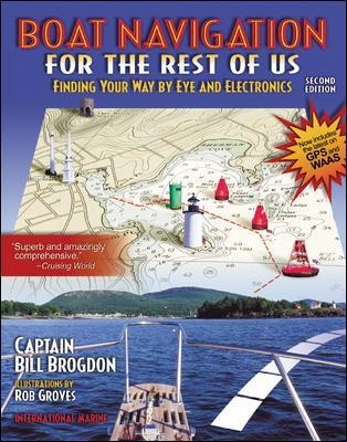
Boat Navigation for the Rest of Us: Finding Your Way By Eye and Electronics
International Marine Publishing Co (Verlag)
978-0-07-137226-8 (ISBN)
- Titel z.Zt. nicht lieferbar
- Versandkostenfrei
- Auch auf Rechnung
- Artikel merken
"Superb and amazingly comprehensive." - Cruising World. "Thorough treatment of traditional and electronic methods by an expert." - "WoodenBoat". "Boat Navigation for the Rest of Us" is the only book that teaches navigation the way small-boat skippers actually navigate: by combining electronic aids like GPS and radar with commonsense visual piloting skills and simple chartwork. This second edition covers important developments in electronic navigation, including dramatic improvements in GPS accuracy, the growing popularity of electronic charts and plotting systems, and the increasing availability of navigation information over the Internet. It's a full course in navigation plus a whole toolbox of little-known tips and shortcuts to deal with real-life situations without a slide rule.
Captain Bill Brogdon (Cape Carteret, NC) served in the U.S. Coast Guard for more than 30 years. He writes regularly for major boating magazines and has twice received the Lawton Award for the most significant contribution to boating safety through the media.
List of SidebarsAcknowledgmentsIntroduction1. How We NavigateGoing to an Object in SightCourse, Speed, and Time: The DRFinding the Boat's PositionElectronic Aid-to-Navigation SystemsBlending Visual, Instrument, and Electronic Information2. Charts and PublicationsChartsLatitude and Longitude; Chart Scale and Projection; Chart Symbols; Direction and Distance; Depths; Chart Dates and Corrections; Great Lakes Charts; Charts for Rivers and ReservoirsPublications3. Navigation Instruments and EquipmentThe CompassDirection; Variation and Deviation; Bad Compass, Good CourseDepthfindersTypes of Depthfinders; Depth Corrections; Choosing a DepthfinderSpeed and Distance LogsTimeBinocularsA Navigator's KitRadarRadar Measurements: Range and Bearing4. Aid-to-Navigation SystemsVisual Aids to NavigationColor, Shape, Lights, and Numbers; Intracoastal Waterway Aids to NavigationSound SignalsThe Global Positioning System and Loran-CPlotters; Additional Similarities and Differences; Accuracy; Coverage; Choosing an Electronic Navigation System; Choosing a Receiver; Differential GPS and WAASRadiobeacons and Radio Direction FindersRaconsOther Radionavigation Systems5. Finding Where You AreSeaman's EyeRadar and Seaman's EyeTaking DepartureDed (Dead) ReckoningTime, Speed, and Distance CalculationsTime; Speed; Distance; Doing the Calculations Mentally; Direction and TimeLines of Position and FixesObjects for Lines of Position; Fixes from Lines of Position; Radar Lines of Position; Line-of-Position and Fix Errors; RangesEstimated PositionsDistance OffElectronic Navigation SystemsWaypointsMeasuring and Storing Waypoints with a Receiver; Plotting GPS and Loran-C Positions on a Chart; Position with Respect to Waypoints; Using Waypoints Measured by Another Receiver; Converting Waypoints from Loran-C to GPS; Corrections to Waypoint PositionsAvoiding GPS and Loran-C ErrorsCheck before Getting Underway; Electronic Position Jumps; Out of Tolerance Signals6. Finding Where to GoSeaman's EyeFrozen Ranges; Steering Clear; Water Colors; WavesGoing to Distant DestinationsElectronic Navigation SystemsCoping with CurrentPlotting; Calculating the Lead Angle; Shortcut Lead Angles; Practical MethodsFollowing the Desired Track Using a Navigation ReceiverBearing to Waypoint; Cross-Track Error; Course Made Good; Estimated Time En Route; Scratch Waypoints; Staying in Good WaterLosing Electronic NavigationRadarBlending Electronic and Visual NavigationIsland Chains, Marshes, and ReservoirsRiver NavigationNight NavigationNavigation in FogRadar for Collision AvoidanceCollision Avoidance in Poor Visibility7. Special TechniquesRiding a Line of PositionThe Deliberate MissThe Electronic Navigation HookLook Behind YouThings That Go WrongSigns of Trouble; Data Entry Errors; Different Bearings to a Waypoint; Shifting Waypoints; Which One Is Wrong?; Onboard Interference; External Interference; Moving the Receiver Long Distances; Cross-Track Error Jumps to ZeroAppendix A. How GPS WorksAppendix B. How Loran-C WorksAppendix C. Good, Bad, and Ugly Receiver FeaturesGlossaryIndex
| Erscheint lt. Verlag | 16.2.2001 |
|---|---|
| Zusatzinfo | 45 Illustrations |
| Verlagsort | Rockport, ME |
| Sprache | englisch |
| Maße | 185 x 234 mm |
| Gewicht | 411 g |
| Themenwelt | Sachbuch/Ratgeber ► Sport ► Segeln / Tauchen / Wassersport |
| Technik ► Fahrzeugbau / Schiffbau | |
| ISBN-10 | 0-07-137226-1 / 0071372261 |
| ISBN-13 | 978-0-07-137226-8 / 9780071372268 |
| Zustand | Neuware |
| Haben Sie eine Frage zum Produkt? |
aus dem Bereich


