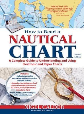
How to Read a Nautical Chart, 2nd Edition (Includes ALL of Chart #1)
Seiten
2012
|
2nd edition
McGraw-Hill Professional (Verlag)
978-0-07-177982-1 (ISBN)
McGraw-Hill Professional (Verlag)
978-0-07-177982-1 (ISBN)
Provides information on reading and relying on electronic and paper nautical charts. This title explains various aspects of electronic and paper nautical charts: how a chart is assembled, how to gauge the accuracy of chart data, how to read charts created by other governments, how to use information such as scale, and more.
Authoritative, practical, and hands-on information on reading and relying on electronic and paper nautical charts
The classic How to Read a Nautical Chart explains every aspect of electronic and paper nautical charts: how a chart is assembled, how to gauge the accuracy of chart data, how to read charts created by other governments, how to use information such as scale, projection technique and datum that every chart contains; how not to get fooled or run aground by overzooming. Nigel Calder teaches you how to squeeze every ounce of information out of a nautical chart (on your GPS, chartplotter, or nav station) and understand the limits of accuracy for all charts, paper and electronic, raster and vector.
This much-awaited second edition addresses the changes in the world of electronic charting, integrated onboard navigation systems, as well as radar overlays and AIS and their interfacing with charts. A new chapter onthe Wiki Revolution explores the mechanisms allowing you to incorporate user-generated content into navigational products and share this content with others—harnessing a user-base never before possible. Calder also explores how 3D-technology and real-time depth and weather information is creating interactive charting capacities that are fundamentally changing how we navigate. Calder's unique, practical insights will help you to navigate safely for years to come.
Niger Calder is the author of Marine Diesel Engines (1987, 1991) and Boatowner's Mechanical and Electrical Manual (1989, 1995), the success of which has made him the most sought-after marine how-to writer in the U.S. and U.K. He has published more than 800 magazine articles in SAIL, Cruising World, Ocean Navigator, Yachting World, etc., and lectures on cruising to sell-out crowds. He is also the author of The Cruising Guide to The Northwest Caribbean (IM, 1991) and Cuba: A Cruising Guide (Imray, 1996). He will be testing his newest ideas with his family during a six-month cruise to the Caribbean and South America this winter.
| Erscheint lt. Verlag | 16.6.2012 |
|---|---|
| Zusatzinfo | 30 Illustrations |
| Sprache | englisch |
| Maße | 216 x 274 mm |
| Gewicht | 553 g |
| Themenwelt | Sachbuch/Ratgeber ► Sport ► Segeln / Tauchen / Wassersport |
| Technik ► Fahrzeugbau / Schiffbau | |
| ISBN-10 | 0-07-177982-5 / 0071779825 |
| ISBN-13 | 978-0-07-177982-1 / 9780071779821 |
| Zustand | Neuware |
| Informationen gemäß Produktsicherheitsverordnung (GPSR) | |
| Haben Sie eine Frage zum Produkt? |
Mehr entdecken
aus dem Bereich
aus dem Bereich
wie ich meinem Traum folge und alleine durch die Ozeane der Welt …
Buch | Hardcover (2024)
Polyglott (Verlag)
CHF 34,90
Buch | Spiralbindung (2023)
Stadler Konstanz (Verlag)
CHF 33,90


