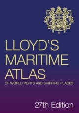
Lloyd's Maritime Atlas of World Ports and Shipping Places
Seiten
2011
|
26th New edition
Informa Law (Verlag)
978-1-84311-949-4 (ISBN)
Informa Law (Verlag)
978-1-84311-949-4 (ISBN)
- Titel erscheint in neuer Auflage
- Artikel merken
Zu diesem Artikel existiert eine Nachauflage
Lloyd's Maritime Atlas of World Ports and Shipping Places
Lloyd's Maritime Atlas, published since 1951, is the oldest and most respected atlas in the shipping industry. The 26th edition, the latest for two years, has been completely updated but has retained the traditional design.
This authoritative publication is the comprehensive way to locate the world's ports and shipping places. The commercial ports are covered in a clear concise manner, focusing on the busiest trading routes. Each regional map features distance tables and ports on a world table.
Key features and benefits:
■70 full colour world, ocean and regional maps; distance tables, major canal and river systems, weather hazards at sea and international load line zones
■Precise latitude/longitude co-ordinates of over 8,000 ports and shipping places from around the world
■All major road, rail and airport links serving the ports
■Detailed coastline, geographical port and alphabetical indexes
■Petroleum/Bunker ports
■Piracy Areas
■Search & Rescue Centre Maps
■Includes a FREE CD-ROM
| Erscheint lt. Verlag | 1.4.2011 |
|---|---|
| Sprache | englisch |
| Maße | 210 x 297 mm |
| Themenwelt | Schulbuch / Wörterbuch ► Lexikon / Chroniken |
| Technik ► Fahrzeugbau / Schiffbau | |
| ISBN-10 | 1-84311-949-8 / 1843119498 |
| ISBN-13 | 978-1-84311-949-4 / 9781843119494 |
| Zustand | Neuware |
| Informationen gemäß Produktsicherheitsverordnung (GPSR) | |
| Haben Sie eine Frage zum Produkt? |
Mehr entdecken
aus dem Bereich
aus dem Bereich
Buch (2024)
Urban & Fischer in Elsevier (Verlag)
CHF 39,95
für Studium und Ausbildung
Buch | Softcover (2024)
Franz Vahlen (Verlag)
CHF 41,70
Daten- Fakten- Karten : Topthema: Flucht & Migration
Buch | Softcover (2024)
Kosmos Kartografie in der Franckh-Kosmos Verlags-GmbH & Co. …
CHF 39,20


