Tour De Mont Blanc
Trailblazer Publications (Verlag)
978-1-905864-12-6 (ISBN)
- Titel ist leider vergriffen;
keine Neuauflage - Artikel merken
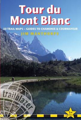
At 4807m (15,771ft), Mont Blanc, the highest mountain in western Europe, and one of the most famous mountains in the world, does not stand alone. The snow dome summit is the highest point of a spectacular massif of peaks stretching 60 miles by 20 miles. The height of Mont Blanc and its adjacent peaks, such as the Grand Jorasses and Mont Dolent, allows for the development of vast glaciers that slip imperceptibly from the high slopes and through the side valleys. The trail (105 miles, 168km) that circumnavigates the massif, passing through France, Italy and Switzerland, is the most popular long distance walk in Europe. Anyone who has completed it will understand why; every day the beauty of the mountains, the valleys and the forests is a constant and welcome companion. On the last day of the circuit, when your feet complete that invisible line around the icy massif, every tiring climb - and there are a few - will have been worth the effort. This comprehensive guide includes: 59 maps 10 town and village plans and 49 large-scale walking maps at 1:20,000 showing route times, gradients, where to stay, interesting features.
Itineraries for all walkers whether walking the 105 mile-(168km)-route in its entirety, or sampling the highlights on day walks and short breaks. Practical information for all budgets where to stay (campsites, gites, hostels, B&Bs, lodges and hotels), where to eat, what to see. Detailed public transport information for all access points"
Jim Manthorpe has trekked in many of the world s mountainous regions from Patagonia to the Himalaya and Scandinavia to the Canadian Rockies. Jim lived for seven years on the west coast of Scotland in Knoydart, the remotest inhabited place in mainland Britain. He is the author of three other Trailblazer guidebooks: South Downs Way, Pembrokeshire Coast Path and Scottish Highlands - The Hillwalking Guide. As well as writing guidebooks Jim works as a wildlife photographer and film-maker.
INTRODUCTION 9 PART 1: PLANNING YOUR TREK With a group or on your own? Walking alone 11 - With a group 12 When to go Weather and climate 13 Getting there Getting to Geneva/Chamonix 14 - Getting from Geneva/Chamonix to Les Houches 15 Getting around Chamonix Valley 15 - Les Contamines 16 - Chamonix to Courmayeur 16 - Champex 16 Budgeting Money 17 What to take The pack on your back 17 - Footwear 17 - Clothes 18 - Toiletries 19 First-aid kit 19 - Water bottle 20 - Hardware 20 - Sleeping kit 20 Camping gear 21 - Bivvy gear 21 Accommodation Camping 21 - Bivvying 22 - Mountain huts 22 - Gites d'Etape 22 Hotels 23 Suggested itineraries Staying in campsites and/or huts 23 - Staying in huts, gites and hotels 24 Mountain safety and weather Know your limits 25 - Mountain safety 25 - Dealing with an accident 29 - The weather 29 - Insurance 32 PART 2: MONT BLANC Flora and fauna Vegetation zones 33 - Mammals and reptiles 34 - Birds 36 Geology 38 History History of the Tour du Mont Blanc 39 - History of mountaineering on Mont Blanc 41 - Highlights (day and weekend walks) 45 PART 3: CHAMONIX Services 46 - Where to stay 47 - Where to eat and drink 50 Nightlife 52 - Local transport 52 PART 4: MINIMUM IMPACT TREKKING The lure of the mountains 53 - Minimizing your environmental impact 54 PART 5: TRAIL GUIDE AND MAPS Using this guide 57 - Trail map key 58 The Tour du Mont Blanc Les Houches 58 Les Houches to Col de Voza 60 (Map 1 59; Map 2 61) Col de Voza to Les Contamines via Bionnassay 62 (Map 3 63; Map 4 69) - Bionnassay 62 - Variante route via Col de Tricot 64 (Map 2a 65; Map 2b 66; Map 2c 67) - Les Contamines 68 Les Contamines to Col de la Croix du Bonhomme 70 (Map 5 71; Map 6 73; Map 7 74; Map 8 75) Col de la Croix du Bonhomme to Refuge des Mottets via Les Chapieux 76 (Map 9 77; Map 10 79; Map 11 81) - Les Chapieux 76 Variante route via Col de Fours 78 (Map 8a 80) Refuge des Mottets to Col ChEcroui 82 (Map 12 83; Map 13 85; Map 14 86; Map 15 87; Map 16 88) Col ChEcroui to Courmayeur via Dolonne 89 (Map 17 90) Variante route via Rifugio Monte Bianco 91 (Map 16a 92) Courmayeur 93 Courmayeur to Rifugio Bonatti via Rifugio Bertone 95 (Map 18 96; Map 19 97; Map 20 98; Map 21 99) - Variante route via Val Sapin 100 (Map 18a 101) Rifugio Bonatti to Rifugio Elena 103 (Map 22 102) Rifugio Elena to La Fouly 103 (Map 23 104; Map 24 105; Map 25 106) - Ferret 107 - La Fouly 107 La Fouly to Champex 108 (Map 26 109; Map 27 110; Map 28 111; Map 29 112) - Champex 113 Champex to Col de la Forclaz via Alp Bovine 114 (Map 30 115; Map 31 116; Map 32 117) - Variante route via FenItre d'Arpette 118 (Map 29a 119; Map 29b 120; Map 33 123) - Shortcut from Chalet du Glacier to Col de Balme via Refuge Les Grands 121 Col de la Forclaz to Col de Balme 122 (Map 32 117, Map 33 123, Map 34 124) - Le Peuty & Trient 122 Col de Balme to Tre le Champ via Aiguillette des Posettes 125 (Map 35 126; Map 36 128) - Variante route via Le Tour 127 Le Tour & Montroc 127 - Tre le Champ & Les Frasserands 129 Argentiere 129 Tre le Champ to La Flegere via the ladders 129 (Map 37 131) Variante route via Col des Montets 133 La Flegere to Les Houches 133 (Map 38 135; Map 39 136; Map 40 137; Map 41 138) PART 6: THE ASCENT OF MONT BLANC With or without a guide? 140 - Weather and climate 142 What to take 142 - The route 142 - Mountain safety 144 PART 7: OTHER ACTIVITIES Aiguille du Midi 145 Pointe Helbronner 146 Mont Blanc Gondola 146 Merlet Animal Park 146 Montenvers Railway and Mer de Glace 147 Paragliding 147 White-water rafting and hydroglisse 148 Mountain biking 149 Climbing 150 APPENDICES A: Bibliography, recommended reading and maps 151 B: Useful words and phrases (French and Italian) 152 C: Glossary 154 D: Public transport 156 E: Mountain photography 161 F: Facilities table 162 G: Metric/imperial equivalents 164 H: Map keys 165 INDEX 166
| Erscheint lt. Verlag | 1.8.2008 |
|---|---|
| Verlagsort | Hindhead, Surrey |
| Sprache | englisch |
| Themenwelt | Sachbuch/Ratgeber ► Sport |
| Reiseführer ► Europa ► Frankreich | |
| Reisen ► Sport- / Aktivreisen ► Europa | |
| ISBN-10 | 1-905864-12-4 / 1905864124 |
| ISBN-13 | 978-1-905864-12-6 / 9781905864126 |
| Zustand | Neuware |
| Informationen gemäß Produktsicherheitsverordnung (GPSR) | |
| Haben Sie eine Frage zum Produkt? |
aus dem Bereich


