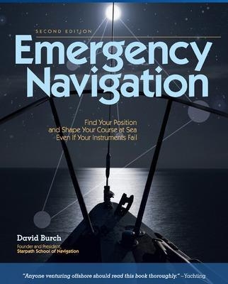
Emergency Navigation
International Marine Publishing Co (Verlag)
978-0-07-148184-7 (ISBN)
Find Your Way at Sea, No Matter What“Inherently interesting and fun to read . . . provides the clearest understanding of general navigation principles we've seen yet.”--BoatU.S. “Thorough and authoritative.”--Sea Kayaker“A definitive work of instant appeal to seamen of all levels of experience.”--The Navigation FoundationEvery sailor knows that instruments can fail. Things get wet, break, fall overboard. Whether you’re safe on your boat or drifting in a life raft, let David Burch show you how to find your way no matter what navigational equipment you have. Often relying on common materials like a small stick, a plastic bottle, even a pair of sunglasses, Burch explains how to make use of all available means--from the ancient skills of Polynesian navigators to the contrails of airliners overhead--to calculate speed, direction, latitude, and longitude and to perform all aspects of piloting and dead reckoning. Learn how to
Steer by sun, stars, wind, and swells Estimate current and leewayImprovise your own knotmeter or plumb-bob sextant Find the sun in a fogbank Estimate latitude with a plate and a knotted string And more vital information
David Burch, the director of the Starpath School of Navigation in Seattle, Washington, has been teaching navigation and seamanship since 1977. He has logged more than 60,000 sea miles, including three wins in the trans-Pacific Victoria to Maui yacht race. He is the author of nine books on marine navigation, including Emergency Navigation (International Marine, 1984), and his magazine articles have appeared in Cruising World, Ocean Navigator, Sailing, and Sea Kayaker. He holds a U.S. Coast Guard Master's license (100 tons). He is also a past Fulbright Scholar and holds a PhD in physics. HOMETOWN: Seattle, WA
List of Figures and TablesForeword to the First EditionPreface to the Second EditionAcknowledgments Chapter 1. IntroductionWhat Is Emergency Navigation?The Scope of This BookPreparation for Navigational EmergenciesChapter 2. Time and Place at SeaLatitude Regions and Seasons DefinedTime in NavigationFinding Position versus Keeping Track of PositionChapter 3. Directions at SeaChoosing a RouteCompass ChecksSteering without a CompassChapter 4. Steering by Wind and SwellsReading the WindSwells, Waves, and RipplesWind ShiftsChapter 5. Steering by the StarsKnow the Whole SkyHow the Stars MoveSteering by the North StarThe Summer TriangleThe Great Square of PegasusFinding North without the North StarSteering by OrionSteering by Gemini and ProcyonSteering by ScorpioSteering by the Southern Cross and the South PoleSteering by Overhead StarsSteering by Zenith StarsStar PathsTiming Low StarsChapter 6. Steering by the SunSunrise and SunsetMorning Sun and Afternoon SunLocal Apparent NoonSolar Time MethodThe Shadow-Tip MethodThe Tropics Rule for the SunSun Crossing Due East or WestSun CompassesWhen the Sun Is ObscuredChapter 7. Steering by Other Things in the SkyThe MoonThe PlanetsClouds, Birds, and PlanesSatellitesChapter 8. Steering in Fog or Under Cloudy SkiesHow to Make a Magnetic CompassDirection Finding with a Portable RadioStreaming a Line along the CenterlineFinding the Sun as a Viking WouldChapter 9. Currents Ocean CurrentsTidal CurrentsWind-Driven CurrentsCoastal CurrentsChapter 10. Dead ReckoningEmergency DRFinding Boat SpeedDR Errors from Speed and DirectionDR Errors from Current and LeewayProgress to WeatherChapter 11. Latitude at SeaMakeshift Altitude Measurements and CalibrationsMakeshift Altitude CorrectionsLatitude from PolarisLatitude from Zenith StarsLatitude from Horizon-Grazing StarsLatitude from Double Transits of Circumpolar StarsLatitude from the Sun at LANLatitude from the Length of DayKeeping Track of LatitudeChapter 12. Longitude at SeaLongitude from Sunrise or SunsetLongitude from LAN (the Equation of Time)Finding UTC from a Known PositionKeeping Track of LongitudeChapter 13. Coastal Piloting without InstrumentsSigns of Land at SeaVisible Range of Lights and LandDistance OffRunning Fix from Radio BearingsCourse Made Good in CurrentChapter 14. What to Do with What You’ve GotRoutine Navigation with EverythingPosition by Radio ContactEverything but UTCEverything but a SextantEverything but Sight Reduction TablesEverything but a CompassEverything but an AlmanacNothing but UTCAnnotated BibliographyBasic Marine NavigationAlmanac DataStars and Star IdentificationFinding Longitude without TimeNo-Instrument NavigationEmergency SeamanshipPeriodicals of Interest to Emergency NavigationMeteorology and OceanographyPublished Aids to NavigationIndex
| Erscheint lt. Verlag | 16.10.2008 |
|---|---|
| Zusatzinfo | 130 Illustrations |
| Verlagsort | Rockport, ME |
| Sprache | englisch |
| Maße | 185 x 231 mm |
| Gewicht | 479 g |
| Themenwelt | Sachbuch/Ratgeber ► Sport ► Segeln / Tauchen / Wassersport |
| Technik ► Fahrzeugbau / Schiffbau | |
| ISBN-10 | 0-07-148184-2 / 0071481842 |
| ISBN-13 | 978-0-07-148184-7 / 9780071481847 |
| Zustand | Neuware |
| Informationen gemäß Produktsicherheitsverordnung (GPSR) | |
| Haben Sie eine Frage zum Produkt? |
aus dem Bereich


