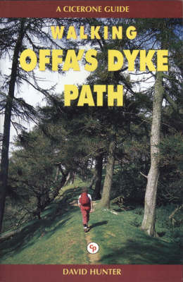
Walking Offa's Dyke Path
Cicerone Press (Verlag)
978-1-85284-160-7 (ISBN)
- Titel erscheint in neuer Auflage
- Artikel merken
Offa's Dyke was constructed by the powerful King of Mercia in the late eighth century to mark out the western boundary of his kingdom. Hundreds of years later, this is the inspiration for a 170-mile long-distance footpath traversing the border country of England and Wales. The Offa's Dyke Path makes its way through varied, sometimes wild, often remote, and frequently superb scenery, linked by a succession of historic towns and attractive villages. David Hunter describes the whole route and makes suggestions for circular walks covering sections of it. Undertaken in its entirety the route offers an attractive, and at times demanding, prospect for the long-distance walker. Done in sections, the walker can please himself. Useful information on parking, maps required, distances, etc., are included and the book is illustrated with colour and black and white photographs. This book has been designed to allow some flexibility in following the official route. While this is fully described, alternative routes, which allow visits to places of interest or to find accommodation are included and form part of the total mileage quoted.
Each chapter covers what for some would be regarded as more than a full day's walk. The overall distance has been further subdivided to allow for shorter excursions, a there-and-back exploration, or to assist in planning round walks.
David Hunter was for many years one of the great army of London commuters, working as a credit manager for a group of department stores and later as treasurer of a large advertising agency. During this time he escaped whenever possible to walk in the Chiltern hills and the North Downs, and made frequent forays along the Ridgeway National Trail. He also wrote features for outdoor and other magazines, and developed his interest in photography, contributing to several photographic libraries. David and his wife, Vera, moved to Worcester and began walking in the Malverns and around Bredon Hill and the hills south of Birmingham, as well as exploring the territory of the rivers Severn and Wye. He has a particular affection for Shropshire and the Welsh border country. David has had a number of books published, including five guides for Cicerone.
1 An Introduction to the walk
Practical matters
Sketch plans and route description
Clothing & Equipment
Rise and fall of the Kingdom of Mercia
Offa's Dyke
The Border Today
2 Sedbury Cliffs to Monmouth
3 Monmouth to Pandy
4 Pandy to Hay-on-Wye
5 Hay-on-Wye to Kington
6 Kington to Knighton
7 Knighton to Newcastle
8 Newcastle to Montgomery
9 Montgomery to Buttington (for Welshpool)
10 Welshpool (Buttington) to Llanymynech
11 Llanymynech to Tyn-y-Coed (for Oswestry)
12 Oswestry (Tyn-y-Coed) to Trevor Rocks (for Llangollen)
13 Llangollen (Trevor Rocks) to Pen-y-stryt
14 Pen-y-stryt to Bwlch Penbarra
15 Bwlch Penbarra to Bodfari
16 Bodfari to Prestatyn
17 Useful Information
Appendix A: Mileage Chart
| Erscheint lt. Verlag | 1.9.2001 |
|---|---|
| Verlagsort | Kendal |
| Sprache | englisch |
| Maße | 116 x 172 mm |
| Gewicht | 250 g |
| Themenwelt | Sachbuch/Ratgeber ► Sport |
| Reiseführer ► Europa ► Großbritannien | |
| ISBN-10 | 1-85284-160-5 / 1852841605 |
| ISBN-13 | 978-1-85284-160-7 / 9781852841607 |
| Zustand | Neuware |
| Haben Sie eine Frage zum Produkt? |
aus dem Bereich


