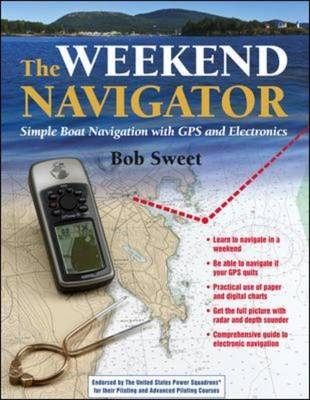
The Weekend Navigator
McGraw-Hill Professional (Verlag)
978-0-07-143035-7 (ISBN)
- Titel ist leider vergriffen;
keine Neuauflage - Artikel merken
Thanks to modern electronic navigation tools, getting from one place to another on the water has never been easier or safer. And thanks to "The Weekend Navigator", learning to use these tools quickly and correctly is now easier than ever! This completely practical, step-by-step guide gets you out on the water quickly and lets you perfect your navigation skills as you enjoy precious hours afloat. Ideal for inland and coastal cruisers, sportfishers, and aspiring recreational boaters, this innovative handbook features an easy-to-use, quick-reference format that helps you operate your GPS, depth sounder, and radar and interpret what they tell you. With the help of over 300 full-colour illustrations, you'll learn how to use your electronics to navigate safely in all conditions, and you'll discover waypoint navigation techniques that let you choose a destination, plot a course, and monitor your progress as you go.You'll also learn how to: plot GPS positions on paper and digital charts; determine the precise range and bearing of your destination; evaluate and compensate for wind and current effects; avoid reefs and other underwater hazards; integrate GPS information with compass courses, visual bearings, dead reckoning, and the other techniques of traditional piloting; and make a seamless transition to chart-and-compass navigation if your electronics fail.
"The Weekend Navigator" provides a strong foundation in the time-honoured skills of piloting, and with this book you can practice those skills on the water, using GPS to keep you pointed in the right direction.Praise for Bob Sweet's "GPS for Mariners" includes: "[Sweet] has the solid and fundamental mastery of the subject that lets him guide the reader step by step through the entire system...Nothing is left out, and nothing is wrong." - "Good Old Boat". "Useful for those looking to buy a GPS, as well as current owners who want to use theirs more efficiently...The information is tailored specifically for boaters and boating uses." - Soundings Adopted by the U.S.Coast Guard Auxiliary for its GPS seminars.Bob Sweet has more than thirty years' experience in boating and the electronics industry. He is a former systems engineer and senior executive who helped develop GPS for the U.S. Air Force. Now a business advisor to high-tech companies and a navigation instructor, Bob holds a Senior Navigator rating with The U.S. Power Squadrons. He is the author of "GPS for Mariners".
Bob Sweet has more than 30 years of experience in the technology and electronics markets and 30 years of boating experience. He has held engineering and senior executive management positions with a number of companies including GTE, Harris, ABA Industries, Inframetrics and Elbit Systems - the last three at the President and CEO level. He has both BS and MS degrees in electrical engineering from Penn State. He started his career as a radar and communications system engineer and, throughout his career, gained extensive experience with GPS including managing a corporate business unit that developed major portions of GPS for the Air Force. More recently, Bob was instrumental in the boating education for the Power Squadrons in Southeastern New England. HOMETOWN: East Falmouth, MA
AcknowledgmentsPart I--IntroductionChapter 1--About this BookNavigating this BookChapter 2--What Is Navigation?The Three Steps of NavigationPiloting without ElectronicsChapter 3--Fundamentals of Waypoint NavigationSample Cruise RevisitedMore on GPSOther Uses for WaypointsChapter 4--The Tools of NavigationNautical ChartsPlotting ToolsOther Navigation ToolsPart II--Prevoyage PlanningChapter 5--Planning with GPS and Paper ChartsPlanning and Paper ChartsPlotting on a ChartEntering Waypoints into Your GPSChapter 6--Planning with Digital ChartsDigital ChartsCruise-Planning SoftwareChart-Planning Software FeaturesWorking with Digital ChartsChartplottersPDAsPlanning for SailingChapter 7--Planning to Avoid DangerDefine the AreaMark the ObstaclesMark LandmarksPart III--Navigating UnderwayChapter 8--Underway with GPS and Paper ChartsSteps in Waypoint NavigationStaying On CourseNavigating a Route with GPSNavigating in a RegionMarking ObjectsKeeping TrackChapter 9--Underway with Digital ChartsUsing the Chartplotter UnderwayUsing a Computer and GPS UnderwayPDAs and Pocket PCsThe Future of Onboard ComputersPart IV--Double-Checking Your NavigationChapter 10--Double-Checking Using InstrumentsQuick ObservationsMore Accurate BearingsChapter 11--Eye of the MarinerHeadingsRangesBearingsCollision BearingsPart V--Responding to Changing ConditionsChapter 12--What to Do If the GPS QuitsStop and RegroupPlan Before ProceedingNavigating without GPSChapter 13--Planning as You Go with GPSFind Where You ArePlot a Safe Path to the New DestinationChapter 14--Tides, Winds, and CurrentsAbout Tides and Tidal CurrentsAdjusting for Tides and Tidal CurrentsOcean CurrentsWind, Waves, and Other Unpredictable EffectsPart VI--Other ElectronicsChapter 15--Navigating with RadarRange Settings for Recreational BoatersRadar DisplayCollision AvoidanceRadar NavigationTracking WeatherChapter 16--Using Depth in NavigationDepth Sounders versus Sonars and FishfindersNavigating with a Depth SounderChapter 17--Using Radio in NavigationIn an EmergencyWeather RadioFixed versus Handheld VHFChapter 18--Using an Electronic CompassTypes of Electronic CompassesUsing the Electronic Compass for NavigationChapter 19--Using an Autopilot in NavigationNavigating with an AutopilotPart VII--Special TechniquesChapter 20--Navigating While Tacking into the WindGetting the Most Out of Each TackChartplotters and Navigation SoftwareChapter 21--Navigating Harbors and Channels with ElectronicsGood VisibilityLimited VisibilityChapter 22--Navigating under Adverse ConditionsLimited VisibilityWind and SeaChapter 23--A Last Word on Avoiding DangerElectronic AlarmsVisual ObservationsUsing RadarChapter 24--Advanced Topics in RadarHow Marine Radar Does Its JobInstallation and AlignmentRadar ControlsChapter 25--Other InstrumentationInstrumentsChapter 26--Connecting It All TogetherBasic InterconnectionsHigher-Speed ConnectionsChapter 27--Electronic Navigation Tools and Rules--A SummaryEquipment Priority ListChecklistChapter 28--Measuring Compass Deviation Using GPSAccurate Compass NavigationDetermining DeviationMeasuring Deviation While You CruiseAppendix 1--Using the Maptech Digital Chart CDAppendix 2--GPS Display Overview--A Side-by-Side ComparisonAppendix 3--Resources and ReferencesIndex
| Zusatzinfo | 275 Illustrations |
|---|---|
| Sprache | englisch |
| Maße | 216 x 274 mm |
| Gewicht | 762 g |
| Themenwelt | Sachbuch/Ratgeber ► Sport ► Segeln / Tauchen / Wassersport |
| Technik ► Fahrzeugbau / Schiffbau | |
| ISBN-10 | 0-07-143035-0 / 0071430350 |
| ISBN-13 | 978-0-07-143035-7 / 9780071430357 |
| Zustand | Neuware |
| Informationen gemäß Produktsicherheitsverordnung (GPSR) | |
| Haben Sie eine Frage zum Produkt? |
aus dem Bereich


