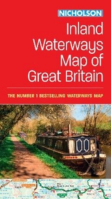
Collins Nicholson Inland Waterways Map of Great Britain
For Everyone with an Interest in Britain’s Canals and Rivers
Seiten
2020
|
New edition
Nicholson (Verlag)
978-0-00-836380-2 (ISBN)
Nicholson (Verlag)
978-0-00-836380-2 (ISBN)
- Titel erscheint in neuer Auflage
- Artikel merken
Zu diesem Artikel existiert eine Nachauflage
The bestselling guides to Britain’s canals and rivers for 50 years.
The map companion to the Collins Nicholson Waterways Guides, covering the entire network of canal and river navigations in England, Scotland and Wales, including newly restored/opened canals and rivers.
The map identifies:
• narrow and broad canals;
• navigable rivers;
• tidal river navigations;
• waterways under construction.
Also:
• contact telephone numbers and dimensions for each waterway
• internet links
Clear insets of the Birmingham Canal Navigations, Scottish inland waterways, the Norfolk Broads and the London area.
Explore the world through accurate and up-to-date mapping.
| Erscheint lt. Verlag | 6.2.2020 |
|---|---|
| Reihe/Serie | Collins Nicholson Waterways Guides |
| Verlagsort | Edinburgh |
| Sprache | englisch |
| Maße | 133 x 240 mm |
| Gewicht | 160 g |
| Themenwelt | Natur / Technik ► Fahrzeuge / Flugzeuge / Schiffe ► Schiffe |
| Reiseführer ► Europa ► Großbritannien | |
| ISBN-10 | 0-00-836380-3 / 0008363803 |
| ISBN-13 | 978-0-00-836380-2 / 9780008363802 |
| Zustand | Neuware |
| Informationen gemäß Produktsicherheitsverordnung (GPSR) | |
| Haben Sie eine Frage zum Produkt? |
