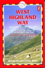
West Highland Way
Seiten
2003
Trailblazer Publications (Verlag)
978-1-873756-54-6 (ISBN)
Trailblazer Publications (Verlag)
978-1-873756-54-6 (ISBN)
- Titel ist leider vergriffen;
keine Neuauflage - Artikel merken
Zu diesem Artikel existiert eine Nachauflage
This new series of walking guides is unique, with highly detailed hand-drawn trail maps featuring the kind of information not normally found on maps -- walking times, gradients, important directions, hotels, restaurants, and points of interest. As one reviewer put it, the maps are "user-friendly, with route-finding tips scribbled onto the map itself. Gradients are indicated by arrows -- great if you don't know contours from condors."Britain's network of long-distance trails enables walkers to explore some of the finest landscapes in the country's best walking areas. Each book includes:
-- Planning and background information
-- Practical information -- places to stay, places to eat, and transport information
-- Itineraries -- day trips or the full 1-2 week route
-- Trail guide
-- Maps -- at a scale of 1:19,500 these are the most detailed available
-- 16pp of color photographsScotland's best-known long distance footpath passes through some of the most spectacular scenery in all of Britain. From the outskirts of Glasgow it winds for 95 miles along the wooded banks of Loch Lomond across the wilderness of Rannoch Moor over the mountains above Glencoe to a dramatic finish at the foot of Britain's highest peak -- Ben Nevis.
| Erscheint lt. Verlag | 24.7.2003 |
|---|---|
| Zusatzinfo | maps |
| Verlagsort | Hindhead, Surrey |
| Sprache | englisch |
| Themenwelt | Sachbuch/Ratgeber ► Sport |
| Reiseführer ► Europa ► Großbritannien | |
| Reiseführer ► Europa ► Schottland | |
| ISBN-10 | 1-873756-54-2 / 1873756542 |
| ISBN-13 | 978-1-873756-54-6 / 9781873756546 |
| Zustand | Neuware |
| Haben Sie eine Frage zum Produkt? |
Mehr entdecken
aus dem Bereich
aus dem Bereich
individuell reisen mit vielen praktischen Tipps
Buch | Softcover (2024)
Michael Müller (Verlag)
CHF 43,90
Reiseführer mit Stadtplan, 4 Spaziergängen und kostenloser Web-App
Buch | Softcover (2023)
Reise Know-How (Verlag)
CHF 22,90


