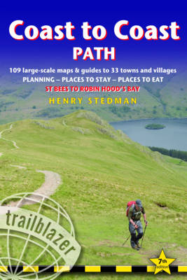
Coast to Coast Path
Trailblazer Publications (Verlag)
978-1-905864-74-4 (ISBN)
- Titel erscheint in neuer Auflage
- Artikel merken
Fully revised 7th edition of this classic191-mile walk across northern England from the Irish Sea to the North Sea,inspired by Alfred Wainwright. Crossing three fabulous national parks - theLake District, the Yorkshire Dales, and the North York Moors - it samples thevery best of the English countryside - rugged mountains and lakes, gentle dalesand stone-built villages; wild moorland; sea cliffs and fishing villages. 10 town plans and 109 large-scale walking maps - at just under 1:20,000 -showing route times, places to stay, places to eat, points of interest and muchmore. These are not general-purpose maps but fully-edited maps drawn by walkersfor walkers.
Itineraries for all walkers - whether walking the route in its entiretyover two weeks or sampling the highlights on day walks and short breaks Practical information for all budgets - camping, bunkhouses, hostels,B&Bs, pubs and hotels; St Bees through to Robin Hood's Bay - where to stay,where to eat, what to see, plus detailed street plans Comprehensive public transport information - for all access points onthe Coast to Coast Path Flora and fauna - four page full color flower guide, plus an illustratedsection on local wildlife Green hiking - understanding the local environment and minimizing our impacton it GPS waypoints. These are also downloadable from the Trailblazerwebsite Plus extra colour sections: 16pp colourintroduction and 16pp of colour mapping for stage sections (one stage per page)with trail profiles.
Henry Stedman is a hiker of considerable experience, having hiked in many parts of Europe, Asia and Africa. He has been writing guidebooks for more than 15 years.
INTRODUCTION About the Coast to Coast pathWainwright's Coast to Coast path 8 - Mr Coast to Coast: AlfredWainwright 9 - How difficult is the Coast to Coast path? 11How long do you need? 12 - When to go 14 PART 1: PLANNING YOUR WALK Practical information for the walkerGPS 17 - Accommodation 19 - Information for foreign visitors 22 Food and drink 25 - Money 27 - Internet access 27 - Other services 27Walking companies 28 - Walking with a dog 31 Budgeting 32 ItinerariesWhich direction? 34 - Suggested itineraries 34 - Village and townfacilities 36 - Day and weekend walks 38 - Side trips 41 What to takeTravelling light 41 - How to carry it 41 - Footwear 42 - Clothes 43Toiletries 44 - First-aid kit 44 - General items 44 - Sleeping bag and camping gear 45 - Money 45 - Maps 45 - Recommended reading 47Sources of further information 48 Getting to and from the Coast to Coast pathNational transport 50 - Getting to Britain 50 - Local transport 52Public transport map 53 PART 2: THE ENVIRONMENT & NATURE Conserving the Coast to Coast pathGovernment agencies and schemes 57 - Campaigning and conservation organisations 59 - Beyond conservation 60 Flora and faunaMammals 61 - Birds 62 - Reptiles 65 - Flowers 65 - Trees 68 PART 3: MINIMUM IMPACT WALKING & OUTDOOR SAFETY Minimum impact walkingEnvironmental impact 77 - Access 80 Outdoor safetyAvoidance of hazards 81 - Weather forecasts 82 - Blisters 83Hypothermia 83 - Hyperthermia 84 - Sunburn 84Collapse of morale 84 PART 4: ROUTE GUIDE AND MAPS Using the guide 86 St Bees 87 Stage 1: St Bees to Ennerdale Bridge 93 (Moor Row 96 - Cleator 96 - Ennerdale Bridge 104) Stage 2: Ennerdale Bridge to Borrowdale 104 (The Red Pike, High Stile & Hay Stacks route 110 - Seatoller 114 - Borrowdale 118) Stage 3: Borrowdale to Grasmere 119 (The ridge-walk alternative to Grasmere via Helm Crag 123 - Easedale 124 - Grasmere 125) Stage 4: Grasmere to Patterdale 129 (The high-level options: Helvellyn & Striding Edge 133; St Sunday Crag 136 - Patterdale 136 Ullswater and Glenridding 139) Stage 5: Patterdale to Shap 140 (Bampton 144 - Shap 148) Stage 6: Shap to Kirkby Stephen 149 (Orton 152 - Newbiggin-on-Lune 156 - Kirkby Stephen 161) Stage 7: Kirkby Stephen to Keld 165 (The three routes over the moors 166 - Keld 173 - Thwaite 176) Stage 8: Keld to Reeth 176 (Swaledale Valley alternative: Muker 185 - Reeth 188) Stage 9: Reeth to Richmond 191 (Richmond 198) Stage 10: Richmond to Ingleby Cross 204 (Colburn, Catterick Bridge & Brompton-on-Swale 205,Danby Wiske 212 - Oaktree Hill 214 - Ingleby Cross & Ingleby Arncliffe 214 - Osmotherley 220) Stage 11: Ingleby Cross to Blakey Ridge 221 (Urra 228 Chop Gate 228 - Great Broughton 228 - Blakey Ridge 232) Stage 12: Blakey Ridge to Grosmont 234 (Glaisdale 234 - Egton Bridge 239 - Grosmont 242) Stage 13: Grosmont to Robin Hood's Bay 243 (Littlebeck 244 - High Hawsker 251 - Robin Hood's Bay 252) APPENDICES Map keys 256 - Taking a dog 257 - GPS Waypoints 259 INDEX 264 - Place name meanings 267 OVERVIEW MAPS & PROFILES 270
| Erscheinungsdatum | 30.03.2016 |
|---|---|
| Verlagsort | Hindhead, Surrey |
| Sprache | englisch |
| Themenwelt | Sachbuch/Ratgeber ► Sport |
| Reiseführer ► Europa ► Großbritannien | |
| ISBN-10 | 1-905864-74-4 / 1905864744 |
| ISBN-13 | 978-1-905864-74-4 / 9781905864744 |
| Zustand | Neuware |
| Haben Sie eine Frage zum Produkt? |
aus dem Bereich


