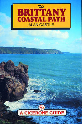
The Brittany Coastal Path
Cicerone Press (Verlag)
978-1-85284-185-0 (ISBN)
- Titel ist leider vergriffen;
keine Neuauflage - Artikel merken
Brittany has some of the most dramatic and varied coastline in all Europe, ranging from the weird rock formations of the Pink Granite Coast to the long white sandy beaches and high clifftops of the Cote d'Emeraude. There are ancient towns to explore and picturesque fishing villages by the score. With its unique language, culture and traditions, Brittany has much to offer the visitor, and for lovers of good food the walk is an epicurean delight. The 360 miles of Path from Morlaix to Mont-Saint-Michel are described in detail. The walk is divided into 9 sections and can be completed in a single trek of about a month's duration or can be split into weekly or fortnightly holidays, or even long weekends. There are also details of 78, mainly circular, walks that are suitable for day walks. Details of accommodation, transport and other facilities are included, plus places of interest and practical information for newcomers to walking in France. The author is a former National Secretary of the Long Distance Walker's Association.
Alan has trekked in over twenty-five countries within Europe, Asia, North and South America, Africa and Australasia, and for seventeen years led organised walking holidays in several European countries. A member of the British Outdoor Writers' Guild, he has written more than a dozen walking guidebooks, several on long distance mountain routes in France. His longest solo walks include a Grand Traverse of the European Alps between Nice and Vienna (1510 miles), the Pilgrim's Trail from Le Puy to Santiago de Compostela (960 miles) and a Coast-to-Coast across the French Pyrenees (540 miles). A Munroist and erstwhile National Secretary and Long Distance Path Information Officer of the Long Distance Walkers Association, Alan now lives at the foot of the Moffat Hills in Scotland, in the heart of the Southern Uplands. Alan's first encounter with the Southern Upland Way was in 1995, when he backpacked the full length of the trail. A decade later he repeated the complete trail a second time, this time mainly using bed and breakfast and hotel accommodation, in order to research this guidebook. He has travelled extensively on foot in most areas of the Southern Uplands, having climbed all of the Donalds and most of the other hills above 500m in height, and traversed them from south to north in 2003 as part of his walk between Land's End and John o'Groats.
INTRODUCTION The Brittany Coastal Path - the GR34 Grandes Randonnees Brittany Climate - When to go Travelling to Brittany Local Transport Overnight Accommodation Hotels Chambres d'hote Youth hostels and Gites d'Etape Camping Eating Out Food Equipment Maps Waymarking and Navigation European Long Distance Trails - The E5 and the E9 Petites Randonnees, Local Routes and Nature Trails Hazards and Safety Dogs Thieves Photography Language Money - Banks and Post Offices Insurance Telephone to Britain Public Holidays of Varying Length and Type Notes on using the Guidebook GUIDE SUMMARY TABLE SECTION 1. MORLAIX TO LANNION Facilities Maps Rambles/Circular Walks/Hikes Summary Places Of Interest Route SECTION 2. LANNION TO PERROS-GUIREC Facilities Maps Rambles/Circular Walks/Hikes Summary Places Of Interest Route SECTION 3. PERROS-GUIREC TO TREGUIER Facilities Maps Rambles/Circular Walks/Hikes Summary Places Of Interest Route SECTION 4. TREGUIER TO PAIMPOL Facilities Maps Rambles/Circular Walks/Hikes Summary Places Of Interest Route SECTION 5. PAIMPOL TO SAINT BRIEUC Facilities Maps Rambles/Circular Walks/Hikes Summary Places Of Interest Route SECTION 6. SAINT BRIEUC TO ERQUY Facilities Maps Rambles/Circular Walks/Hikes Summary Places Of Interest Route SECTION 7. ERQUY TO SAINT JACUT VIA CAP FREHEL Facilities Maps Rambles/Circular Walks/Hikes Summary Places Of Interest Route SECTION 8. SAINT JACUT TO SAINT MALO Facilities Maps Rambles/Circular Walks/Hikes Summary Places Of Interest Route SECTION 9. SAINT MALO TO MONT-SAINT-MICHEL Facilities Maps Rambles/Circular Walks/Hikes Summary Places Of Interest Route SECTION 9A. MONT-SAINT-MICHEL TO HIREL: INLAND ALTERNATIVE VIA DOL-DE-BRETAGNE Facilities Maps Rambles/Circular Walks/Hikes Summary Places Of Interest Route APPENDIX 1: YOUTH HOSTELS AND GITES D'ETAPE IN BRITTANY AND NEAR THE COASTAL PATH APPENDIX 2: USEFUL FRENCH AND BRETON WORDS APPENDIX 3: INDEX OF RAMBLES/CIRCULAR WALKS/HIKES APPENDIX 4: USEFUL ADDRESSES APPENDIX 5: BIBLIOGRAPHY
| Erscheint lt. Verlag | 1.1.1995 |
|---|---|
| Reihe/Serie | Cicerone Guide |
| Zusatzinfo | Laminated Cover |
| Verlagsort | Kendal |
| Sprache | englisch |
| Maße | 116 x 172 mm |
| Themenwelt | Sachbuch/Ratgeber ► Sport |
| Reiseführer ► Europa ► Frankreich | |
| ISBN-10 | 1-85284-185-0 / 1852841850 |
| ISBN-13 | 978-1-85284-185-0 / 9781852841850 |
| Zustand | Neuware |
| Haben Sie eine Frage zum Produkt? |
aus dem Bereich


