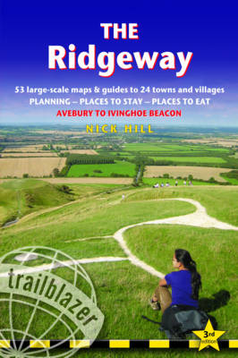
The Ridgeway: Trailblazer British Walking Guide
Trailblazer Publications (Verlag)
978-1-905864-40-9 (ISBN)
- Titel erscheint in neuer Auflage
- Artikel merken
Practical guide to walking the whole of the Ridgeway National Trail. The Ridgeway path begins near Avebury and runs 87 miles across the high chalk downs of Wiltshire, into the Thames Valley and on to the Chiltern Hills of Buckinghamshire, finishing at Ivinghoe Beacon near Aylesbury. Includes: Ridgeway map, 53 large-scale maps (1:20,000), guides to 24 towns and villages. Detailed accommodation: campsites, B&Bs, hotels, hostels and bunkhouses. Places to eat: cafes, teashops, pubs and restaurants. Detailed public transport information. Itineraries for all walkers including day Ridgeway walks. Downloadable GPS waypoints. Colour pictures including 4 paqe flower and butterfly guide.
Nick Hill is Trailblazer's cartographer. He lives in Wiltshire, England, very near the start of the Ridgeway on which he regularly hikes.
INTRODUCTION PART 1: PLANNING YOUR WALK About the Ridgeway History 9 - How difficult is the Ridgeway? 10 - How long do you need? 11 Practical information for the walker Accommodation 12 - Food and drink 14 - Money 17 - Information for foreign visitors 18 - Other services 19 - Walking companies and luggage transfer 20 - Disabled access 20 - Mountain biking 21 - Motor vehicles 21 - Horse riders 21 - Taking dogs along the Ridgeway 22 Budgeting 22 When to go Seasons 23 - Temperatures and rainfall 24 - Daylight hours 24 Festivals and events 24 Itineraries Village and town facilities table 26 - Suggested itineraries 28 - The best day and two-day walks 29 - Which direction? 30 - Side trips 30 What to take Keep it light 32 - How to carry it 32 - Footwear 33 - Clothes 33 Toiletries 34 - First-aid kit 34 - General items 34 - Camping gear 35 Money 35 - Maps 35 - Sources of further information 36 Recommended reading 37 Getting to and from the Ridgeway Getting to Britain 38 - National transport 38 - Local transport 41 Local bus services 42 - Public transport map 44 PART 2: MINIMUM IMPACT AND OUTDOOR SAFETY Minimum impact walking Economic impact 46 - Environmental impact 46 - Access 49 Outdoor safety Avoidance of hazards 51 - Weather forecasts 52 - Health 52 PART 3: THE ENVIRONMENT AND NATURE Conservation of the Ridgeway Natural England 54 - Campaigning and conservation organisations 56 Flora and fauna Mammals 57 - Birds 59 - Butterflies 62 - Trees 62 - Flowers 63 PART 4: ROUTE GUIDE AND MAPS Using this guide Trail maps 65 Marlborough Services 66 - Where to stay 67 - Where to eat and drink 68 Avebury and around Avebury 71 - Avebury stone circle 72 - West Overton 76 - West Kennet & East Kennet 76 - A walk around Avebury 78 - Avebury to Marlborough walk 82 The route guide Alternative starts to the Ridgeway 86 Overton Hill to Foxhill 88 (Ogbourne St George 96 - Liddington 100) Foxhill to Court Hill (& Wantage) 101 (Bishopstone 101 - Ashbury 105 Woolstone 106 - Uffington 109 - Down Barn Farm 110 - Sparsholt 112 Letcombe Regis 114 - Wantage 116) Court Hill to Goring 119 (East Ilsley 125 - Compton 126 Aldworth 128 - Streatley 130 - Goring 132) Goring to Watlington 133 (South Stoke 134 - North Stoke 138 Wallingford 139 - Crowmarsh Gifford 142 - Nuffield 146 Watlington 150) Watlington to Princes Risborough 151 (Lewknor 152 - Kingston Blount 152 - Chinnor 156 - Princes Risborough 161) Princes Risborough to Wigginton (& Tring) 163 (Wendover 165 Wigginton 172 - Tring 174) Wigginton to Ivinghoe Beacon 177 (Aldbury 178 - Ivinghoe 180) APPENDICES Appendix A: Map key 182 Appendix B: The Greater Ridgeway 183 Appendix C: GPS waypoints 184 INDEX 187
| Reihe/Serie | British Walking Guides |
|---|---|
| Zusatzinfo | Colour photos inc 4pp flower & butterfly guide; 53 large-scale BW maps |
| Verlagsort | Hindhead, Surrey |
| Sprache | englisch |
| Maße | 120 x 180 mm |
| Gewicht | 244 g |
| Themenwelt | Sachbuch/Ratgeber ► Sport |
| Reisen ► Karten / Stadtpläne / Atlanten ► Europa | |
| Reiseführer ► Europa ► Großbritannien | |
| ISBN-10 | 1-905864-40-X / 190586440X |
| ISBN-13 | 978-1-905864-40-9 / 9781905864409 |
| Zustand | Neuware |
| Haben Sie eine Frage zum Produkt? |
aus dem Bereich


