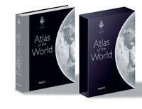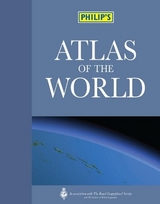
Philip's Atlas of the World
Seiten
2008
|
18th Revised ed.
Philip's (Verlag)
978-0-540-09256-7 (ISBN)
Philip's (Verlag)
978-0-540-09256-7 (ISBN)
- Titel erscheint in neuer Auflage
- Artikel merken
Zu diesem Artikel existiert eine Nachauflage
Includes maps of the USA and Canada; maps of Torres Strait and Panama Canal; international airports in Congo, Cape Verde Islands, Philippines, South Korea and India; high-speed rail lines in China; the rail link joining North Korea and South Korea, and the Lotschberg rail tunnel in Switzerland; and national parks in Norway, Turkey, and Costa Rica.
The detailed physical and political maps in "Philip's Atlas of the World" have been fully revised and updated. Praised by the "Daily Mail" as 'clearer than "The Times"', the unique combination of relief colouring and hill-shading gives an exceptional portrayal of landforms. Latest updates to the maps include newly redrawn maps of the USA and Canada; new maps of Torres Strait and Panama Canal; new international airports in Congo, Cape Verde Islands, Philippines, South Korea and India; new high-speed rail lines in China; the new rail link joining North Korea and South Korea, and the new Lotschberg rail tunnel in Switzerland; plus new national parks in Norway, Turkey, South Africa, Uganda and Costa Rica.This new edition features the informative 'World Geography' section, packed with maps, diagrams and text explaining key world themes such as climate change, geology, trade, agriculture, industry and population.
Also included are urban-area and city-centre maps for 69 of the world's largest and most economically important cities, including all major capitals - this edition includes enlarged city-centre maps of Beijing (Olympic City 2008), Amsterdam, Bangkok and Moscow, with new locator maps to indicate each city's position in its global context.In addition, the 'Images of Earth' section shows spectacular satellite views of 17 major cities and regions across the globe. Illustrated with flags and locator maps, the 34-page A-Z 'Gazetteer of Nations' provides key facts and figures for every sovereign state. The 84,000-name index, including geographical features and historical place names as well as towns and cities, gives full latitude/longitude co-ordinates and letter-figure grid references. A 1,000-entry 'Geographical Glossary' explains the derivations of many unfamiliar place names - for example: wadi = dry watercourse; jebel = mountain.
Philip's publish a wide range of maps and atlases of streets and roads , of the world, and for children and education. They also publish book s on astronomy, pocket reference books and encyclopedias.
| Erscheint lt. Verlag | 22.9.2008 |
|---|---|
| Zusatzinfo | 193pp section physical/political maps; 34pp 'World Cities'; 48pp 'World Geography'; 34pp gazetteer |
| Verlagsort | London |
| Sprache | englisch |
| Maße | 300 x 440 mm |
| Gewicht | 3808 g |
| Themenwelt | Reisen ► Karten / Stadtpläne / Atlanten ► Welt / Arktis / Antarktis |
| ISBN-10 | 0-540-09256-8 / 0540092568 |
| ISBN-13 | 978-0-540-09256-7 / 9780540092567 |
| Zustand | Neuware |
| Informationen gemäß Produktsicherheitsverordnung (GPSR) | |
| Haben Sie eine Frage zum Produkt? |
Mehr entdecken
aus dem Bereich
aus dem Bereich
mit Fakten und Infos zu allen Kontinenten
Buch | Hardcover (2024)
Kosmos Kartografie in der Franckh-Kosmos Verlags-GmbH & Co. …
CHF 35,90


