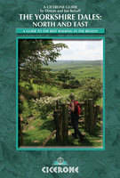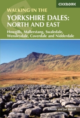
The Yorkshire Dales: North and East
Cicerone Press (Verlag)
978-1-85284-509-4 (ISBN)
- Titel erscheint in neuer Auflage
- Artikel merken
This walking guidebook to the Yorkshire Dales offers 42 day walks and suggestions for longer treks in the north and east of the Dales National Park, including the Howgills, Mallerstang, Nidderdale, Wensleydale, Swaledale and Coverdale. The walking ranges between 3 and 12 miles, with advice on how to extend the routes. Each valley has a character of its own, and this intimate and varied landscape harmonises, as nowhere else in the country, the work of nature and the hand of man. This guide takes you on an exploration of the dales and surrounding hills and moors among some of the most remarkable limestone landscape in the country, illustrated with OS mapping and evocative photography.
It is one of a two-volume series of walks in all of the Yorkshire Dales.
Dennis and Jan Kelsall are outdoor writers and photographers, contributing to various magazines and producing a weekly walking feature for the Lancashire Evening Post. They have a keen interest in the environment, its geology, flora and wildlife. Other titles by Dennis and Jan Kelsall published by Cicerone are The Pembrokeshire Coastal Path, Walking in Pembrokeshire and The Ribble Way.
Introduction
The Dales Landscape
Evolution of the Landscape
Geological History
Human Settlement
Industry and Enterprise
Farming in the Dales
Plants and Wildlife
The Northern and Eastern Dales
The Yorkshire Dales National Park
Practicalities
Navigation and Maps
Careful Planning
Clothing and Footwear
Food and Drink
Taking your Car
Leaving your Car Behind
Using this Guide
The Walks
Part 1: The Howgill Fells
1 Sedbergh and the River Rawthey
2 The Rivers Rawthey and Lune from Sedbergh
3 Winder, Calders and the Calf
4 Carlin Gill and Fell Head from Fairmile Gate
5 The River Rawthey from the Cross Keys Inn
6 Cautley Crag and the Calf
7 Around Wandale Hill
8 Baugh Fell from Rawthey Bridge
9 Grisedale
Part 2: Mallerstang
10 High Seat
11 Pendragon Castle and Little Fell
12 Wild Boar Fell and Swarth Fell
Part 3: Swaledale and Arkengarthdale
13 Apedale and Harkerside Moor
14 Grinton and Maiden Castle
15 Fremington Edge
16 Slei Gill
17 Whaw to Dale Head
18 Old Gang and Surrender
19 Beside the River Swale from Gunnerside
20 Gunnerside Gill
21 Ivelet Bridge from Muker
22 Great Shunner Fell and Lovely Seat from Thwaite
23 Muker, Thwaite and Kisdon Force from Keld
24 Whitsundale and the Head of the River Swale
Part 4: Wensleydale and Coverdale
25 A Walk in Coverdale
26 West Witton and the River Ure to Redmire Force
27 Aysgarth to West Burton
28 Aysgarth Falls
29 Ivy Scar from Aysgarth
30 Whitfield Gill Force and Mill Gill Falls
31 By the River Ure from Bainbridge
32 Bainbridge to Semer Water
33 Aysgill Force
34 Dodd Fell Hill and Drumaldrace
35 Cotterdale
36 Great Shunner Fell from Hardraw
37 The High Way
Part 5: Nidderdale
38 Brimham Rocks
39 Ashfold Side
40 Middlesmoor and How Stean Gorge
41 Nidderdale
42 Little Whernside
Appendix 1: Route summaries and suggestions for longer routes
Appendix 2: Where to find out more
| Erscheint lt. Verlag | 6.10.2011 |
|---|---|
| Illustrationen | Jan Kelsall |
| Zusatzinfo | 42 colour OS map extracts and 1 overview map |
| Verlagsort | Kendal |
| Sprache | englisch |
| Maße | 116 x 172 mm |
| Gewicht | 340 g |
| Themenwelt | Sachbuch/Ratgeber ► Sport |
| Reiseführer ► Europa ► Großbritannien | |
| ISBN-10 | 1-85284-509-0 / 1852845090 |
| ISBN-13 | 978-1-85284-509-4 / 9781852845094 |
| Zustand | Neuware |
| Informationen gemäß Produktsicherheitsverordnung (GPSR) | |
| Haben Sie eine Frage zum Produkt? |
aus dem Bereich


