


Philip's Red Books Kent and East Sussex
Seiten
2008
Philip's (Verlag)
978-0-540-09418-9 (ISBN)
Philip's (Verlag)
978-0-540-09418-9 (ISBN)
- Titel erscheint in neuer Auflage
- Artikel merken
Zu diesem Artikel existiert eine Nachauflage
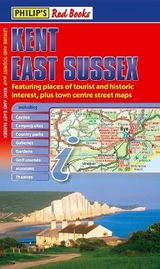
A map of Kent and East Sussex. It offers coverage of the area's road network at a scale of approximately 2.25 miles to 1 inch. It also includes town centre street maps for Canterbury, Chatham and Rochester. It shows places of tourist and historic interest, including castles, camping sites, country parks, galleries, gardens, and golf courses.
This leisure and tourist map of Kent and East Sussex gives detailed coverage of the area's road network at a scale of approximately 2.25 miles to 1 inch. It also includes town centre street maps for Canterbury, Chatham and Rochester. The map shows places of tourist and historic interest, including castles, camping sites, country parks, galleries, gardens, golf courses, marinas, museums, nature trails, historic sites, sports venues, theatres, theme parks, wildlife parks and zoos. An index to principal places of interest is also featured. In a convenient folded format, this single-sided sheet map is ideally suited for both leisure and business use, whether by locals or visitors.
This leisure and tourist map of Kent and East Sussex gives detailed coverage of the area's road network at a scale of approximately 2.25 miles to 1 inch. It also includes town centre street maps for Canterbury, Chatham and Rochester. The map shows places of tourist and historic interest, including castles, camping sites, country parks, galleries, gardens, golf courses, marinas, museums, nature trails, historic sites, sports venues, theatres, theme parks, wildlife parks and zoos. An index to principal places of interest is also featured. In a convenient folded format, this single-sided sheet map is ideally suited for both leisure and business use, whether by locals or visitors.
| Erscheint lt. Verlag | 24.4.2008 |
|---|---|
| Reihe/Serie | Leisure & Tourist Maps |
| Verlagsort | London |
| Sprache | englisch |
| Maße | 640 x 900 mm |
| Themenwelt | Reisen ► Bildbände |
| ISBN-10 | 0-540-09418-8 / 0540094188 |
| ISBN-13 | 978-0-540-09418-9 / 9780540094189 |
| Zustand | Neuware |
| Haben Sie eine Frage zum Produkt? |