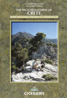
The High Mountains of Crete
Cicerone Press (Verlag)
978-1-85284-525-4 (ISBN)
- Titel ist leider vergriffen;
keine Neuauflage - Artikel merken
Guidebook to walking the high mountains of Crete with its dramatic gorges and numerous peaks rising to over 2100m, high mountain plains, forested crags, massive cliffs and remote beaches. A combination of the climate and its ancient historical sites make the Greek island of Crete a great destination for any holidaymaker. In addition to a wide selection of walks and trekking routes in the White Mountains, this book covers Mount Ida in central Crete and the Lassithi Mountains to the east. The guide includes: Western Crete (53 walks in the White Mountains and on the south coast together with 10 multi-day trekking routes; Central Crete (17 walks and treks on Mount Ida and in the Psiloritis range); Eastern Crete (12 walks and treks in the Lassithi Mountains) and coverage of the E4 Trail across each of these ranges. There is also lots of general information provided on walking in Crete and getting to the trailhead.
In 1979, after returning from a spell in the early Dubai building boom, Loraine Wilson swapped life as an Architectural Assistant for trek leading, mainly in the mountains of Greece. A lifelong hillwalker and backpacker, she has been walking the Cretan mountains since 1982.
INTRODUCTION
Hillwalking and Trekking Regions
Getting There
Flying to Athens.
Ferryboat from Piraeus
Arriving in Crete: Airports
Chania
Heraklion
Arriving in Crete: Ferryboat Ports
Souda (for Chania)
Heraklion (and bus stations)
Rethymnon (and bus station)
Arriving in the Evening
Getting to the Trailhead
Public Transport
Taxis
Shopping and Accommodation
Shopping in Towns
Shopping in the Countryside
Accommodation in the Countryside
Noise Pollution
Mountain Refuges
General Information, Skills and Equipment
Public Holidays
Time Difference
The 'Language Barrier'
Weather
The Winter Months
Water
Shelter
Types of Pathways
The E4 Trail
Walking Technique
Backpacking and Camping
Daysack and Trekking Essentials
Mobile Phones/Telephones
Compass, Altimeter and GPS
Contour Maps
Emergencies
Clothing and Footwear
Lone Women Walkers
Insects and Other Hazards
Wildlife and Hunting
Plants, Trees and Flowers
Using this Guide
Grading System
Walking Times
PART 1 THE WHITE MOUNTAINS - THE LEFKA ORI
Route Suggestions
The Omalos Plain
Walk Grade Route
1 A Around the Omalos Plain
2 B The Gorge of Samaria National Park
3 C The Ascent of Gingilos
4 A Xyloscala to Kallergi Refuge
5 C Kallergi Refuge to Melendaou
6 D Xyloscala to Koustoyerako via Strifomadi or E4 Trail variation
6a D Koustoyerako to Xyloscala via Strifomadi
7 C/D Omalos to Koustoyerako via Ay. Theodoros Chapel
7a C/D Koustoyerako to Omalos via Ay. Theodoros Chape
8 B Omalos to Ay. Irini Gorge
9 B Ay. Irini Gorge to Souyia
9a B Souyia to Lissos and Paleochora (E4 Trail)
10 C Omalos to Zourva
10a C Zourva to Omalos
11 A Zourva to Meskla
12 C Omalos to Lakki and Meskla
12a C Lakki to Omalos
The Northern Foothills (see also Walks 11a, b, c)
Walk Grade Route
13 C Kambi to Volikas Refuge
14 B/C Kambi to Melidoni
14a B/C Melidoni to Kambi
15 C Kares to Gournes
16 B/C Melidoni to Fres
17 A Fres to Vrisses
18 A Fres to Vafes via Tzitzifes
19 C Melidoni to Vafes via Vothanas
19a C Vafes to Melidoni via Vothanas
20 A Vafes to Vrisses
20a A Vrisses to Vafes
21 C Vafes to Askifou
The Askifou Plain
Walk Grade Route
22 A Around the Plain
23 A Askifou to Imbros
24 A The Imbros Gorge
25 A Kommitades to Hora Sfakion
26 B/C The Asfendos Gorge from Askifou
27 D Askifou-Goni to Kallikratis
28abc B Connecting Walks from Kallikratis
29 B The Kallikratis Gorge
30 B Askifou-Ammoudari to Niato (E4 Trail)
31 D The Ascent of Kastro
32 B/C Askifou to Imbros via Trikoukia
33 C Askifou to Anopolis (or Hora Sfakion) via Kali Lakki and Mouri
34 C Askifou to Vafes
35 B Krappis to Lake Kourna
Anopolis
Walk Grade Route
36 A/B Anopolis to Loutro
37 A Kambia to Loutro
38 A Kambia to Anopolis or Ay. Ekaterini
39 B Kambia to Hora Sfakion
40 A Anopolis to Aradena
40a C The Aradena Gorge
41 A Aradena to Ay. Ioannis and Sellouda
42 B Aradena to Ay. Roumeli via Sellouda
43 B/C The Aradena Forest and Kroussia
44 C Anopolis to Askifou via Kali Lakki
The South Coast of Sfakia
Walk Grade Route
45 B Hora Sfakion to Loutro (E4 Trail)
46 B Hora Sfakion to Anopolis
47 C Hora Sfakion to Mouri
48 B/C Loutro to Livaniana and (a) Anopolis or (b) Marmara Beach
49 B Loutro to Ay. Roumeli (E4 Trail)
50 B The Gorge of Samaria National Park
51 A Around Ay. Roumeli
52 C/D The Eligas Gorge
53 B/C Ay. Roumeli to Anopolis via Sellouda
Mountain Treks
The Madares
Valleys of the Central Massif
Katsiveli
Potamos
Route Suggestions
Trek Grade Route
T1 D Theriso to Livada via Kolokithas
T1a D Livada to Theriso
T2 D Kambi to Livada via EOS Volikas Refuge
T2a D Livada to Kambi
T3 E Askifou to Livada via Niato and Grias Soros (E4 Trail)
T3a E Livada to Niato and Askifou (E4 Trail) (Trek 3 in reverse)
T4 C/D Livada to Katsiveli (E4 Trail)
T4a C/D Katsiveli to Livada (E4 Trail)
T5 C/D Katsiveli to Potamos (E4 Trail)
T5a C/D Potamos to Katsiveli
T6 D Omalos (or Kallergi Refuge) to Potamos (and Katsiveli)
via Melendaou (E4 Trail)
T6a D Potamos to Kallergi Refuge (E4 Trail)
T7 D Potamos to Ay. Ioannis via Zaranokefala
T7a D Ay. Ioannis to Potamos via Zaranokefala
T8 D Anopolis to Katsiveli
T8a D Katsiveli to Anopolis
The Ascent of Pachnes
T9 C/D Roussies to Pachnes Summit
T9a C/D Pachnes Summit to Katsiveli
T9b C/D Katsiveli to Pachnes Summit
The South Coast
T10 D Ay. Roumeli to Souyia (E4 Trail)
T10a D Souyia to Ay. Roumeli (E4 Trail)
PART 2 PSILORITIS - MOUNT IDA
The Summit
The Nida Plain
Approach Routes to the Mountain
From the North
From the South
From the West
Route Suggestions
Walks and Treks from Trailheads of the Foothills
Walk Grade Route
P1 C/D Anoyeia to the Nida Taverna
(a) Ay. Yakinthos to Nida Taverna on the E4 Trail
(b) Ay. Yakinthos to Nida Taverna via Old Droving Route
P2 C Zaros to Ay. Ioannis Chapel via the Rouvas Gorge
P3 D Ay. Ioannis Chapel to the Nida Plain (E4 Trail)
P4 C Kamares to the Kamares Cave
P5 C/D Kamares Cave to the Nida Plain
P6 D Kamares to the Summit of Mount Ida
P7 B/C The Arcadi Monastery to Aravanes Kampos
P8 D Aravanes Kampos to the Nida Taverna
P9 D Mount Ida Summit: Northern Approach Path
P10 D Aravanes Kampos to Toumbotos Prinos EOS Refuge
P11 C/D The Amari Valley: Fourfouras and Kouroutes
Walks and Treks from Trailheads on the Nida Plain
Walk Grade Route
P12 C/D Nida to the Summit of Mount Ida
P13 D Summit of Mount Ida: Descent to Kamares
P14 C/D Nida to Anoyeia on the E4 Trail
P14a C/D Nida to Anoyeia on Old Droving Trail
P15 D Nida to Ay. Ioannis Chapel (and on to Zaros
via Rouvas Gorge) on E4 Trail
P16 D Nida to Kamares via Kamares Cave
P17 D Nida Taverna to the Arcadi Monastery
PART 3 THE LASSITHI MOUNTAINS
| Zusatzinfo | Over 120 colour photos and 14 colour maps |
|---|---|
| Verlagsort | Kendal |
| Sprache | englisch |
| Maße | 116 x 172 mm |
| Gewicht | 460 g |
| Themenwelt | Sachbuch/Ratgeber ► Sport |
| Reiseführer ► Europa ► Griechenland | |
| ISBN-10 | 1-85284-525-2 / 1852845252 |
| ISBN-13 | 978-1-85284-525-4 / 9781852845254 |
| Zustand | Neuware |
| Haben Sie eine Frage zum Produkt? |
aus dem Bereich


