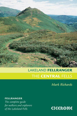
The Central Fells
Cicerone Press (Verlag)
978-1-85284-540-7 (ISBN)
- Titel ist leider vergriffen;
keine Neuauflage - Artikel merken
Lakeland Fellranger guidebook covering 28 summits in the Central Fells of the Lake District, including a variety of ascents in the high ground between Great Langdale and Keswick. The area is flanked to the west by Stake Pass, Langstrath, Borrowdale and Derwentwater, and to the east by Grasmere, Dunmail Raise and Thirlmere.
Each of the 28 fells has a dedicated chapter describing a plethora of walking routes of differing characters and difficulties (from wide bridleways up to easy scrambles), which can easily be combined to make ascents, descents, traverses or ridge routes. The chapter begins with a customised Harvey map that illustrates the routes, and shows ridge connections to neighbouring fells to assist in the planning of extended walks.
In many instances pen and ink drawn diagrams show the routes from a given perspective to assist visualisation. The guidebook is fully illustrated throughout with clear elevation diagrams, detailed summit panoramas and lots of inspiring photographs.
The Central Fells is part of the eight-volume Lakeland Fellranger series by Mark Richards. Together they provide a comprehensive guide to explore and enjoy the fells of the Lake District, with a selection of routes up more than 220 hills.
Mark Richards moved to Cumbria in the early 1990s. Here he developed a passion for the finest of all walking landscapes. He is a founder of the Hadrian's Wall Trust, a member of the Outdoor Writers and Photographers Guild and broadcasts on BBC Radio Cumbria.
From fireside to fellside
This guide Fix the Fells
Access
Safety
Starting points
1 Armboth Fell 479m/1572ft
2 Bell Crags 558m/1831ft
3 Bleaberry Fell 589m/1932ft
4 Blea Rigg 556m/1824ft
5 Calf Crag 537m/1762ft
6 Eagle Crag 520m/1706ft
7 Gibson Knott 421m/1381ft
8 Grange Fell 416m/1365ft
9 Great Crag 452m/1483ft
10 Harrison Stickle 736m/2415ft
11 Helm Crag 405m/1329ft
12 High Raise 762m/2500ft
13 High Rigg 355m/1165ft
14 High Seat 608m/1995ft
15 High Tove 515m/1690ft
16 Loft Crag 692m/2270ft
17 Loughrigg Fell 335m/1099ft
18 Pavey Ark 697m/2287ft
19 Pike o'Stickle 708m/2323ft
20 Raven Crag 463m/1519ft
21 Sergeant Man 736m/2414ft
22 Sergeant's Crag 574m/1883ft
23 Silver How 395m/1296ft
24 Steel Fell 553m/1814ft
25 Tarn Crag 485m/1591ft
26 Thunacar Knott 723m/2372ft
27 Ullscarf 726m/2382ft
28 Walla Crag 379m/1243ft
Index
| Erscheint lt. Verlag | 11.12.2013 |
|---|---|
| Zusatzinfo | 28 Harvey map extracts, plus elevations and summit panoramas |
| Verlagsort | Kendal |
| Sprache | englisch |
| Maße | 130 x 196 mm |
| Gewicht | 520 g |
| Themenwelt | Sachbuch/Ratgeber ► Sport |
| Reiseführer ► Europa ► Großbritannien | |
| ISBN-10 | 1-85284-540-6 / 1852845406 |
| ISBN-13 | 978-1-85284-540-7 / 9781852845407 |
| Zustand | Neuware |
| Haben Sie eine Frage zum Produkt? |
aus dem Bereich


