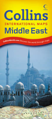
Middle East
2008
|
New edition
Collins (Verlag)
978-0-00-727632-5 (ISBN)
Collins (Verlag)
978-0-00-727632-5 (ISBN)
- Titel ist leider vergriffen;
keine Neuauflage - Artikel merken
Completely revised, folded sheet map of the whole of the Middle East, presently the most politically volatile area in the world.
Scale 1:4 000 000; 1 cm to 40 km; 1 inch to 63 miles
MAIN FEATURES
Fully revised and updated reference map of the Middle East. The map covers, in excellent detail, one of the most politically unstable parts of the world and is an ideal reference document. Includes large-scale inset maps of Israel (Palestine) and the Nile Delta. The reverse of the sheet contains a comprehensive index to over 11 000 named features shown on the map.
AREA OF COVERAGE
From the Black Sea, Turkey and the Caspian Sea in the north to Yemen, the Gulf of Aden and the Horn of Africa in the south and from Egypt in the west to Pakistan in the east. It covers all of Iraq, Kuwait, The Gulf (Persian Gulf), Saudi Arabia and Iran as well as Turkey, Israel (Palestine), Syria, Jordan and the Gulf States, the Red Sea, the eastern Mediterranean, Pakistan, Azerbaijan, Turkmenistan, Tajikistan, Uzbekistan and Kyrgyzstan, Georgia and Armenia.
WHO THE PRODUCT IS AIMED AT
Armchair traveller and for home and business reference.
| Erscheint lt. Verlag | 6.5.2008 |
|---|---|
| Reihe/Serie | Collins International Maps |
| Verlagsort | London |
| Sprache | englisch |
| Maße | 115 x 257 mm |
| Gewicht | 133 g |
| Themenwelt | Reisen ► Karten / Stadtpläne / Atlanten ► Naher Osten |
| Reisen ► Karten / Stadtpläne / Atlanten ► Asien | |
| ISBN-10 | 0-00-727632-X / 000727632X |
| ISBN-13 | 978-0-00-727632-5 / 9780007276325 |
| Zustand | Neuware |
| Haben Sie eine Frage zum Produkt? |
Mehr entdecken
aus dem Bereich
aus dem Bereich
reiß- und wasserfest (world mapping project)
Karte (gefalzt) (2024)
Reise Know-How (Verlag)
CHF 16,90
Karte (gefalzt) (2024)
Freytag-Berndt und ARTARIA (Verlag)
CHF 21,90
Karte (gefalzt) (2023)
Reise Know-How (Verlag)
CHF 16,90


