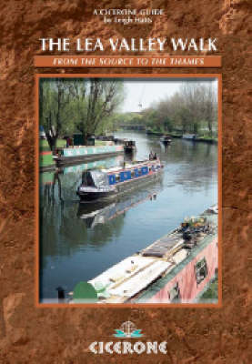
The Lea Valley Walk
Cicerone Press (Verlag)
978-1-85284-522-3 (ISBN)
- Titel erscheint in neuer Auflage
- Artikel merken
Split into 20 stages in this guidebook, this 50-mile walk is one of the finest and most varied walking routes in London, tracing the route of the River Lea from Leagrave, near Luton to Island Gardens at Greenwich where it joins the Thames Path. As it follows the river it undergoes a fascinating metamorphosis from rural pathway to urban trail. So whether you choose to walk for health, fresh air or views of wildlife and countryside, to visit friends, to explore heritage attractions, to escape or simply to explore your surroundings, the Lea Valley Walk offers it all. The Lea Valley, once London's market garden, is now once again recognised as a rich green lung running down the east side of the capital. Some of the sections are very short. Yet these stretches often contain much heritage and countryside to enjoy - such as the one mile between Cheshunt and Waltham Abbey. Thanks to the many railway stations alongside the Park, between Ware and London, the Walk can be reached easily. This is a walk that can be enjoyed by everybody from the keen long-distance walker to those with young children or those new to taking exercise.
Leigh Hatts has been walking the Thames towpath and Docklands since 1981 when he worked on the feasibility study which resulted in establishomg the route as a National Trail. Leigh has worked as a reporter with the walkers' magazine TGO and as arts correspondent of the Catholic Herald. He is co-founder of Bankside Press and London's in SE1 listings magazine.
Map: the Lea Valley Walk
Introduction
1 Leagrave to Luton 4 miles (6.5km)
2 Luton to Luton Airport Parkway 2 miles (3.2km)
3 Luton Airport Parkway to Harpenden 4½ miles (7km)
4 Harpenden to Hatfield 8 miles (13km)
5 Hatfield to Hertford 7¼ miles (11.25km)
6 Hertford to Ware 2 miles 3.2km)
7 Ware to St Margarets 2 miles (3.2km)
8 St Margarets to Rye House 1¼ miles (2km)
9 Rye House to Broxbourne 3 miles (4.8km)
10 Broxbourne to Cheshunt 3 miles (4.km)
11 Cheshunt to Ponders End 4½ miles (7km)
12 Ponders End to Tottenham Hale 4 miles (6.5km)
13 Tottenham Hale to Lea Bridge 2 miles (3.2km)
14 Lea Bridge to Three Mills 3 miles (4.8km)
15 Three Mills to Limehouse 2¼ miles (3.5km)
16 The Meridian Walk: An Alternative End 2¼ miles (3.5km)
17 Olympic Park Walk 3 miles (4.8km)
Bibliography
| Erscheint lt. Verlag | 16.5.2007 |
|---|---|
| Verlagsort | Kendal |
| Sprache | englisch |
| Maße | 116 x 172 mm |
| Gewicht | 180 g |
| Themenwelt | Sachbuch/Ratgeber ► Sport |
| Reiseführer ► Europa ► Großbritannien | |
| ISBN-10 | 1-85284-522-8 / 1852845228 |
| ISBN-13 | 978-1-85284-522-3 / 9781852845223 |
| Zustand | Neuware |
| Haben Sie eine Frage zum Produkt? |
aus dem Bereich


