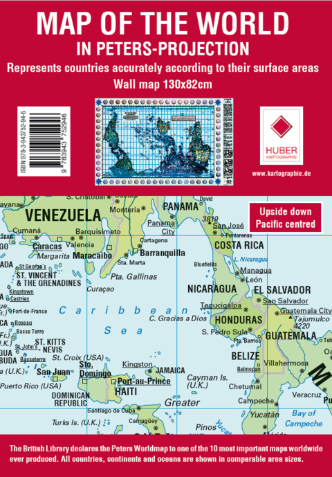
Poster Weltkarte Petersprojektion, Up-side-down Englisch, 130x82cm
(südorientiert, pazifikzentriert)
Seiten
2024
Huber Kartographie (Verlag)
978-3-943752-94-6 (ISBN)
Huber Kartographie (Verlag)
978-3-943752-94-6 (ISBN)
Diese flächentreue politische Weltkarte in Petersprojektion und Englischer Sprache, ist Pazifik zentriert und Süd orientiert.
Die Karte zeigt den Pazifik in der Mitte und den Atlantik an den äußeren Rändern. Zudem wird sie südliche Hemisphäre oben dargestellt, wodurch Australien mehr ins Zentrum rückt.
Die Peters Weltkarte wird in zwei Größen angeboten: 130 cm x 82cm (diese Version) und etwas kleiner in 82,5 cm x 52,3 cm.
Außerdem in drei Sprachen: Deutsch, Englisch und Französisch sowie jeweils Nord- und Süd orientiert. This true area political world map in Peter's projection and English language, is Pacific centred and south oriented.
The map shows the Pacific Ocean in the centre and the Atlantic Ocean on the outer edges. In addition, the southern hemisphere is shown at the top, placing Australia more in the centre.
The Peters world map is available in two sizes: 130 cm x 82 cm (this version) and slightly smaller at 82.5 cm x 52.3 cm.
Also available in three languages: German, English and French as well as north and south orientated.
| Zusatzinfo | Weltkarte |
|---|---|
| Verlagsort | München |
| Sprache | englisch |
| Maße | 820 x 1300 mm |
| Themenwelt | Reisen ► Karten / Stadtpläne / Atlanten ► Welt / Arktis / Antarktis |
| Schlagworte | Englisch • Pazifik zentriert • Peters • Petersprojektion • Poster • Südorientiert • up-side-down • Wandkarte • Weltkarte • World map |
| ISBN-10 | 3-943752-94-1 / 3943752941 |
| ISBN-13 | 978-3-943752-94-6 / 9783943752946 |
| Zustand | Neuware |
| Haben Sie eine Frage zum Produkt? |
Mehr entdecken
aus dem Bereich
aus dem Bereich
1:30 Mio. mit Posterleisten, mit Oberflächenlaminat
Karte (gerollt) (2023)
INTERKART Landkarten & Globen (Verlag)
CHF 32,90


