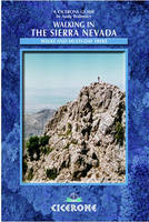
Walking in the Sierra Nevada
Cicerone Press (Verlag)
978-1-85284-435-6 (ISBN)
- Titel ist leider vergriffen;
keine Neuauflage - Artikel merken
The Sierra Nevada, the highest mountain range in Spain, provides tremendous scope for the adventurous mountain traveller: there are rugged peaks over 3000m (Alta Montana), remote valleys, crystal-clear streams and some very interesting scenery among the lower limestone peaks of Baja Montana. Mountain bikers will find plenty of routes to explore; in winter there are snow sports galore, from downhill skiing and snowboarding to Nordic ski tours and winter mountaineering. With the tourist excesses of the Alps thankfully still absent here, the Sierra Nevada can provide the kind of experience which is now becoming rare in many of the world's other mountain areas. This guide covers the high sector of the range and will prove invaluable to any visitor to the area. There is information on camping and accommodation, road access, mountain-biking routes, local bases, topography and climate, as well as descriptions of 45 walking routes that vary in length from 3km to 56km.
Andy Walmsley was born in Lancashire, and has always been involved in outdoor activities. Despite a serious accident in 1981, he remains an active mountain-goer. Andy has spent much time exploring the Spanish Sierra Nevada mountains for this guide.
PART 1: Road Access within the Range
Road Guide Map
Introduction
RG1 Lower Sierra Nevada Road (GR420 to Parador Nacional)
RG2 Upper Sierra Nevada Road (GR420 to Veleta summit)
RG3 Güéjar Sierra and Genil Valley Road (GR460 to San Juan)
RG4 Genil Valley to Sierra Nevada Link Road (Charcon-El Desvio)
RG5 Borreguiles Access Road (from Upper Sierra Nevada [Veleta] Road)
RG6 Yeguas Access Track from Upper Sierra Nevada [Veleta] Road
RG7 Camino de los Neveros (Huetor Vega-El Purche)
RG8 Monachil Service Road
RG9 Huenes Valley Forestry Road (La Zubia to Huenes/Dilar Valleys)
RG10 Ermita Vieja/Los Miradores Road (from Aguadero)
RG11 Arroyo de Torrente Track System
RG12 Alpujarras Roads
RG13 Caballo South Ridge Track Network
RG14 Chico Valley and Lanjarón Access Track
RG15 South Sierra Nevada Road (GR411Pampaneira to Veleta Col)
RG16 Mulhacén Summit Road
RG17 Puerto de la Ragua (Laroles to La Calahorra)
RG18 La Calahorra to Guadix via Jeres del Marquesado
RG19 Marquesado del Zenete Forest Road
RG20 Purullena and La Peza Road (Short cut Guadix-Granada)
PART 2: Baja Montaña (Low Mountains)
Baja Montaña Map
Introduction
1 Boca de la Pesca from Cortijo Sevilla
2 Pico de la Carne from Puente de los Siete Ojos
3 Cerro Huenes via Fuente Fria
4 Carne, Gordo, Huenes, and Tamboril from Siete Ojos
5 Ascent of Trevenque from Cortijo Sevilla
6 Ascent of Trevenque from Collado del Trevenque
7 Toma del Canal and Las Arenales from Cortijo Sevilla
The Pico del Tesoro Ridge
8 Pico del Tesoro and Cerros Cortijuela/Cocón from Casa de la Cortijuela
9 Cerro del Mirador from Cortijuela
Los Alayos de Dilar
10 Corazón de la Sandía from Los Miradores
11 Corazón de la Sandía from Cortijo Sevilla
12 Los Castillejos from Chaquetas
13 Integral de los Alayos
14 Circuit of Trevenque
PART 3: Alta Montaña (High Mountains)
Introduction
A: Routes from the Genil Valley
Genil Valley Map
15 Vereda de la Estrella
16 Ascents from the Refugio del Vadillo Hut
17 Ascent to Mulhacén from Cueva Secreta
18 Ascent of Puntal de la Caldera via Loma de las Casillas
19 To the Crestones de Rio Seco from Cueva Secreta
20 To the Corral del Veleta from Cortijo de la Estrella
Other possible routes in the Valle del Genil
B: Routes from the Sierra Nevada Road
Sierra Nevada Road (North) Map
21 Cazoleta from the Parador Nacional
22 Ascent of Veleta from the Parador Nacional via Cazoleta and Loma de San Juan
23 Corral del Veleta and Los Machos via Veredon Superior
24 To Refugio de Elorrieta from Hoya de la Mora
25 To Refugio de Elorrieta via Tajos de la Virgen from Posiciones del Veleta
26 Tajos de Los Machos from Refugio Elorrieta
27 Cerro del Caballo from Refugio de Elorrieta via Tajos Altos, returning via the Vereda Cortada
Sierra Nevada Road (South) Map
28 Los Machos from Refugio del Poquiera
29 Loma Pela and Puntal de la Caldera from Corral de Rio Seco (former site of Felix Mendez hut)
30 Mulhacén from Laguna de la Caldera
31 Alcazaba from Laguna de la Caldera via El Corredor
32 To Cañada de las Siete Lagunas from Mulhacén Summit Road
C: Routes in the Alpujarras and Marquesado Forest
Lanjarón Valley Map
33 Ascent of Cerro del Caballo from Lanjarón
Eastern Tops Map
34 Ascent of Mulhacén from Trevélez
35 To Cañada de las Siete Lagunas from Trevélez
36 Ascent of Alcazaba from Cañada de las Siete Lagunas
37 Ascent of Mulhacén from Cañada de las Siete Lagunas
38 From Trevélez to Jeres del Marquesado via Puerto de Jeres
39 Ascent of Cerro Pelao from Jeres del Marquesado
PART 4: Longer and Multi-Day Routes
Introduction
40 The Eastern 3000-ers from Trevélez
41 From San Juan to Trevélez via Cuneta de Vacares
42 A tour of Baja Montaña from Cortijo Sevilla
43 El Trio Grande (The Big Three) from San Juan
44 A Tour of Sierra Nevada
45 The Integral de los Tres Mil (All the 3000-ers)
| Erscheint lt. Verlag | 8.6.2015 |
|---|---|
| Zusatzinfo | 50 colour photos and 8 overview maps |
| Verlagsort | Kendal |
| Sprache | englisch |
| Maße | 116 x 172 mm |
| Gewicht | 210 g |
| Themenwelt | Sachbuch/Ratgeber ► Sport |
| Reiseführer ► Europa ► Spanien | |
| ISBN-10 | 1-85284-435-3 / 1852844353 |
| ISBN-13 | 978-1-85284-435-6 / 9781852844356 |
| Zustand | Neuware |
| Haben Sie eine Frage zum Produkt? |
aus dem Bereich


