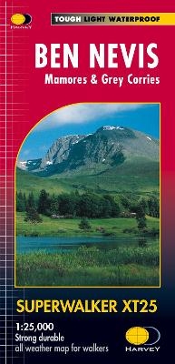
Ben Nevis
Mamores & Grey Corries
2017
|
2nd edition
Harvey Map Services Ltd (Verlag)
978-1-85137-402-1 (ISBN)
Harvey Map Services Ltd (Verlag)
978-1-85137-402-1 (ISBN)
Ben Nevis with the Mamores and Grey Corries ranges at 1:25,000 on a double-sided, waterproof and tear-resistant map from Harvey Map Services in their Superwalker series, with the peak area also shown in greater detail at 1:12,500. The map divides the area north/south, with a good overlap between the sides, extending from Fort William past Loch Treig to Chno Deang, plus south to Loch Leven and the Blackwater Reservoir. The enlargement highlights the bad visibility descent route including instructions. The main map at 25K also highlights recommended mountain bike trails.
| Erscheint lt. Verlag | 30.9.2017 |
|---|---|
| Reihe/Serie | Superwalker XT25 |
| Zusatzinfo | 2 maps |
| Verlagsort | Perthshire |
| Sprache | englisch |
| Maße | 116 x 243 mm |
| Gewicht | 56 g |
| Themenwelt | Reisen ► Karten / Stadtpläne / Atlanten ► Europa |
| ISBN-10 | 1-85137-402-7 / 1851374027 |
| ISBN-13 | 978-1-85137-402-1 / 9781851374021 |
| Zustand | Neuware |
| Haben Sie eine Frage zum Produkt? |
Mehr entdecken
aus dem Bereich
aus dem Bereich
Straßen- und Freizeitkarte 1:250.000
Karte (gefalzt) (2023)
Freytag-Berndt und ARTARIA (Verlag)
CHF 19,90
Karte (gefalzt) (2023)
Freytag-Berndt und ARTARIA (Verlag)
CHF 19,90
Östersund
Karte (gefalzt) (2023)
Freytag-Berndt und ARTARIA (Verlag)
CHF 21,90


