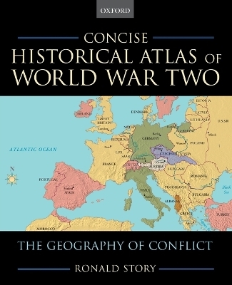
Concise Historical Atlas of World War Two
Oxford University Press Inc (Verlag)
978-0-19-518220-0 (ISBN)
World War II classes have been, and continue to be among the most highly enrolled classes in History Departments, yet there is a serious lack of good supplementary materials to match with main survey texts. This is particularly true for World War II atlases and books in general outlining the geography of WWII. World War II was pre-eminently a war of rapid and far-reaching conquest with rapid and far-reaching movement. A good sense of world geography is essential to grasping the magnitude and sweep of the contending alliances in the war. The books that already exist are quite lengthy and cumbersome to use in the classroom, not to mention often much too expensive to adopt as supplementary texts. Every reviewer agreed that a concise, affordable volume of maps was needed in the market. Ronald Story has created a relatively short book of WWII maps, which consists of 50 4-color maps covering the most significant phases of the war, each with an adjacent facing page of explanatory text. The collection covers both conventional and non-conventional areas, and the layout allows instructors to easily pick and choose which maps to use according to what they are already covering or wish to cover in their courses. The explanatory text does three things: explains features of the conflict in question, shows changes in circumstances through map flows, and suggests longer-term consequences of campaigns. This text will provide students with a comfortable knowledge of the constantly changing borders and populations, essential to understanding WWII. Some examples of maps Story is includes are "Europe in 1914," "The Invasion of Poland (1939)," "Japan Expansion to 1941," "The Red Advance (1943-1944)," "The Conquest of Southeast Asia" and "Post-War Europe" to name a few. Story construct his manuscript from a list of maps he has already compiled and used as supplementary material in his own World War II class for the past 20 years. His experience in the classroom makes him familiar with what works best for students; this text will be a welcome learning tool for the World War II course, and promises to have some retail potential as well.
Introduction
1. Europe in 1914
2. Africa
3. Europe in 1920
4. The French Frontier Between the Wars
5. Spain (1930s)
6. Europe in 1939
7. The Invasion of Poland (1939)
8. The Fall of France (1940)
9. The Partition of France
10. The Battle of Britain (1940-1941)
11. The Battle of the Atlantic (1940-1943)
12. The Desert War (1940-1942)
13. The Battle of El Alamein (October-November 1942)
14. The Conquest of North Africa (November 1942-May 1943)
15. Barbarossa--The German Invasion of the U.S.S.R. (June-September 1941)
16. The Drive on Moscow (October-December 1941)
17. The Caucasus Campaign (May-November 1942)
18. The Battle of Stalingrad (September 1942-January 1943)
19. Kursk (Summer 1943)
20. The Soviets' Move West (December 1943-April 1944)
21. Resistance
22. Strategic Bombing (1942-1945)
23. Italy (1943-1944)
24. Operation Overlord--The Normandy Invasion (June 1944)
25. The Allied Advance (July-August 1944)
26. The Battle of White Russia (Summer 1944)
27. The Liberation of France (August-September 1944)
28. The Battle of the Bulge (December 1944)
29. The Defeat of Nazi Germany (1945)
30. The Fall of Berlin (April 1945)
31. The Liberation of the Camps (1945)
32. Occupied Germany
33. Postwar Europe
34. Asia in the Early 20th Century
35. China in the Early 20th Century
36. The Expansion of Japan to 1938
37. China Divided--The Long March (1934-1935)
38. Pearl Harbor (December 1941)
39. The Conquest of Southeast Asia (December 1941-June 1942)
40. The Battle of Midway (June 1942)
41. New Guinea (1942-1944)
42. The Central Pacific Drive (November 1943-July 1944)
43. The Battle of Leyte Gulf (October 1944)
44. The Starvation of the Home Islands
45. Okinawa (Spring 1945)
46. China-Burma-India
47. The Air War (1944-1945)
48. The Atomic Bomb (August 1945)
49. Occupied Japan
50. Independent Asia
| Erscheint lt. Verlag | 4.5.2006 |
|---|---|
| Zusatzinfo | 50 maps in colour |
| Verlagsort | New York |
| Sprache | englisch |
| Maße | 191 x 233 mm |
| Gewicht | 272 g |
| Themenwelt | Reisen ► Karten / Stadtpläne / Atlanten |
| Geschichte ► Allgemeine Geschichte ► 1918 bis 1945 | |
| Geschichte ► Teilgebiete der Geschichte ► Militärgeschichte | |
| ISBN-10 | 0-19-518220-0 / 0195182200 |
| ISBN-13 | 978-0-19-518220-0 / 9780195182200 |
| Zustand | Neuware |
| Informationen gemäß Produktsicherheitsverordnung (GPSR) | |
| Haben Sie eine Frage zum Produkt? |
aus dem Bereich


