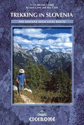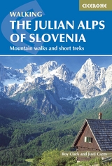
The Julian Alps of Slovenia
Cicerone Press (Verlag)
978-1-85284-438-7 (ISBN)
- Titel ist leider vergriffen;
keine Neuauflage - Artikel merken
'The Julian Alps of Slovenia' contains over 60 walks which bring the best of the Julian Alps to the English-speaking walker. The walks and treks in this guidebook are organised around five bases in the Julian Alps - Kranjska Gora, Bovec, Kobarid, Bled and Bohinj - all of which have a range of accommodation and public transport facilities. There is something here for everyone - from easy valley walks and rougher forest trails to high-mountain protected routes, some of which require Alpine mountaineering experience. Several possibilities for multi-day walks are included. The Julian Alps are situated in the small independent republic of Slovenia, at the south-eastern end of the Alpine chain. Their highest peak, Triglav, at 2864m, may be smaller than some of the better-known western giants, but what the mountains lack in stature they make up for in interest and accessibility. The dramatic limestone peaks drop steeply through forests to flower meadows, and will give you a feast for the eyes no matter which direction you turn.
Together Roy Clark and Justi Carey have around 50 years of mountaineering experience which has shaped their whole lives. Their passion for the outdoors has led to travels across the world, including Iceland, North America, Jordan and New Zealand. In 2002 they moved to Slovenia in search of new challenges, and are currently living in the heart of the Julian Alps, where they are happily exploring this new area and culture.
Section 1: Kranjska Gora
Route 1: Zelenci
Route 2: Tamar and Planica
Route 3: Srednji Vrh
Route 4: Slap Martuljek (Martuljek waterfall)
Route 5: Vrsid Pass
Route 6: Visoki Mavrinc
Route 7: Ped (Tromeja)
Route 8: Vitranc/Ciprnik
Route 9: Sleme
Route 10: Jerebikovec
Route 11: Mala and Velika Mojstrovka
Route 12: Mala Mojstrovka via the Hanzova Pot
Route 13: Prisank
Route 14: Jalovec
Route 15: Spik
Route 16: Skrlatica
Route 17: Triglav by the Tominskova Pot and the Prag Route
Route 18: Triglav by the Plemenice (or Bamberg) Route
Route 19: Kanjavec
Section 2: Bohinj
Route 20: The Tour of Lake Bohinj
Route 21: Slap Savica (Savica Waterfall)
Route 22: Rudnica
Route 23: Korita Mostnice
Route 24: Lopata Virgin Forest
Route 25: Vogel
Route 26: Drna prst
Route 27: Spodnje Bohinjske Gore (the Lower Bohinj Ridge)
Route 28: Prsivec
Route 29: Bogatin and Mahavsdek
Route 30: Triglav Lakes Valley and Veliko spidje
Route 31: Triglav - the Southern Approach
Section 3: Bovec
Route 32: The Bovec Basin
Route 33: Izvir Glijuna and Slap Virje
Route 34: Kluye
Route 35: Humdid - the First World War Walk
Route 36: The Soda Trail
Route 37: Svinjak
Route 38: Visoki Kanin and Prestreljenik
Route 39: Rombon
Route 40: Pogadnikov Dom and Kriski Podi
Route 41: Planja and Razor
Route 42: Kriy, Stenar and Bovski Gamsovec
Route 43: Krn
Route 44: Mangart
Section 4: Bled
Route 45: The Tour of Lake Bled
Route 46: Osojnica
Route 47: Vintgar Gorge
Route 48: Bohinjska Bela and Kupljenik
Route 49: Ribenska Gora
Route 50: Taley
Route 51: Galetovec
Route 52: Debela Ped, Brda and Lipanski Vrh
Section 5: Kobarid
Route 53: The Historical Walk
Route 54: Dreyniski Kot
Route 55: Matajur
Route 56: Stol
Route 57: Krasji Vrh
Section 6: Hut-to-Hut Routes
Route 58: Around Lake Bohinj
Route 59: Kranjska Gora to Trenta
Route 60: Bovec to Bohinj
Route 61: Aljazev Dom
| Erscheint lt. Verlag | 14.2.2013 |
|---|---|
| Zusatzinfo | 30 maps and over 80 colour photos |
| Verlagsort | Kendal |
| Sprache | englisch |
| Maße | 116 x 172 mm |
| Gewicht | 390 g |
| Themenwelt | Sachbuch/Ratgeber ► Sport |
| Reiseführer ► Europa ► Slowenien | |
| ISBN-10 | 1-85284-438-8 / 1852844388 |
| ISBN-13 | 978-1-85284-438-7 / 9781852844387 |
| Zustand | Neuware |
| Informationen gemäß Produktsicherheitsverordnung (GPSR) | |
| Haben Sie eine Frage zum Produkt? |


