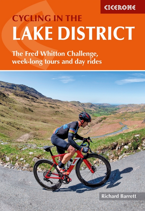
Cycling in the Lake District
The Fred Whitton Challenge, week-long tours and day rides
Seiten
2024
|
2nd Revised edition
Cicerone Press (Verlag)
978-1-78631-188-7 (ISBN)
Cicerone Press (Verlag)
978-1-78631-188-7 (ISBN)
Guidebook to the Fred Whitton Challenge ride (179km/112 miles over 7 iconic passes) and an alternative 5-day tour of the Lake District, plus 15 tough day rides from Keswick, Ambleside, Penrith and bases to the southwest and southeast of the National Park, taking in the best of the area's road cycling.
A guidebook to the 179 km (112 mile) Fred Whitton Challenge plus a five-day cycle tour and 15 challenging day rides in the Lake District. The routes are centred around Keswick, Ambleside, Penrith, and the southwest and southeast regions of the National Park.
The day rides vary in length between 31 and 68 km (19-42 miles) with difficulty ratings from moderate to challenging. The Fred Whitton Challenge covers over 180 km (112 miles) including the famous Hardknott Pass whilst the alternate five-day cycle varies in length from 14 to 75 kms (9-46 miles) each day totalling 478 km (297 miles).
Full logistical information, advice, and tips for the Fred Whitton Challenge
1:100,000 or 1:200,000 mapping included for each route
Many different routes included with varying difficulty
GPX files available to download
Elevation profiles included for each route
Richard Barrett spent his working life as a professional marketer, but still found time for climbing, winter mountaineering and sea kayaking. He first visited the Harris hills as a teenager and became a regular visitor. He lived in North Harris for a number of years, where he and his wife ran a guest house and, although now a city-dweller, he still makes frequent forays to the Hebrides, reconnecting with the wilderness and catching up with old friends.
| Erscheinungsdatum | 20.03.2024 |
|---|---|
| Reihe/Serie | Cicerone guidebooks |
| Zusatzinfo | Maps, elevation profiles and colour photos |
| Verlagsort | Kendal |
| Sprache | englisch |
| Maße | 116 x 172 mm |
| Gewicht | 230 g |
| Themenwelt | Sachbuch/Ratgeber ► Sport ► Motor- / Rad- / Flugsport |
| Reiseführer ► Europa ► Großbritannien | |
| Reisen ► Sport- / Aktivreisen ► Europa | |
| ISBN-10 | 1-78631-188-7 / 1786311887 |
| ISBN-13 | 978-1-78631-188-7 / 9781786311887 |
| Zustand | Neuware |
| Haben Sie eine Frage zum Produkt? |
Mehr entdecken
aus dem Bereich
aus dem Bereich
individuell reisen mit vielen praktischen Tipps
Buch | Softcover (2024)
Michael Müller (Verlag)
CHF 43,90
Reiseführer mit Stadtplan, 4 Spaziergängen und kostenloser Web-App
Buch | Softcover (2023)
Reise Know-How (Verlag)
CHF 22,90


