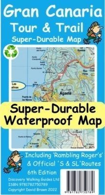
Gran Canaria Tour and Trail Map
Seiten
2022
Discovery Walking Guides Ltd (Verlag)
978-1-78275-078-9 (ISBN)
Discovery Walking Guides Ltd (Verlag)
978-1-78275-078-9 (ISBN)
For the best adventures, use the best map. Gran Canaria Tour & Trail Super-Durable Map (50k scale) is a large 960mm by 700mm double sided map sheet which folds to its 235mm by 120mm pocket size. A special concertina map fold makes the map easy to unfold and refold in use. Super-Durable means water-proof and tear-proof, simply wipe clean with a damp cloth if your map gets dirty. This map has a "2 Year Guarantee" covering adventurous use. Gran Canaria North is on one side with South on the reverse side, while a generous common overlap minimises your map turning.
This 6th edition is the result of DWG partnering 'Rambling Roger', Isabelle and Dane, surveying Gran Canaria in detail to produce this map. 20 metre and 100 metre contours combined with altitude shading bring these impressive landscapes to life. All of the legendary Tour & Trail attention to detail is included so that you will find those petrol stations, mirador viewpoints with parking, refreshment stops with parking and accurate road numbering that are so essential when adventuring by hire car. 'Off-Tarmac' Gran Canaria Tour & Trail Map is in a league of its own thanks to all the hiking trails and dirt tracks surveyed by Roger, Isabelle and Dane. Rambling Roger's walking trails from his latest guides are highlighted in red making this map and Roger's guides perfect for your walking adventures. We have also checked the walking routes from `Landscapes of Gran Canaria' and `Rother Gran Canaria' so whichever guide book you use this is your first choice map for your adventures. While Gran Canaria Tour & Trail Super-Durable Map will give years of adventurous use all the materials used in its production are fully recycleable.
Quite simply, this is the toughest, most useable map of Gran Canaria for all your hiking, biking, car touring adventures.
Digital editions of our Gran Canaria Tour & Trail Map are available as in-app purchases for Outdooractive and Locus Map apps. Discovery Walking Guides offer digital editions of Gran Canaria Tour & Trail Map in kmz (Garmin), sqlite.db for apps, and Oziexplorer formats, see website dwgwalking.co.uk for details.
| Erscheint lt. Verlag | 14.2.2022 |
|---|---|
| Zusatzinfo | full colour topographical map |
| Verlagsort | Northampton |
| Sprache | englisch |
| Maße | 120 x 235 mm |
| Gewicht | 60 g |
| Themenwelt | Reisen ► Karten / Stadtpläne / Atlanten |
| ISBN-10 | 1-78275-078-9 / 1782750789 |
| ISBN-13 | 978-1-78275-078-9 / 9781782750789 |
| Zustand | Neuware |
| Haben Sie eine Frage zum Produkt? |
Mehr entdecken
aus dem Bereich
aus dem Bereich
Karte/Kartografie (2024)
BVA BikeMedia (Verlag)
CHF 25,90
Karte (gerollt) (2023)
Freytag-Berndt und ARTARIA (Verlag)
CHF 39,90
Karte (gerollt) (2023)
Freytag-Berndt und ARTARIA (Verlag)
CHF 31,90


