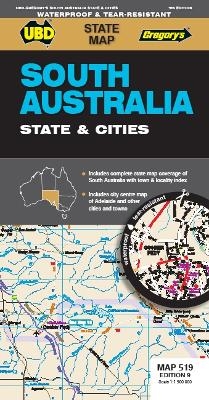
South Australia State & Cities Map 519 10th waterproof
Seiten
2021
|
Tenth Edition
UBD Gregory's (Verlag)
978-0-7319-3295-5 (ISBN)
UBD Gregory's (Verlag)
978-0-7319-3295-5 (ISBN)
- Titel ist leider vergriffen;
keine Neuauflage - Artikel merken
The latest edition of the South Australia State and Cities map is an essential tool when travelling in South Australia.
It includes a state map and index to towns and localities at a scale of 1 : 1 900 000 and state touring information. In addition to this, there is a map covering 150km around Adelaide including the Yorke & Fleurieu Peninsulas and Kangaroo Island at a scale of 1 : 100 000 and street level mapping for Adelaide City and Coober Pedy, Hahndorf, Kangaroo Island, Murray Bridge, Nuriootpa, Renmark and Victor Harbor.
It includes a state map and index to towns and localities at a scale of 1 : 1 900 000 and state touring information. In addition to this, there is a map covering 150km around Adelaide including the Yorke & Fleurieu Peninsulas and Kangaroo Island at a scale of 1 : 100 000 and street level mapping for Adelaide City and Coober Pedy, Hahndorf, Kangaroo Island, Murray Bridge, Nuriootpa, Renmark and Victor Harbor.
| Erscheint lt. Verlag | 11.11.2021 |
|---|---|
| Reihe/Serie | State Map |
| Zusatzinfo | Full colour |
| Sprache | englisch |
| Maße | 690 x 920 mm |
| Themenwelt | Reisen ► Karten / Stadtpläne / Atlanten |
| ISBN-10 | 0-7319-3295-1 / 0731932951 |
| ISBN-13 | 978-0-7319-3295-5 / 9780731932955 |
| Zustand | Neuware |
| Informationen gemäß Produktsicherheitsverordnung (GPSR) | |
| Haben Sie eine Frage zum Produkt? |
Mehr entdecken
aus dem Bereich
aus dem Bereich
Karte (gerollt) (2023)
Freytag-Berndt und ARTARIA (Verlag)
CHF 31,90
Karte (gefalzt) (2023)
Freytag-Berndt und ARTARIA (Verlag)
CHF 21,90
Wander-, Rad- und Freizeitkarte, 7. Auflage
Karte (gefalzt) (2023)
Pietruska (Verlag)
CHF 16,90


