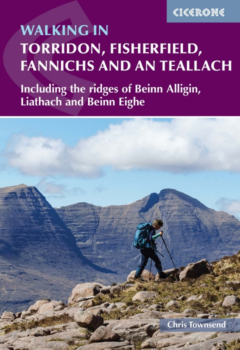
Walking in Torridon, Fisherfield, Fannichs and An Teallach
Cicerone Press (Verlag)
978-1-78631-028-6 (ISBN)
A guidebook to 50 walks and scrambles in north-western Scotland. Exploring the beautiful scenery of north and south Torridon, Fisherfield Forest, Letterewe and the Fannichs, the routes are suitable for experienced walkers.
The walks range from 6 to 58km (4–36 miles) and can be enjoyed in 2–20 hours. The routes include 27 Munros, 20 Corbetts and 14 Graham summits.
1:50,000 OS maps are included for each route
Detailed information on planning, access and history of the area
Easy access from Ullapool
Highlights include Beinn Alligin, Beinn Eighe and Liathach
Chris Townsend writes for TGO and has written 25 books, including Scotland in Cicerone's World Mountain Ranges series and accounts of his hike along the Pacific Northwest Trail and his continuous round of the Munros.
Map key
Overview map
Introduction
Geology and landscape
Plants and wildlife
History and people
When to walk
Getting there
Bases and accommodation
Equipment
Access
Maps and GPS
Safety
Environmental ethics
Using this guide
Southern Torridon - Applecross and Coulin Forest
Route 1 Beinn Bh&##xe0;n
Route 2 Sgùrr a' Chaorachain
Route 3 Meall Gorm
Route 4 Sgùrr a' Gharaidh and Glas Bheinn
Route 5 An Ruadh-Stac and Maol Chean-dearg
Route 6 Fuar Tholl and Sgorr Ruadh
Route 7 Beinn Liath Mhòr
Route 8 Circuit of Coire L&##xe0;ir
Route 9 Carn Breac and Beinn na Feusaige
Route 10 Beinn Damh
Route 11 Beinn na h-Eaglaise
Route 12 Ben Shieldaig
Route 13 Sgorr nan Lochan Uaine and Sgùrr Dubh
Northern Torridon - Glen Torridon to Loch Maree
Liathach
Route 14 Round the back of Liathach
Route 15 Liathach: Spidean a' Choire L&##xe8;ith
Route 16 Liathach: Mullach an Rathain
Route 17 Traverse of Liathach
Beinn Eighe
Route 18 Beinn Eighe: Ruadh-stac Mòr and Spidean Coire nan Clach
Route 19 Traverse of Beinn Eighe
Beinn Alligin
Route 20 Beinn Alligin: Tom na Gruagaich and Sgùrr Mòr
Route 21 Beinn Alligin: traverse including the Horns
Route 22 Beinn Dearg
Route 23 Meall a' Ghiuthais and the Mountain Trail
Route 24 Ruadh-stac Beag
Route 25 Beinn a' Chearcaill
Route 26 Baosbheinn
Route 27 Beinn an Eòin
Loch Maree to Loch Broom - Letterewe and Fisherfield
Route 28 Beinn a' Mhùinidh
Route 29 Slioch
Route 30 Beinn L&##xe0;ir
Route 31 Meall Mh&##xe8;innidh
Route 32 Beinn Àirigh Charr
Route 33 Loch Maree three
Route 34 Beinn a' Ch&##xe0;isgein Beag and Beinn a' Ch&##xe0;isgein Mòr
Route 35 A' Mhaighdean and Ruadh Stac Mòr
Route 36 The Gleann na Muice ridge
Route 37 Fisherfield Six
Route 38 Beinn Dearg Mòr and Beinn Dearg Bheag
An Teallach
Route 39 An Teallach: Sgùrr Fiòna and Bidein a' Ghlas Thuill
Route 40 Traverse of An Teallach
Route 41 S&##xe0;il Mhòr
The Fannichs
Route 42 Creag Rainich
Route 43 Beinn Bheag and Groban
Route 44 Fionn Bheinn and Meall a' Chaorainn
Route 45 Beinn nan Ramh
Route 46 A' Chailleach and Sgùrr Breac
Route 47 Meall a' Chrasgaidh, Sgùrr nan Clach Geala, Sgùrr nan Each
Route 48 The eastern Fannichs
Route 49 Beinn Liath Mhòr a' Ghiubhais Lì
Route 50 Traverse of the Fannichs
Appendix A Route summary table
Appendix B Useful contacts
Appendix C Glossary of Gaelic words
Appendix D The Bothy Code
Appendix E Further reading
| Erscheinungsdatum | 21.07.2022 |
|---|---|
| Reihe/Serie | Cicerone guidebooks |
| Zusatzinfo | 51 maps; over 50 colour photos |
| Verlagsort | Kendal |
| Sprache | englisch |
| Maße | 116 x 172 mm |
| Gewicht | 260 g |
| Themenwelt | Sachbuch/Ratgeber ► Sport |
| Reisen ► Sport- / Aktivreisen ► Europa | |
| ISBN-10 | 1-78631-028-7 / 1786310287 |
| ISBN-13 | 978-1-78631-028-6 / 9781786310286 |
| Zustand | Neuware |
| Haben Sie eine Frage zum Produkt? |
aus dem Bereich
