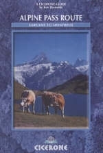
Alpine Pass Route
Cicerone Press (Verlag)
978-1-85284-405-9 (ISBN)
- Titel erscheint in neuer Auflage
- Artikel merken
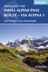
The Alpine Pass Route traverses Switzerland from east to west - from the ancient town of Sargans on the borders of Leichtenstein, to Montreux on the shores of Lake Geneva. It covers some 325 kilometres of mountain and valley, and crosses 16 passes with an accumulation of almost 18,000 metres of height gain in 15 stages. Each pass is different: from the remote slender crest of the Richetli to the broad tourist-thronged Kleine Scheidegg or the rocky crest of the Bunderchrinde and the grassy saddle of the Blattipass with its incredible views of the Oberland giants. Snow-capped peaks accompany the walker - the Todi and the Titlis; the Wetterhorn, Eiger and Jungfrau; the Kandersteg peaks; Wildstrubel, Wildhorn and Diablerets. Accommodation is plentiful. The route can be done as one long hard walk, or split into two easier holidays. There are many options - cable-cars; chair-lifts and funiculars can be used in many places. It is a route to suit all walkers.
Kev Reynolds is a freelance writer, photojournalist and lecturer. He has published many books on the Alps, a series of trekkers' guides to Nepal and, nearer to home, several guides on walking in southern England. A member of the Alpine Club, Austrian Alpine club and the Outdoor Writers' Guild, he is also first Honorary Member of the British Association of European Mountain Leaders. Most winters find Kev travelling around Britain sharing his love of wild places through his lectures.
The Route
Stage 1: Sargans - Mels - Weisstannen
Stage 2: Weisstannen - Foopass - Elm
Stage 3: Elm - Richetlipass - Linthal
Stage 4: Linthal - Klausenpass - Altdorf
Stage 5: Altdorf - Surenenpass - Engelberg
Stage 6: Engelberg - Jochpass - Meiringen
Stage 7: Meiringen - Grosse Scheidegg - Grindelwald
Stage 8: Grindelwald - Kleine Scheidegg - Lauterbrunnen
Stage 9: Lauterbrunnen - Mürren - Sefinenfurke - Griesalp
Stage 10: Griesalp - Hohtürli - Kandersteg
Stage 11: Kandersteg - Bunderchrinde - Adelboden
Stage 12: Adelboden - Hahnenmoospass - Lenk
Stage 13: Lenk - Lauenen - Gsteig
Stage 14: Gsteig - Blattipass - Col des Andérets - Col des Mosses
Stage 15: Col des Mosses - Col de Chaude - Montreux
| Erscheint lt. Verlag | 17.3.2008 |
|---|---|
| Zusatzinfo | 100 colour photos, 16 profiles and 16 maps |
| Verlagsort | Kendal |
| Sprache | englisch |
| Maße | 116 x 172 mm |
| Gewicht | 280 g |
| Themenwelt | Sachbuch/Ratgeber ► Sport |
| Reisen ► Reiseführer ► Europa | |
| ISBN-10 | 1-85284-405-1 / 1852844051 |
| ISBN-13 | 978-1-85284-405-9 / 9781852844059 |
| Zustand | Neuware |
| Informationen gemäß Produktsicherheitsverordnung (GPSR) | |
| Haben Sie eine Frage zum Produkt? |
aus dem Bereich


